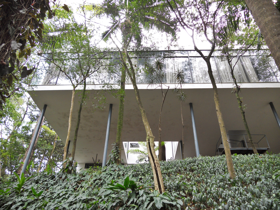
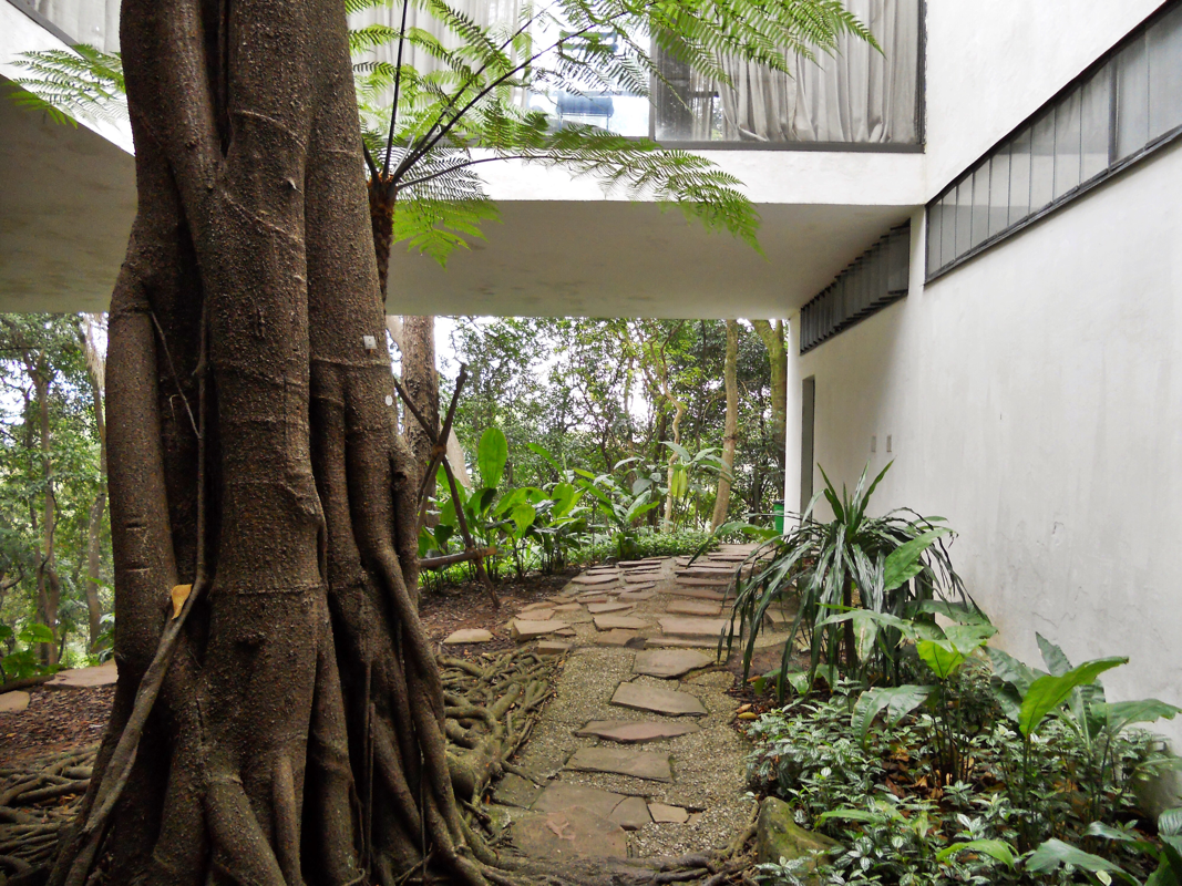
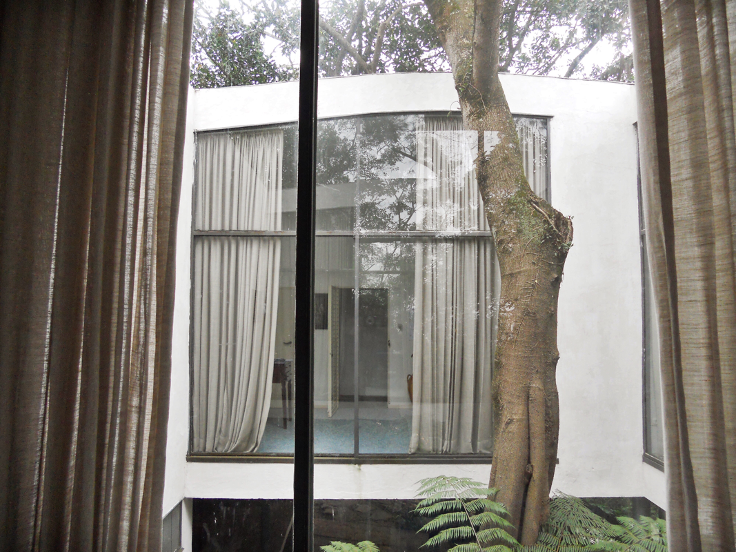
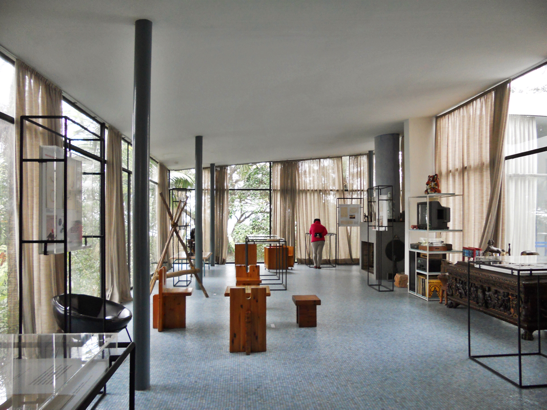
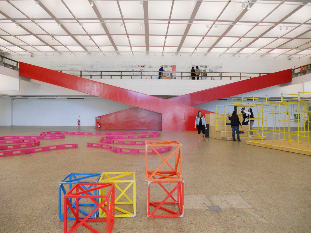
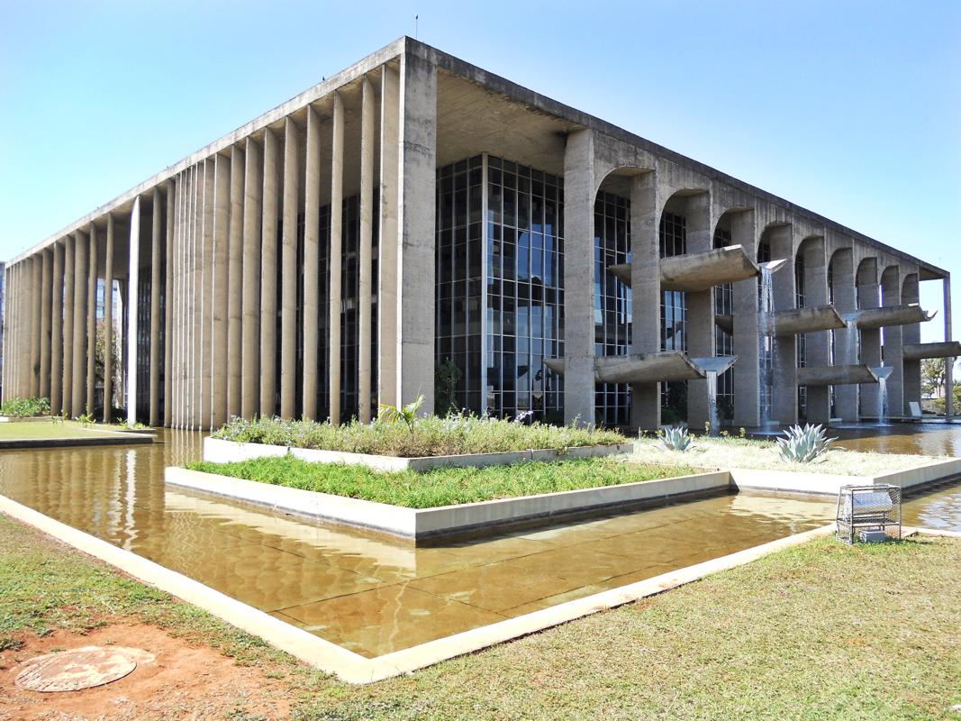
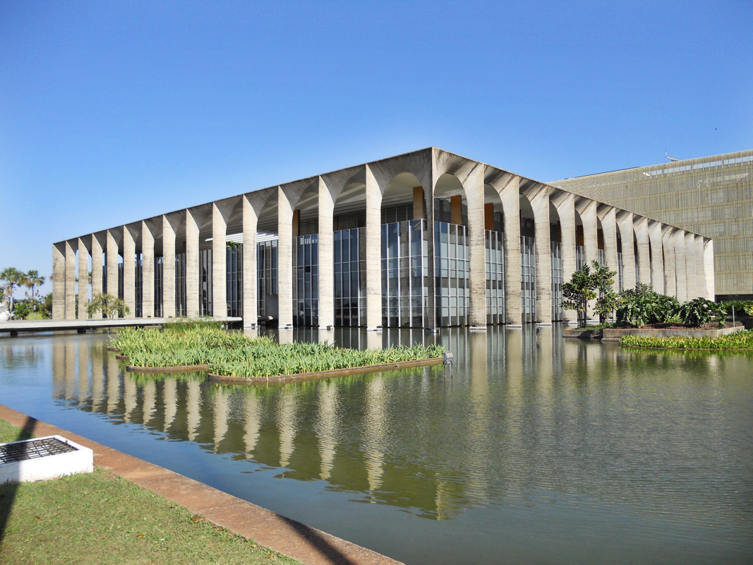
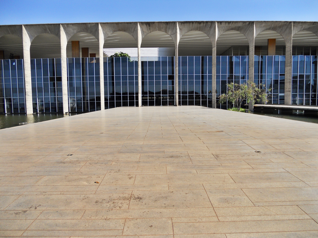
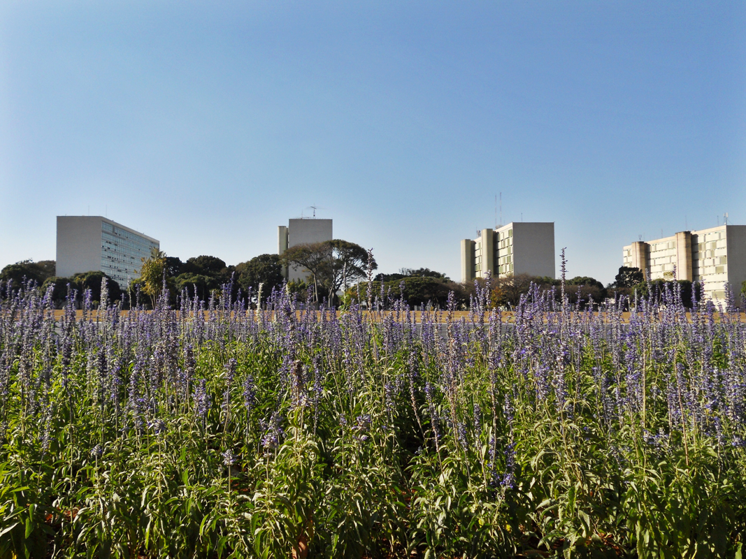
|
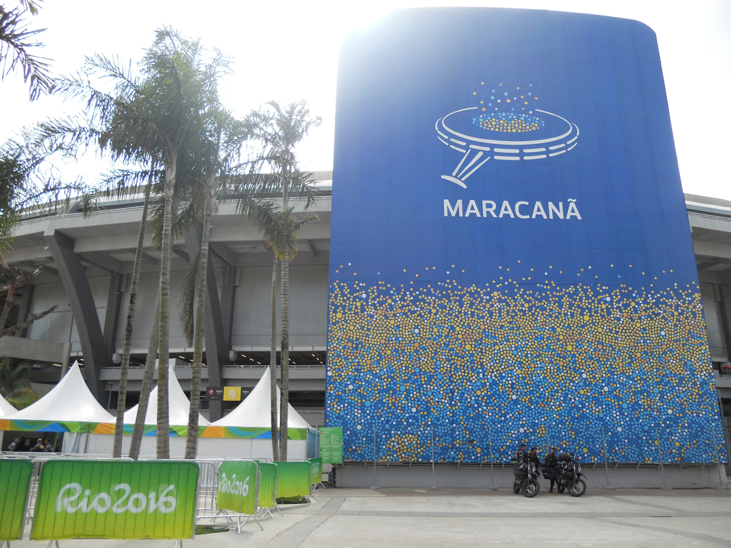
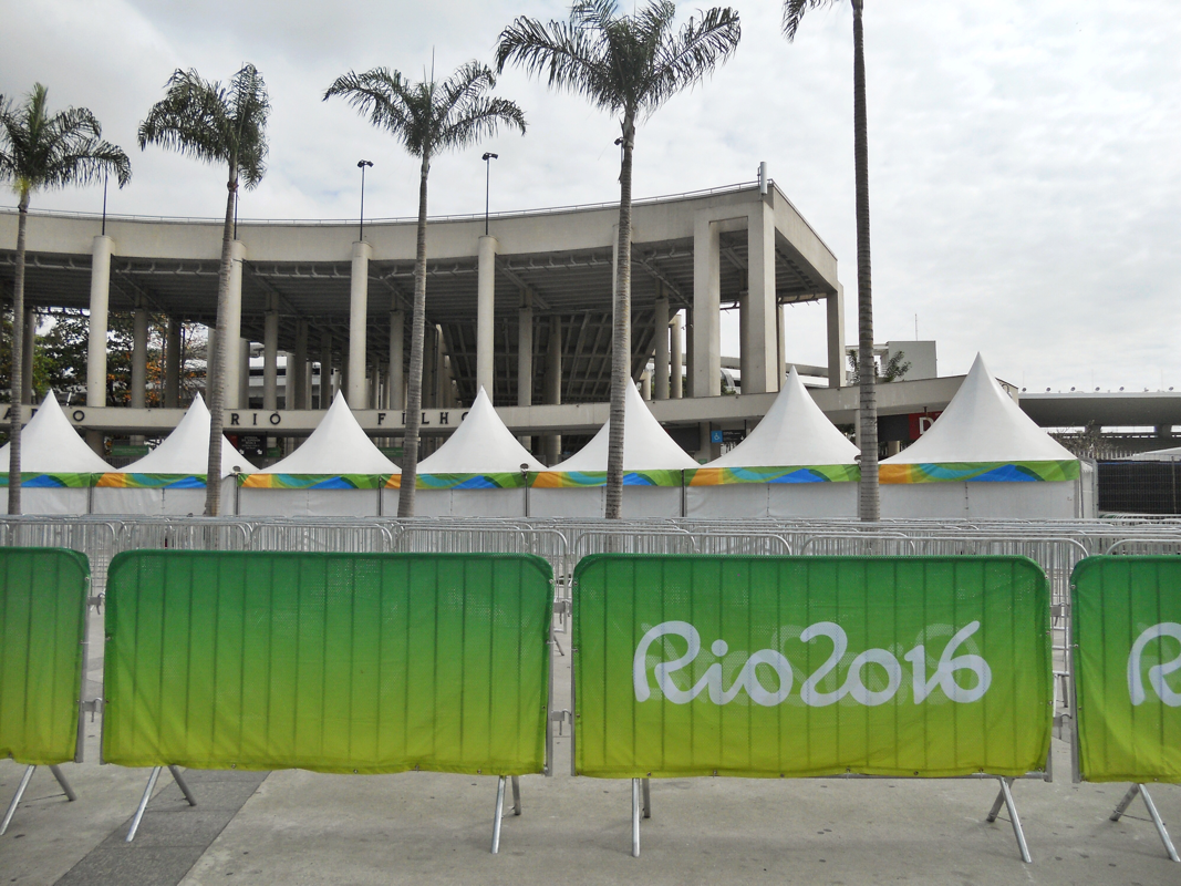
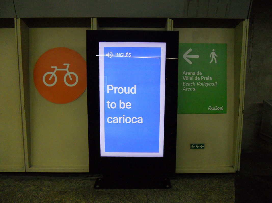
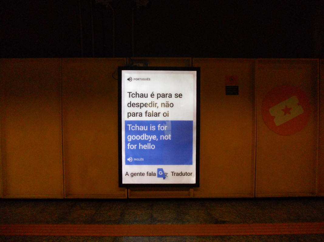
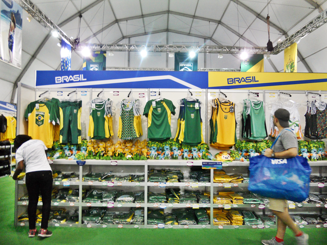
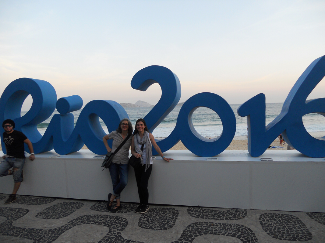
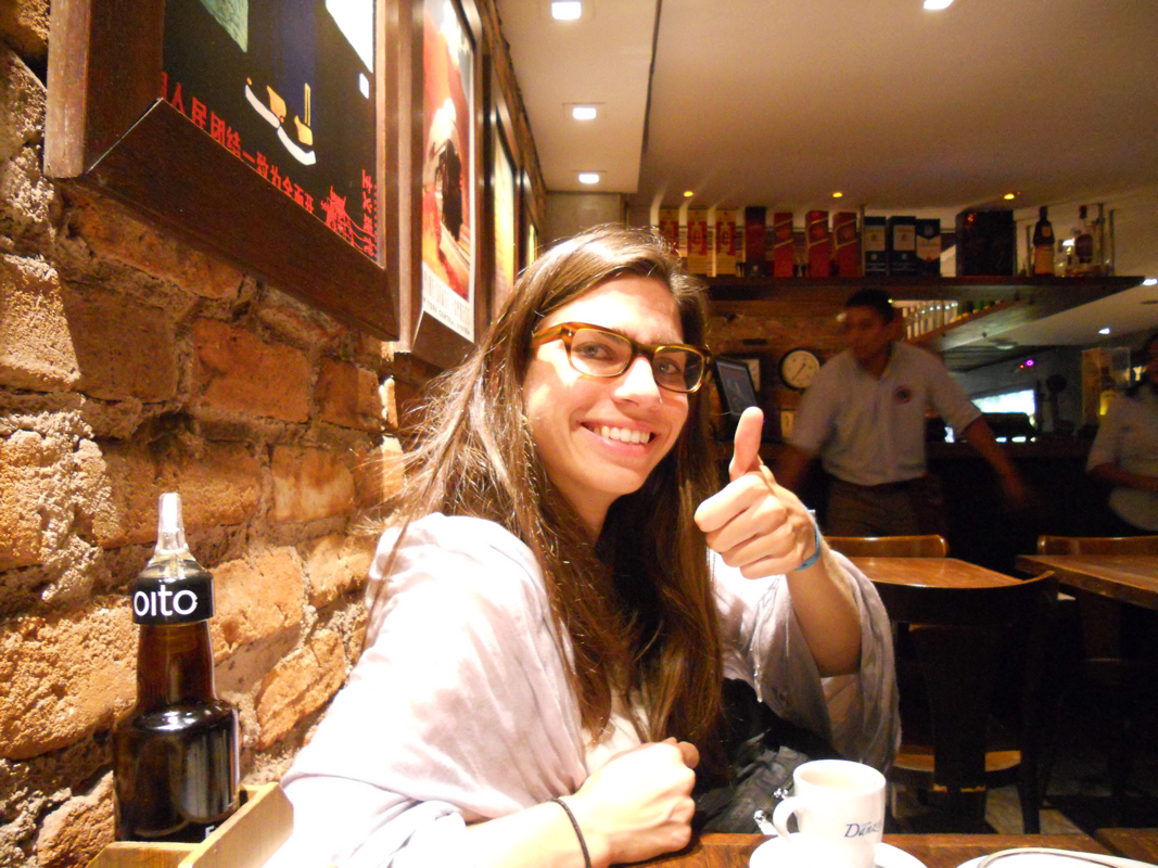
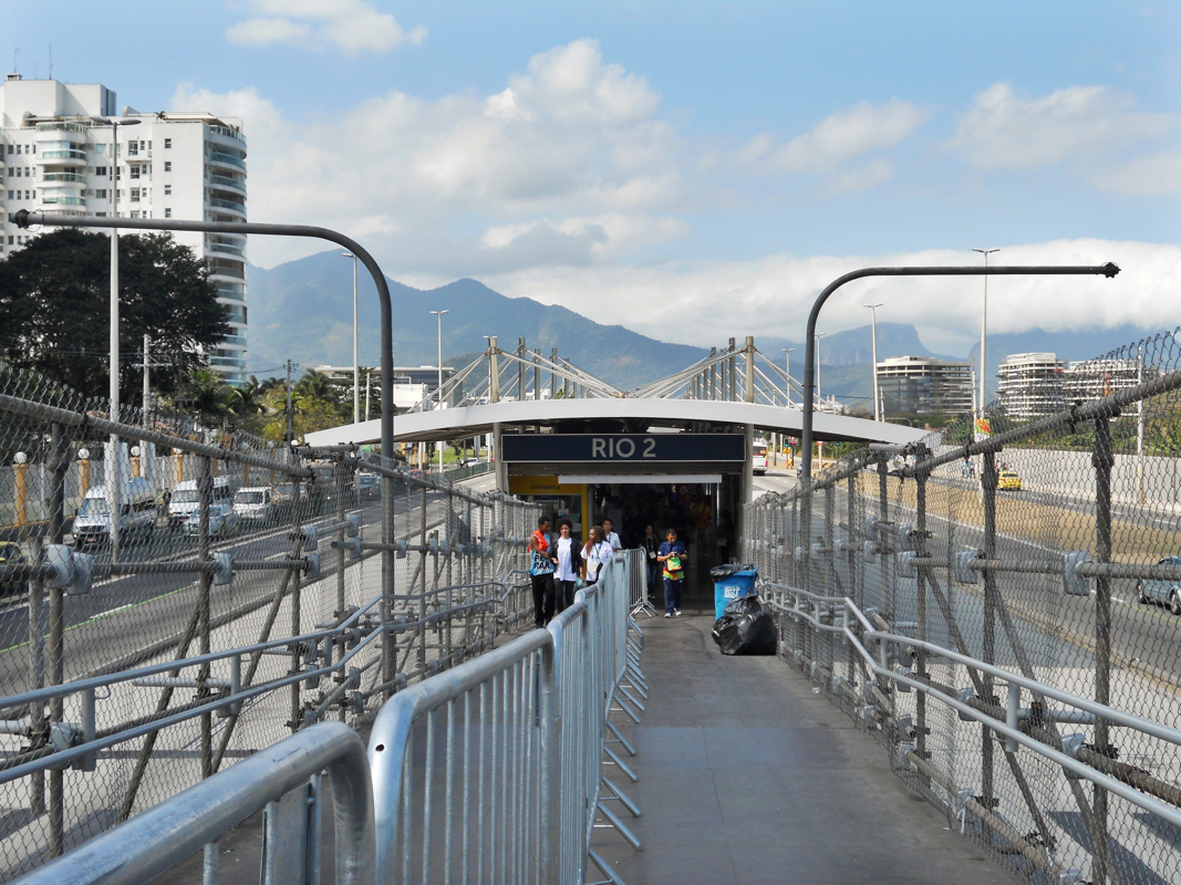
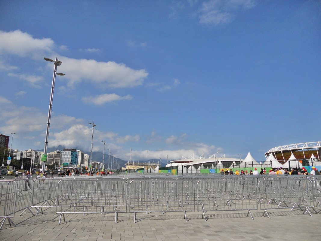
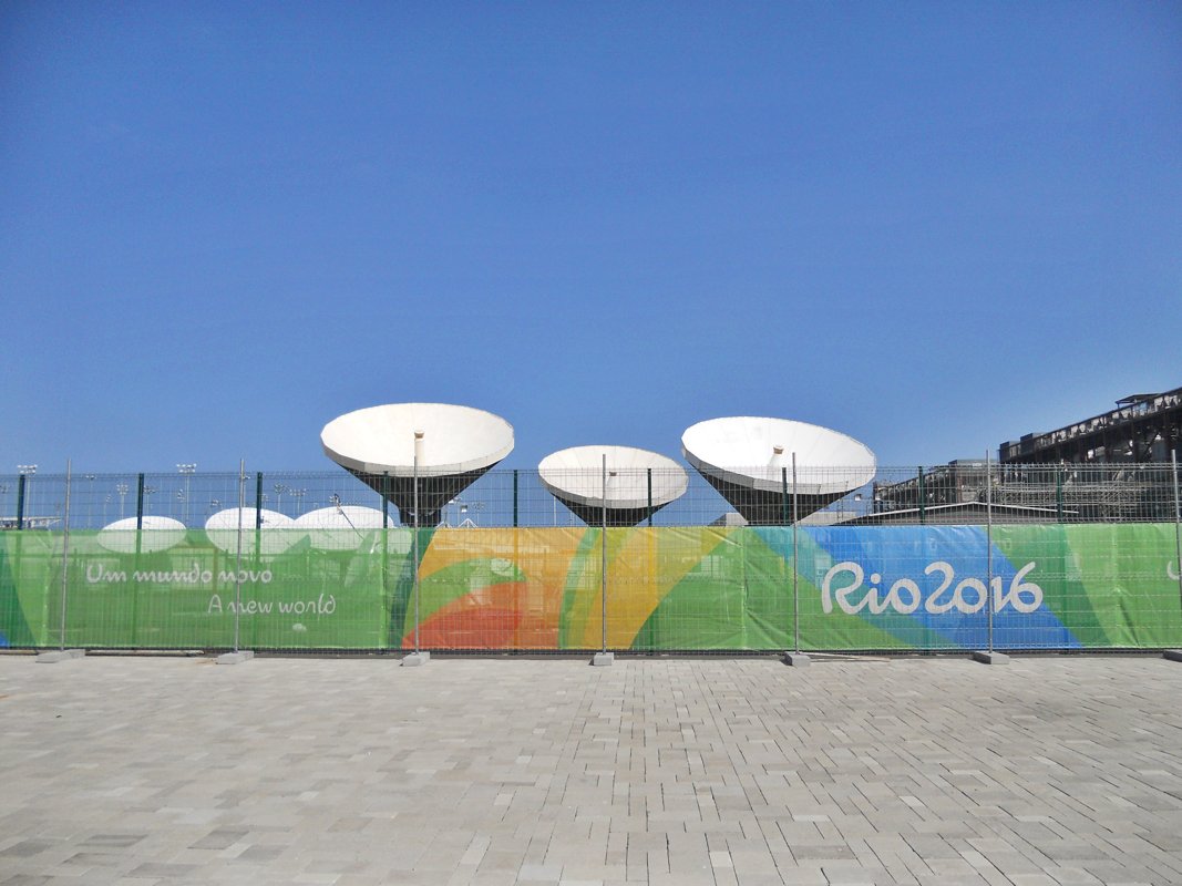
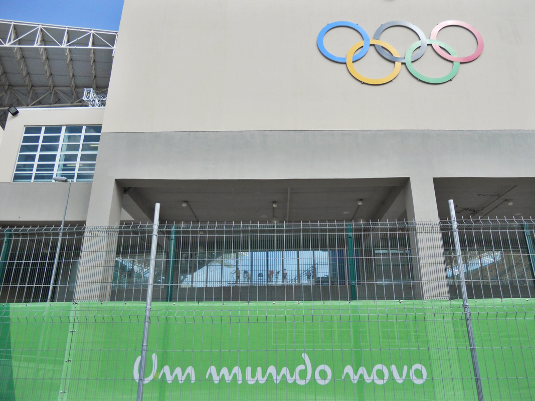
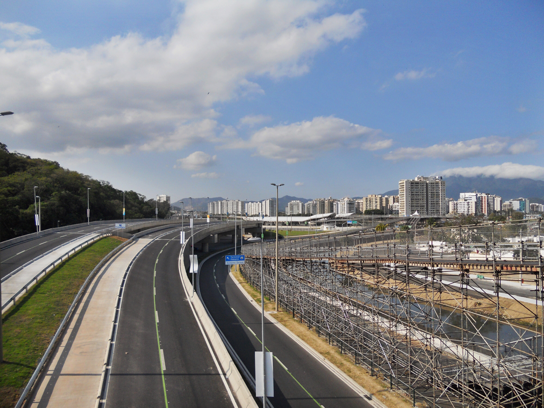
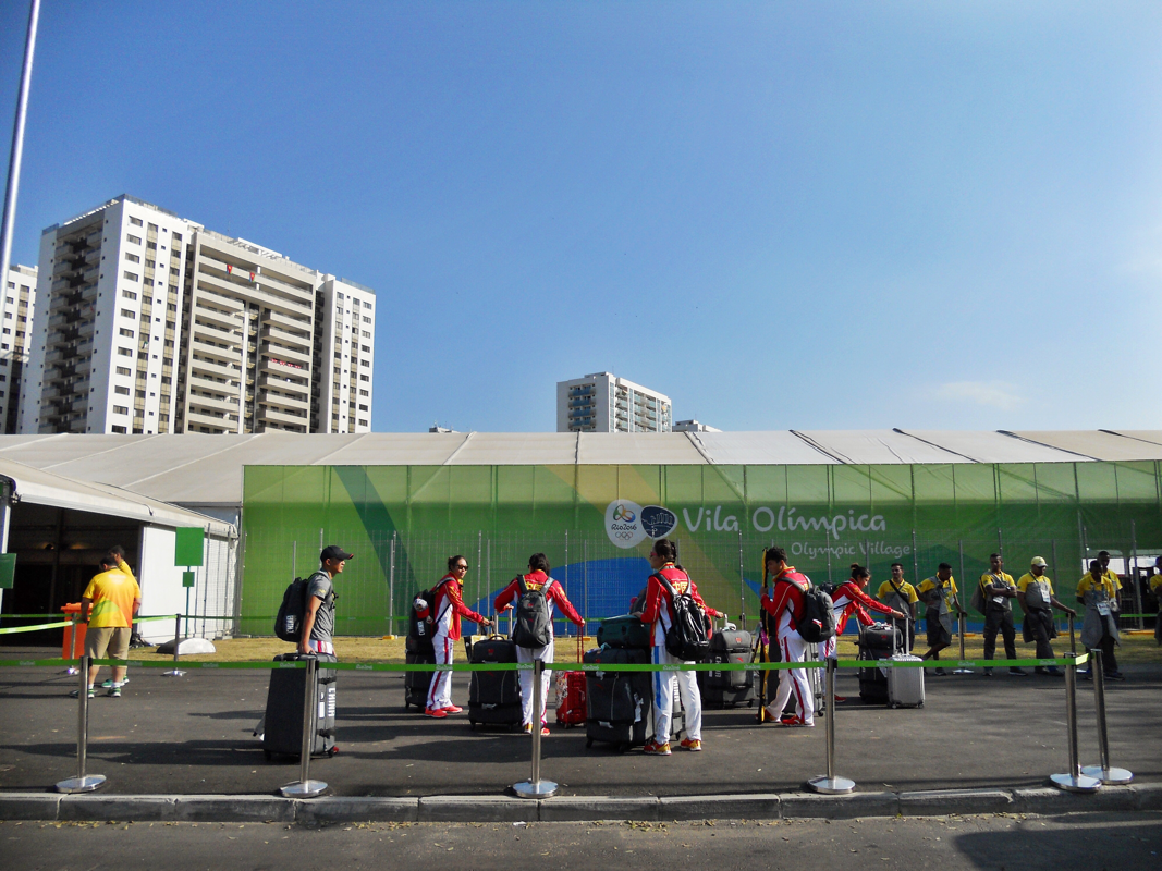
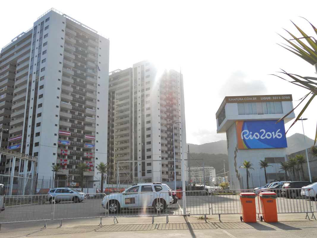
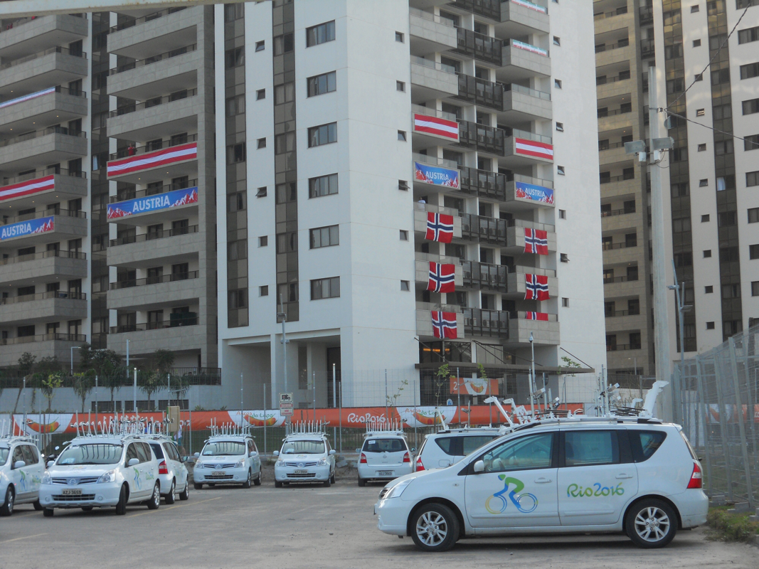
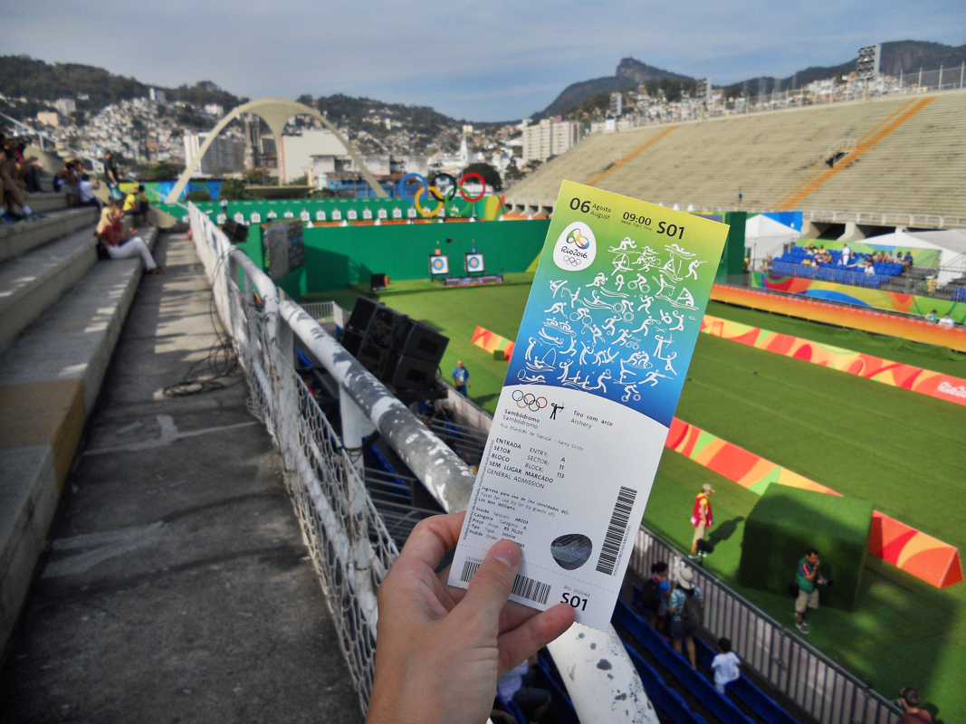
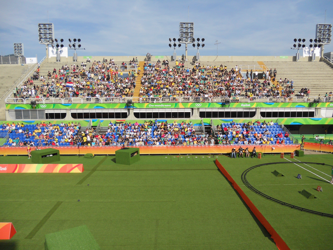
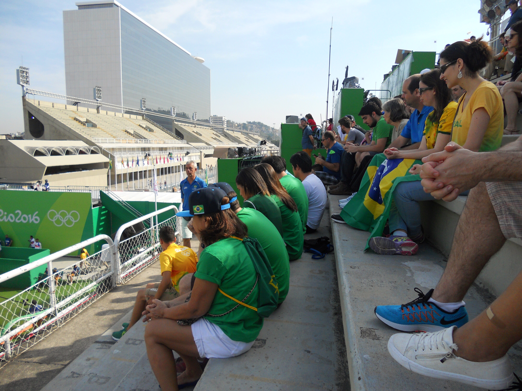
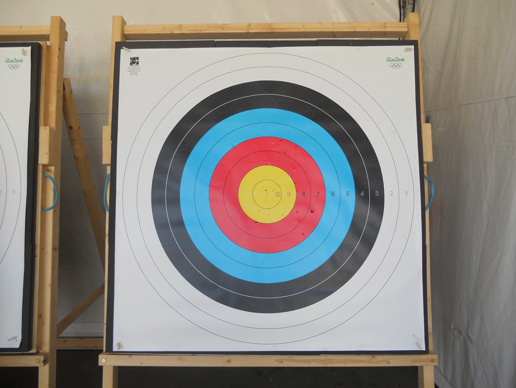
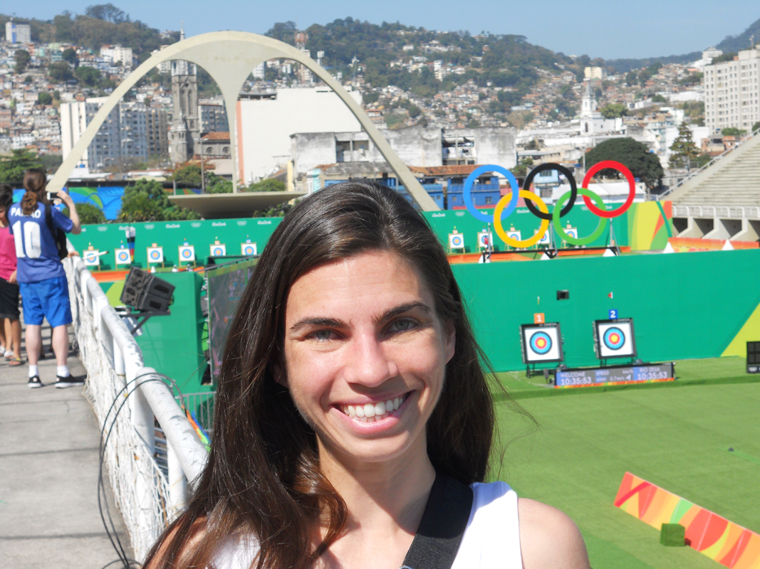
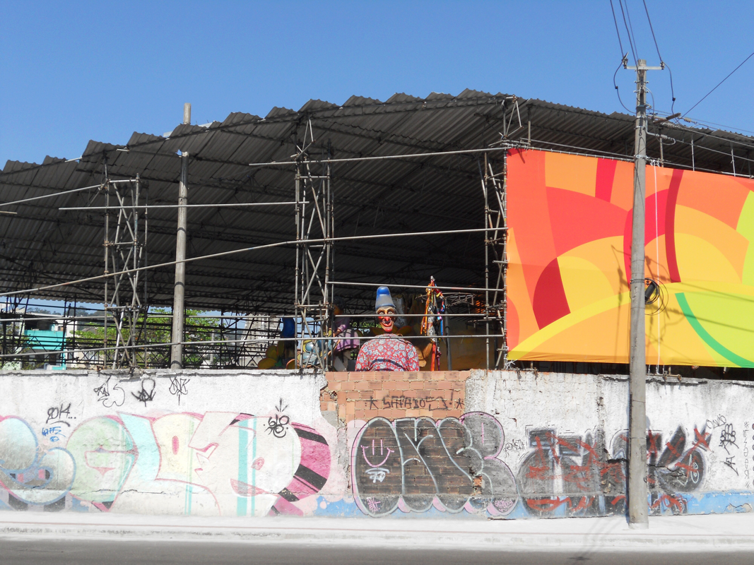
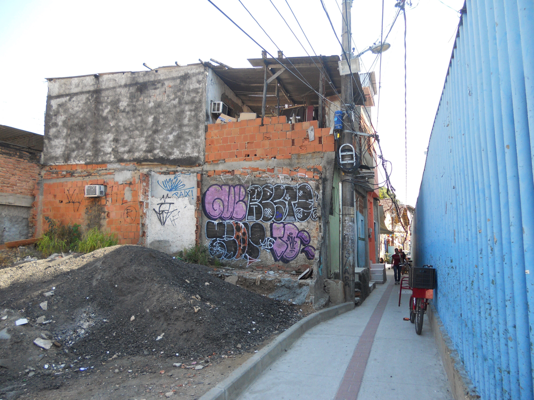
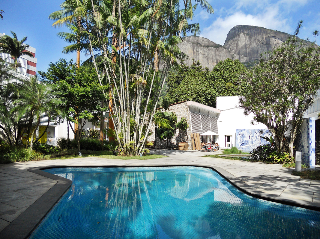
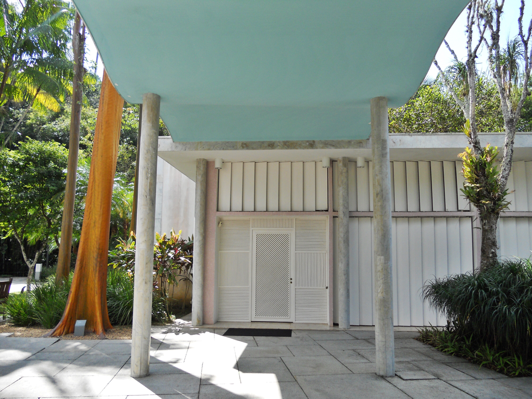
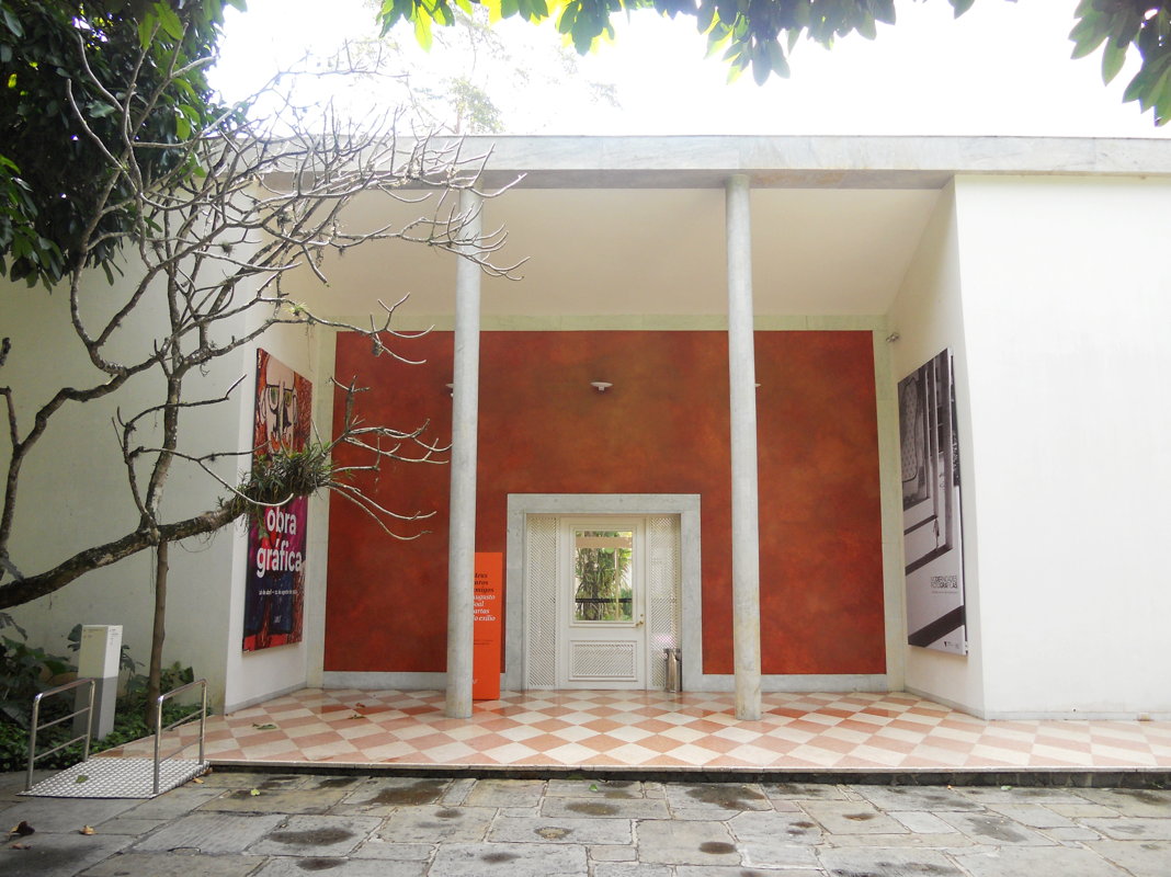
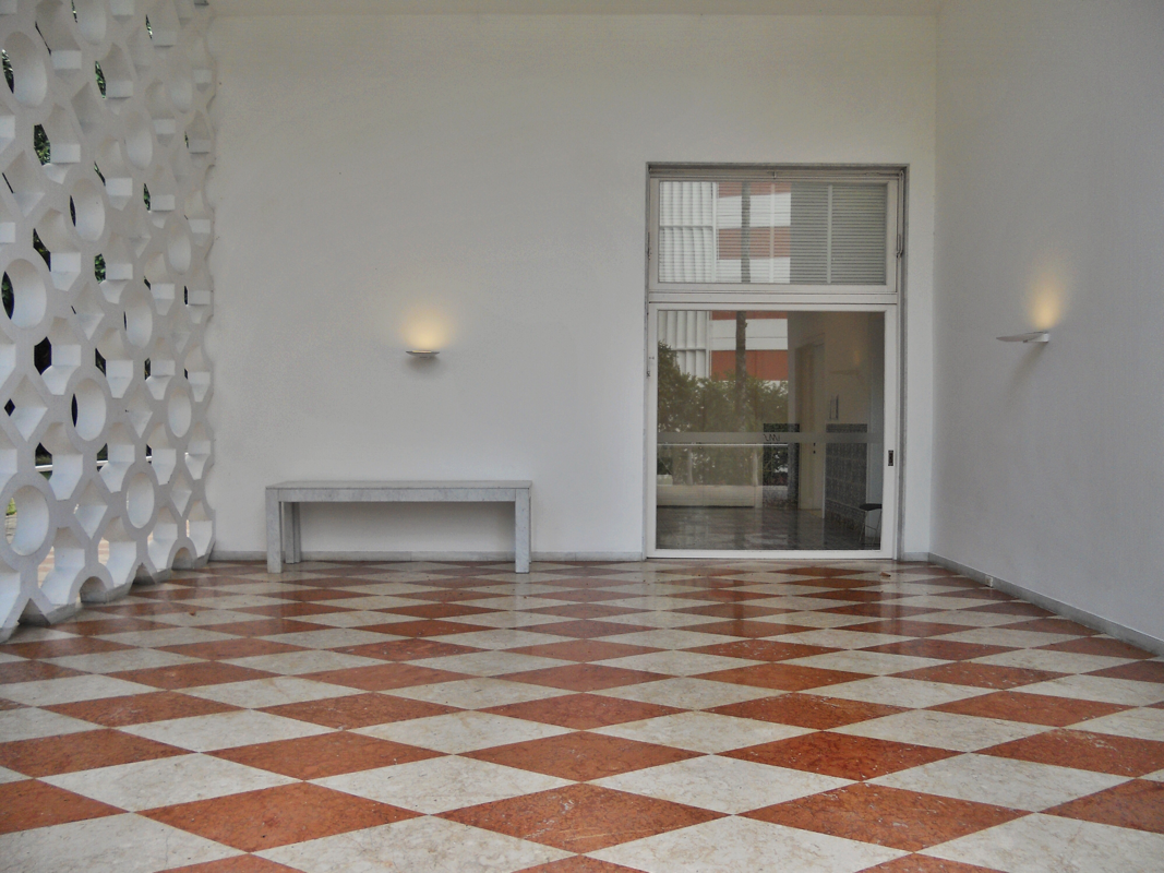
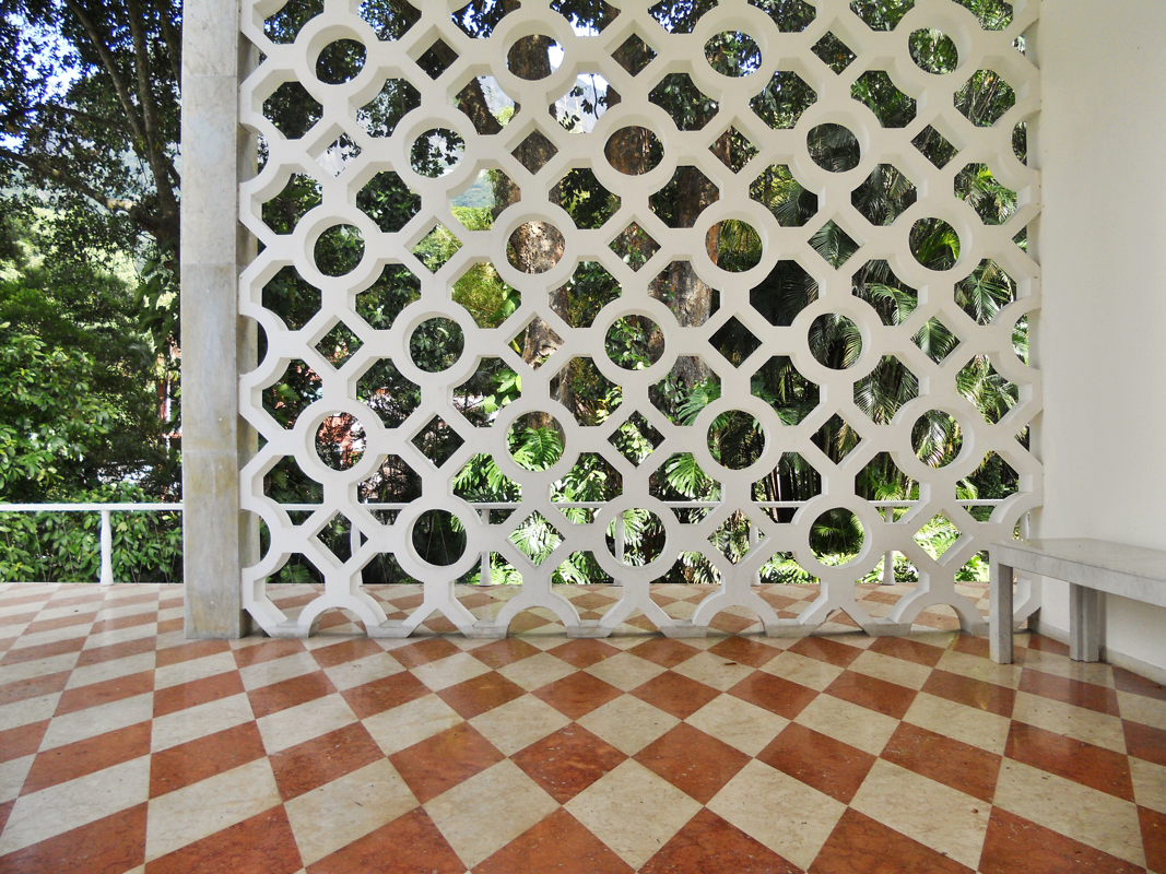
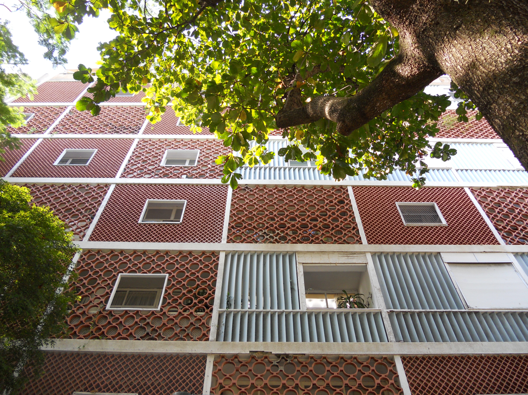
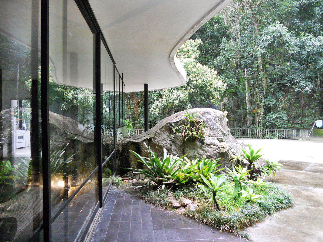
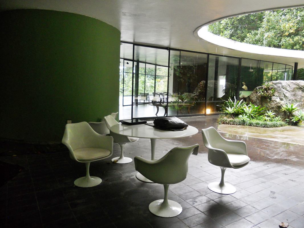
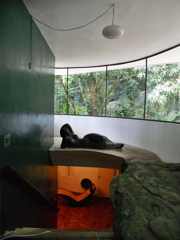
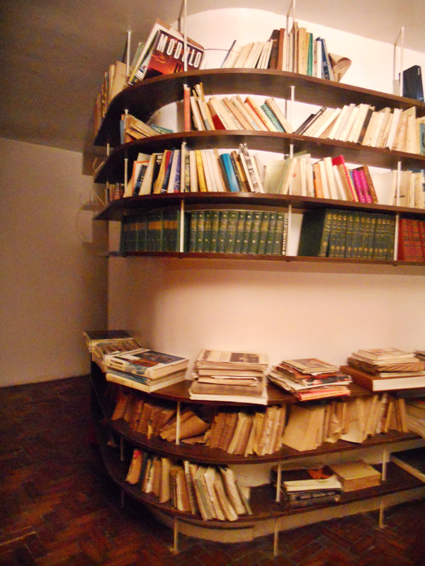
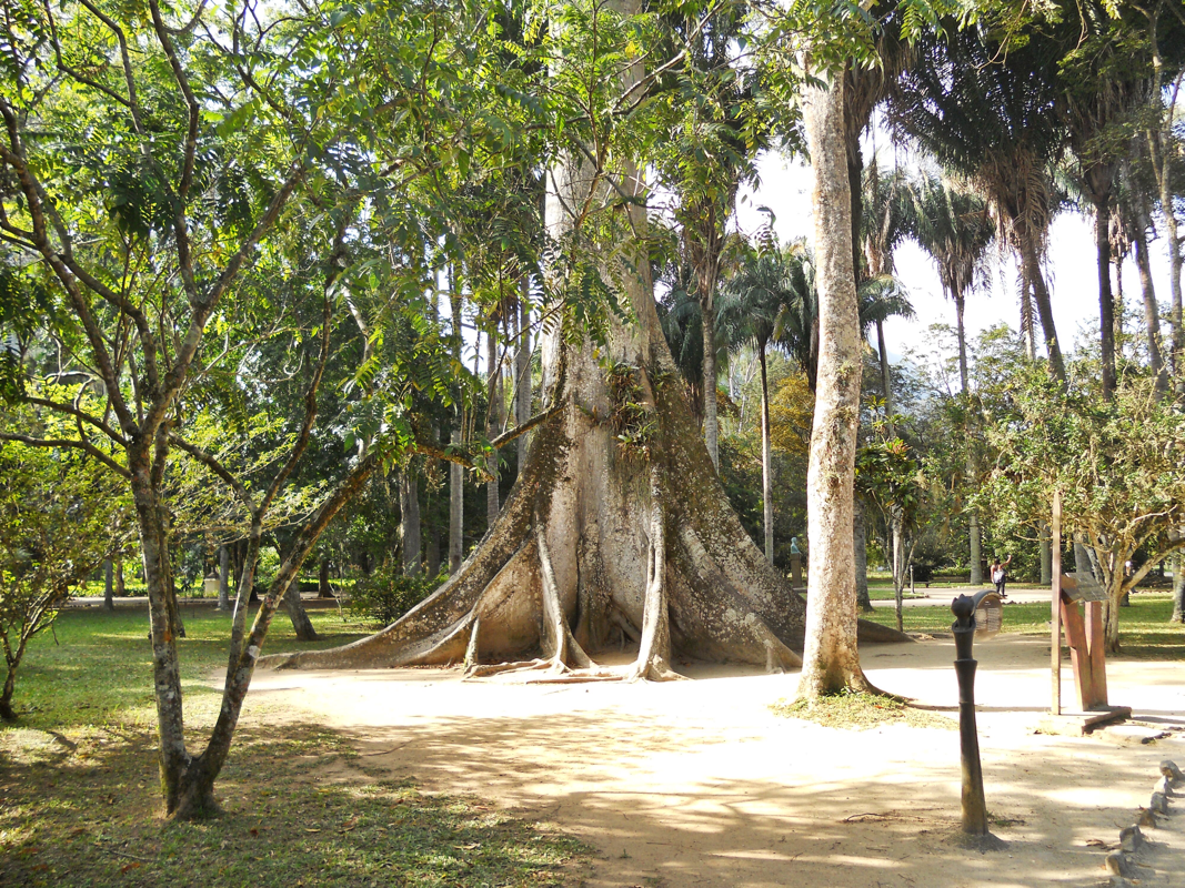
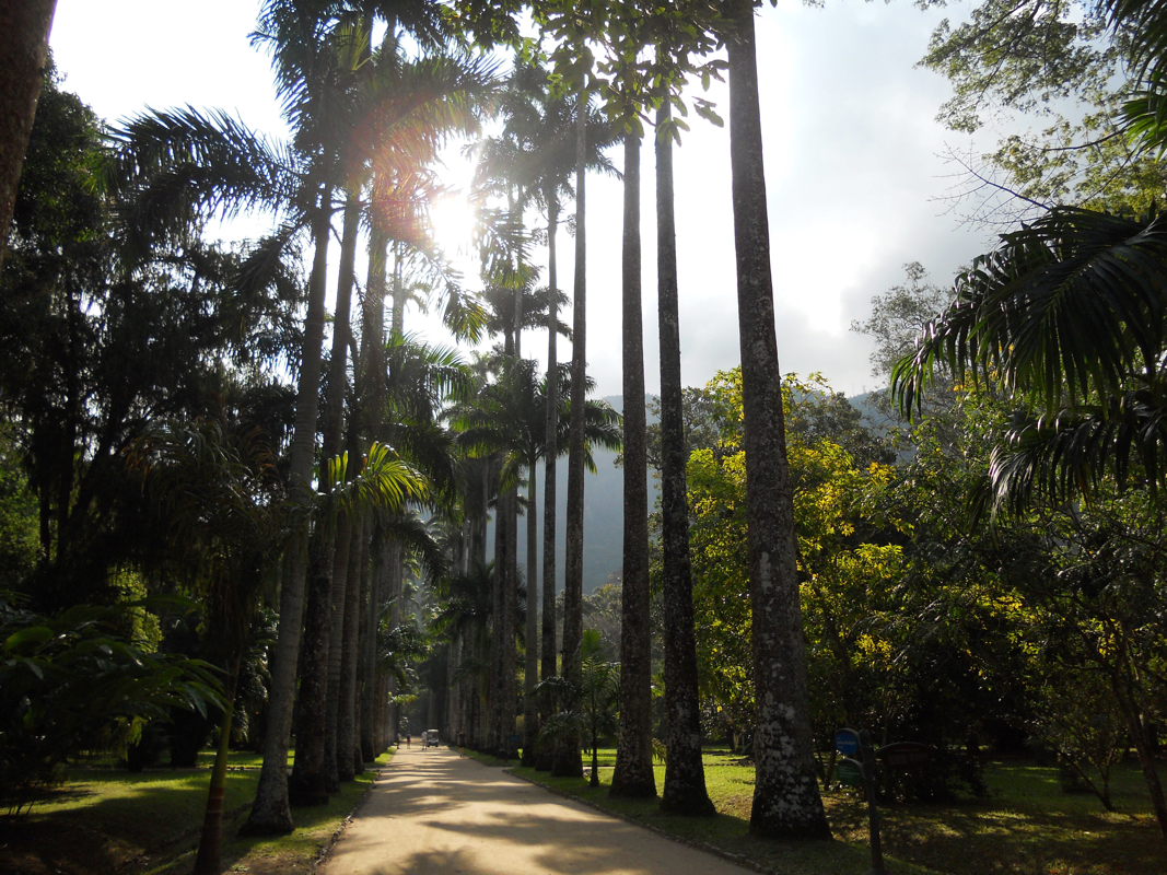
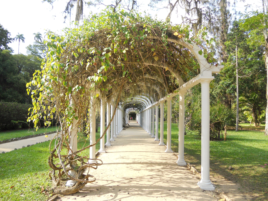
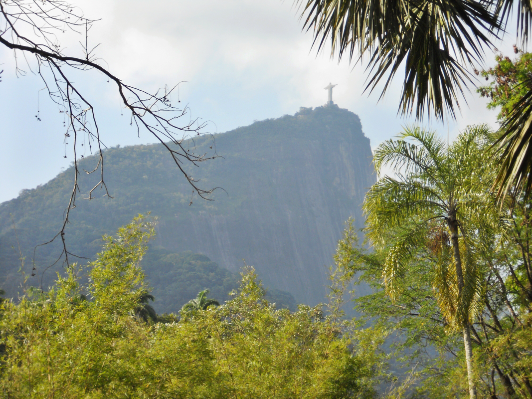
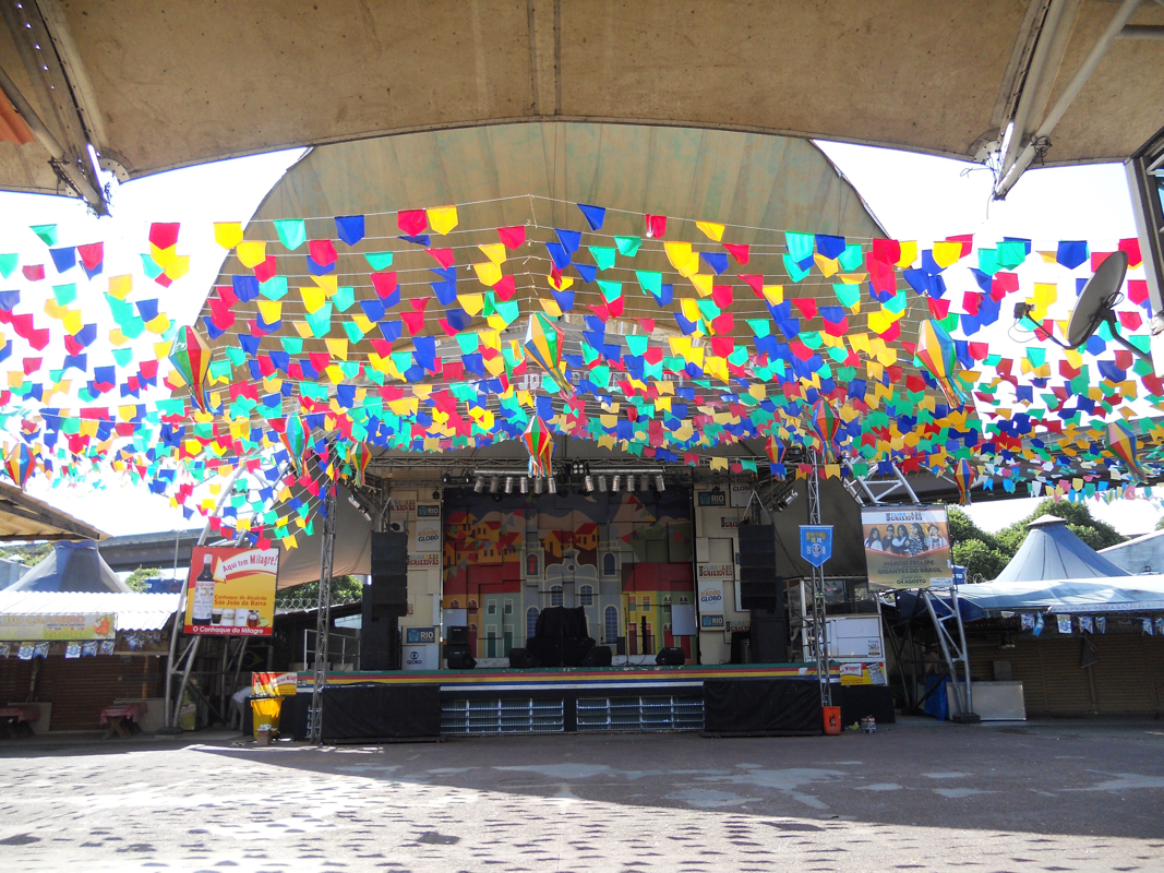
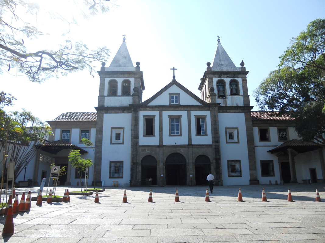
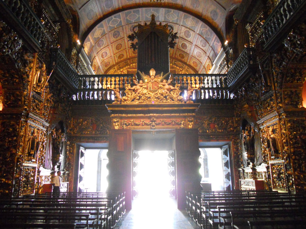
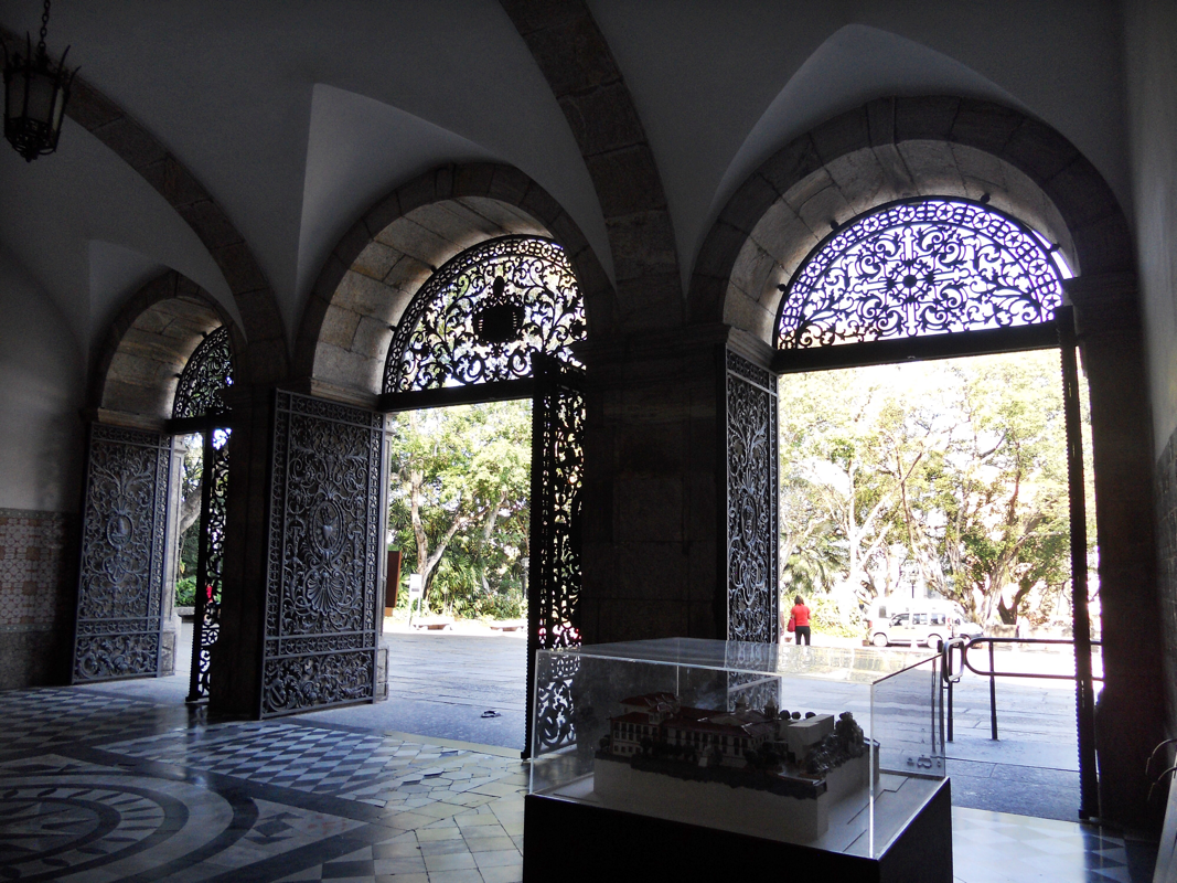
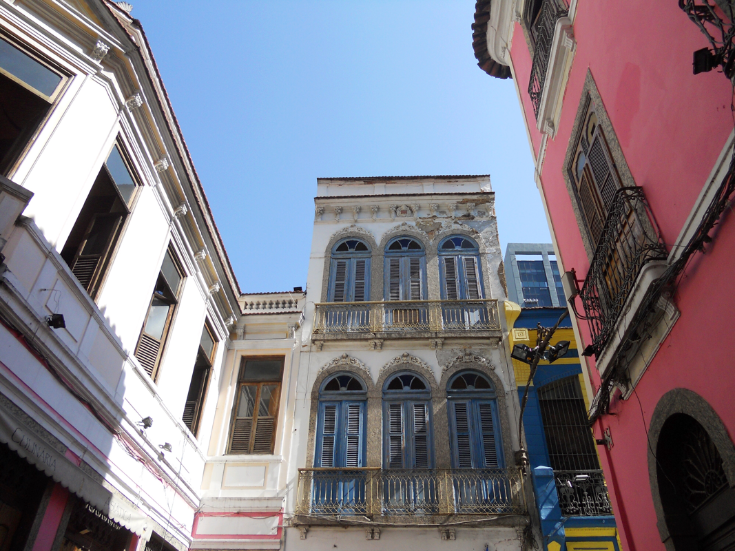
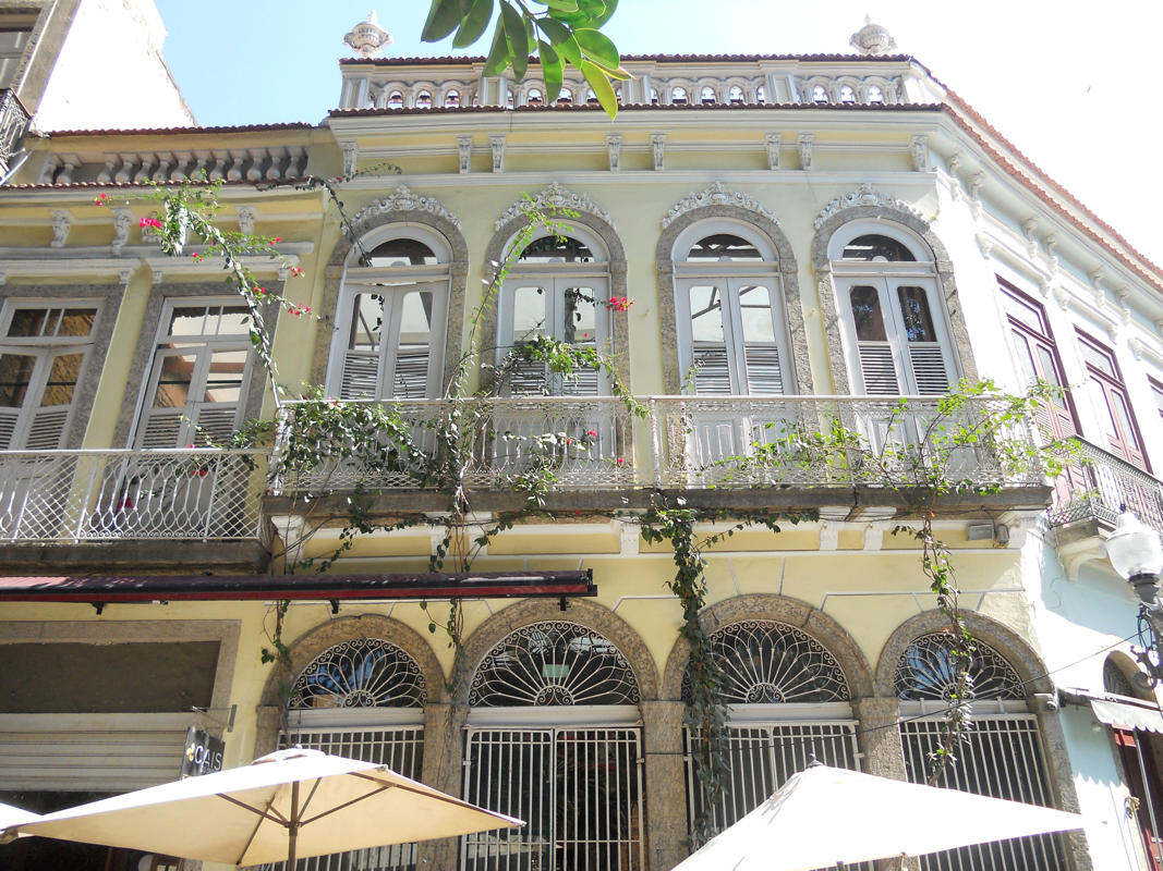
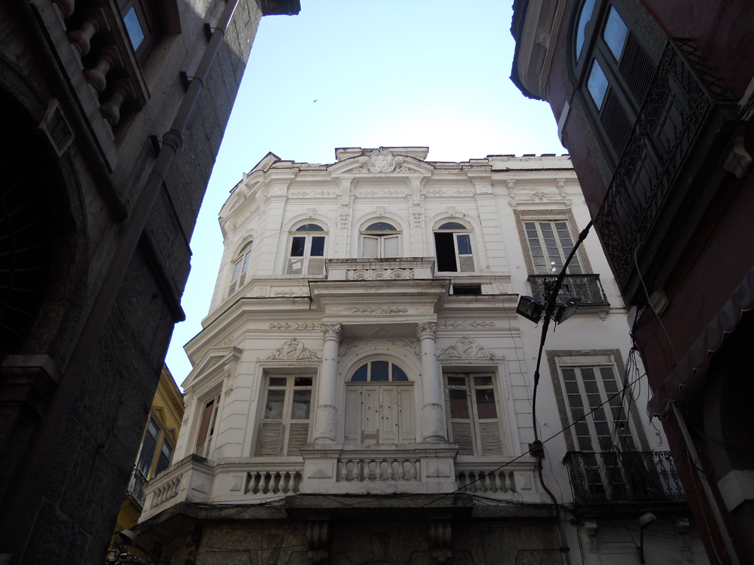
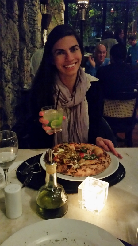
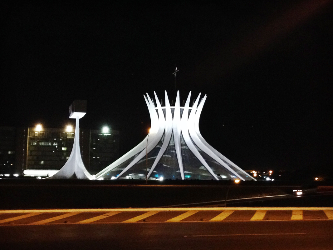
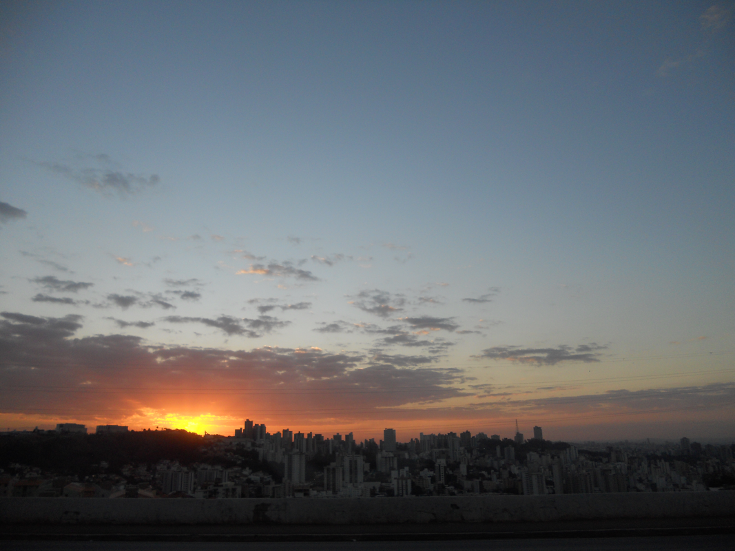
I left Brazil in a similar state of mind as to when I had first arrived -- a state of anticipation. I spent the last week of my Brazilian summer exploration in Rio de Janeiro during the opening days of the Olympic Games. The city -- locals and visitors alike -- hummed with nervous excitement. No one was quite sure what traffic would be like, which roads would be closed, which forms of public transit would work, which museums would be open, if the crowds would be huge... I scheduled my trip to overlap with the Olympics because I was interested in seeing how a country puts itself on a world stage in the present day. The expression of ideas about progress and national character was a key component of Brazilian modernism in the 1930s, 40s, and 50s that I have been studying, and I took the opportunity to consider how a similar aim might be enacted now. The Olympics seemed to pervade the city, and at times to really take over. For instance: a city holiday was declared on the day before and the day of the opening ceremony; national museums such as the Museu Nacional de Belas Artes and the Museo Histórico Nacional were closed; a short-term national law was implemented that required travelers to arrive at Brazilian airports at least two hours before any flight; military police with very large guns patrolled street corners; and volunteers in uniforms of khaki pants and yellow shirts popped up in subway stations to help visitors navigate (oh, how helpful this would have been when I first started my trip!). My main take-away regarding a city's transformation during a major international event such as the Olympics can be summed up in one word: branding. Olympics signage was widespread, as was other related advertising. Having used Google translate extensively on my trip, their ads were especially endearing. In many respects, however, life in Rio was relatively normal. I watched the opening ceremony with my good friend AnnAliki at a "per kilo" buffet restaurant in Ipanema, and we couldn't believe how empty it was. Just the two of us cheering for the United States and her native Greece, with a couple other Brazilians. (The party was clearly elsewhere!) Many of the Olympics activities were concentrated in an area of new building in Barra da Tijuca, a beachside neighborhood located about 30 kilometers, or roughly 18 miles, west of the center of Rio. Lucio Costa designed the original plan for this area in 1969. Sometimes dubbed the Miami of Rio, Barra da Tijuca exhibits some characteristics that are similar to Costa's earlier plan for Brasília -- wide boulevards, large open spaces, and high-rise residential buildings. I visited Barra da Tijuca the day before the Olympics began. It took me two hours -- one way! -- to get there on public transportation. Exiting the rapid bus transit station -- the promised metro extension has not yet been opened to the public -- I emerged into miles of temporary walkways that connect the multiple arenas of the Parque Olimpico. AECOM master-planned the park, which contains nine stadiums for 13 different events. London's WilinsonEyre designed the largest of the venues, the Arenas Cariocas, which is planned to be used as an Olympic training center after the games. Some venues are being reused from the 2007 Pan American Games; others like the handball arena, the work of the Brazilian firms Oficina de Arquitetos and Lopes, Santos, and Ferreira Gomes, alongside UK-based AndArchitects, is slated to be dismantled and rebuilt as four schools after the games. I could really only skirt the park, but there was still a lot to see, including the athletes' housing in the Olympic Village, which was built on public land and will become luxury housing after the games. Rio's hosting of the Olympic Games has been the source of much debate, controversy, and protest. Zika virus, pollution, the great levels of income inequality in the city and who will benefit from the Games, are all critical issues surrounding this global event. Rio's Olympics motto, "um mundo novo," kind of makes you just want to cry out for the city's leaders to clean up the Guanabara Bay if what they really want is "a new world." In other ways, it is hard to deny how Rio suits the summer Olympics. In addition to near-perfect weather this time of year, the city has several large existing built and natural spaces for the events. Maracanã, for example, a large soccer stadium that was built for the 1950 World Cup, served as the venue for the opening and closing ceremonies. Niemeyer's Sambódromo, the site of annual samba parades during Rio's Carnival, was the venue for archery and the marathon. Lagoa Rodrigo de Freitas was used for rowing, and Copacabana beach was fittingly used for beach volleyball. I snagged tickets to a round of men's archery in the Sambódromo on the morning of the day of my flight back to the States -- $20 and a mere two subway stops away! Just a portion of the stands were used for the event, which you can see in my photos. Signs on the nearby streets instructed drivers to keep sounds/honking to a minimum so as to not distract the athletes. After archery, I walked around the Sambódromo; to the south is a storage facility for Carnival costumes that hinted at what fills this space at other times of year. To the east, directly adjacent to the Sambódromo, are favela housing conditions -- a jarring and troubling contrast to the Olympic venue. Of course, there were more sights I wanted to take in while in Rio. I stopped by the Instituto Moreira Salles, a cultural institute housed in the former residence of Raymundo Ottoni de Castro Maya, an art patron and industrialist who lived here from 1954-57. (Steve and I visited another one of Ottoni de Castro Maya's houses during the first week of the trip, the Museu Chácara do Céu.) Italian-educated architect Olavo Redig de Campos designed Instituto Moreira Salles with Brazilian modernist principles and a few twists. For instance, the courtyard, the mountain views, and the thin marble pilotis are all familiar tropes, but the red-walled entrance said to be inspired by the Villa of the Mysteries at Pompeii is a surprise. Redig de Campos also took the cobogós, or the open brick walls that Costa employed on balconies for shade, and made them decidedly decorative. Scale is modulated, making the cobogós monumental. Compare Redig de Campos's scheme with that of Costa at Parque Guinle - the last photo in this series. I had the wonderful opportunity to meet Dr. José Pessôa, Professor of Architecture at the Universidade Federal Fluminense, and to speak with him about my research. Prof. Pessôa very graciously arranged for me to visit the Casa das Canoas, Niemeyer's own home in the lush hillside of Rio, dating to the early 1950s. Typically, this space functions as the headquarters for the Oscar Niemeyer Foundation, but at present the building is under restoration and I would not otherwise have been able to see this canonical work. It was pouring rain when we visited -- but it's always good to experience architecture under varying weather conditions! A large boulder anchors the composition of the house; interior and exterior spaces straddle it. Long horizontal extensions of the roof keep the house shaded on sunny days. Similar curving lines form other details in the house, such as the bookshelf on the lower level. Here are a few more snapshots, a smattering of sights seen on my last few days: the tranquil Jardim Botânico, the colorful market at São Cristóvão, the opulent Mosteiro de São Bento, and the two small patches of "little Portugal" in downtown Rio, Travessa do Comércio and Morro da Conceição. On my last night I watched the sunset from Arpoador -- I couldn't have imagined a better way to say "tchau for now" to Brazil. 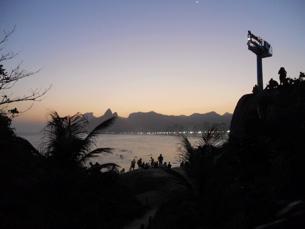 And now -- YOU! Thank you so much for visiting my blog. If you'd like to go back at flip through previous posts, the "archives" section on the righthand side of my site makes that a bit easier to do. If you've just landed on Brazil Bound for the first time, you can learn more about my project on the About page. My posts about Minas Gerais, Brasília, and São Miguel das Missoes also provide a diverse sampling of the range of my activities this summer. I am incredibly grateful to the Center for Advanced Study in the Visual Arts for making it possible for me to explore Brazilian architecture this summer -- my horizons have truly been broadened. I am so thankful for my family, friends, colleagues, and mentors who supported and helped me in all stages of the planning and execution of this study. To my new friends who welcomed me in Brazil -- thank you for making me feel at home in your country. And to the dozens and dozens (probably hundreds) of Brazilian strangers who helped me find off-the-beaten-path buildings, or patiently decoded my Portuguese, or walked me to bus stops I couldn't find -- muito obgriada. This experience has opened up a completely new discourse to me as a scholar, and I look forward to seeing how it will shape my approach to my future scholarship and teaching. A state, if you will, of anticipation. 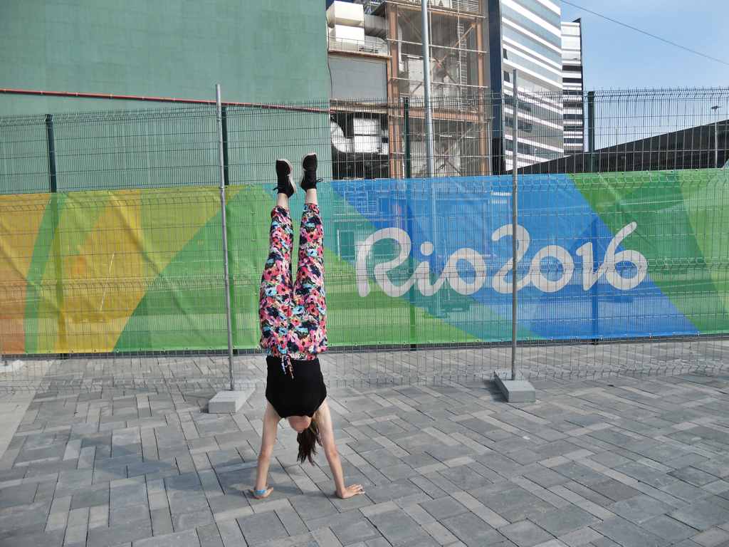
2 Comments
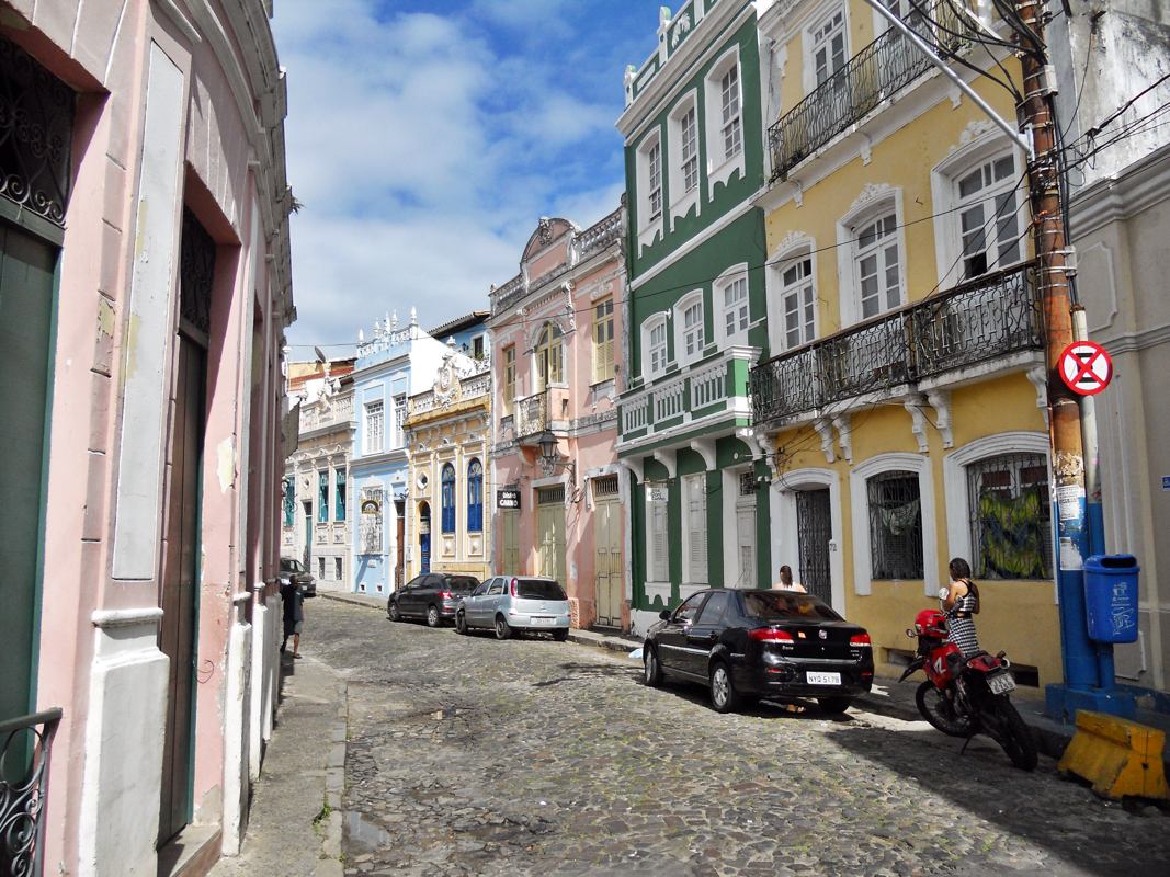
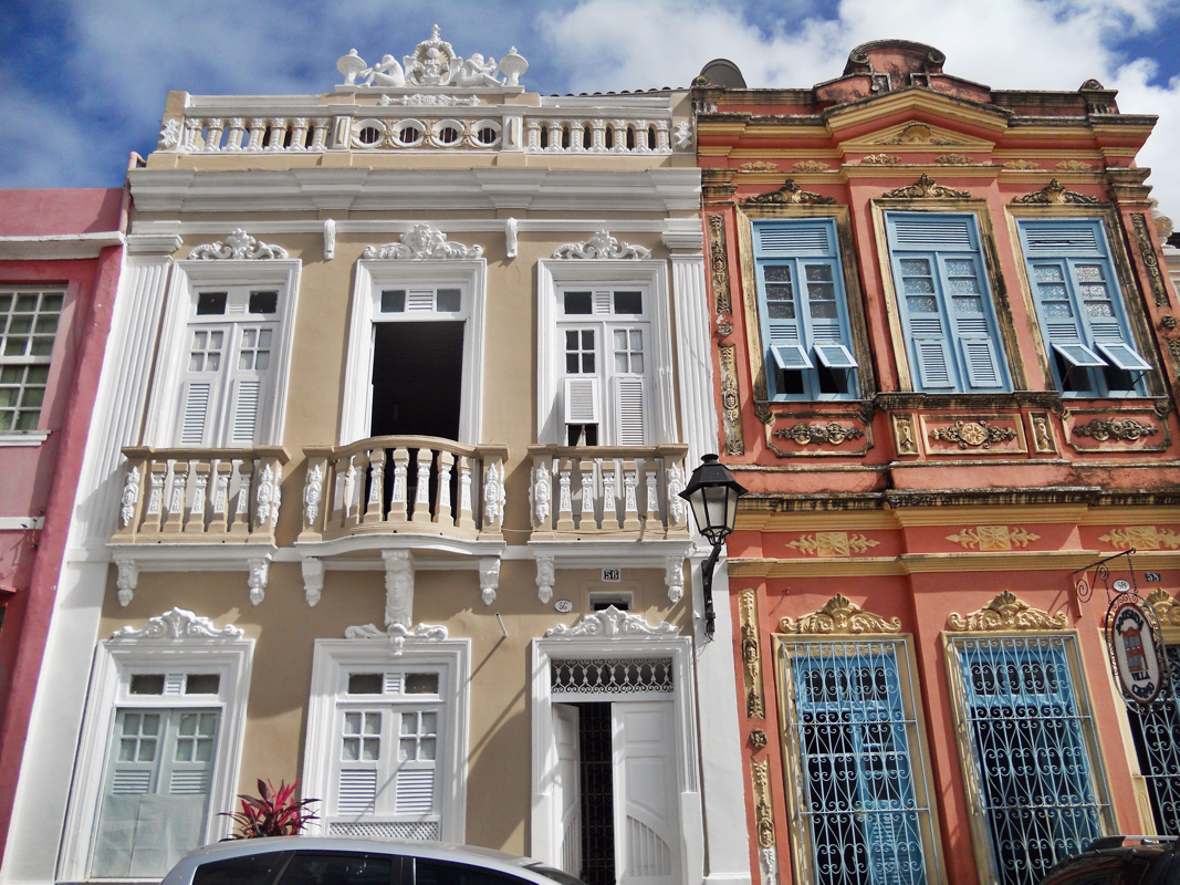
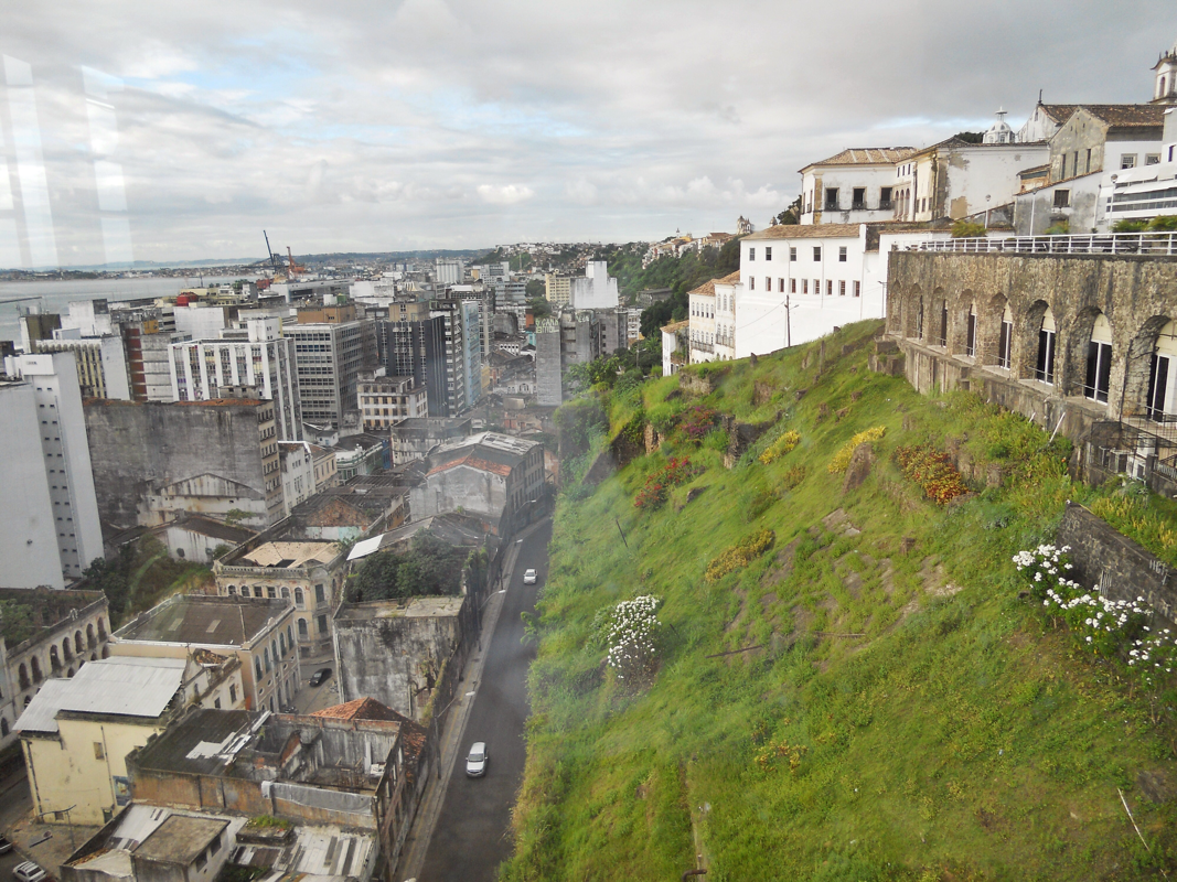
From my first walk through the achingly beautiful Pelourinho, Salvador da Bahia's historic center -- actually no, maybe from the breakfast table in my pousada on my first morning here -- Salvador was high on my mental wishlist of places to return to in my lifetime. I am so grateful I was able to visit this incredible city on my trip to Brazil this summer, but three days was just not enough to take in all the pastel-hued 17th and 18th-century buildings, tropical breezes, and reverberating drum beats.
Salvador da Bahia was the capital of colonial Brazil from 1549 to 1763, and functioned as a major port of the country's sugarcane industry and African slave trade. The city's wealth, and the displays of such richness in its opulent baroque architecture, relied heavily on the labor of enslaved Africans.
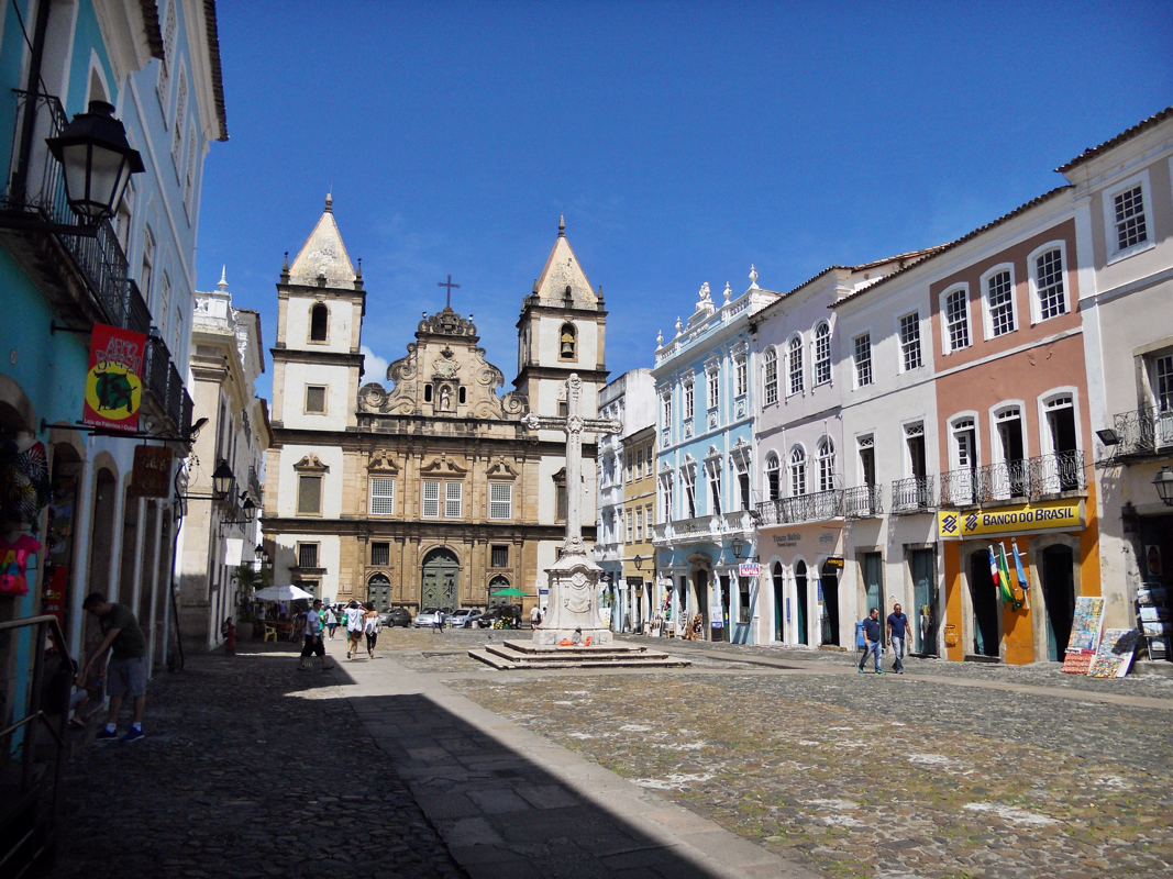
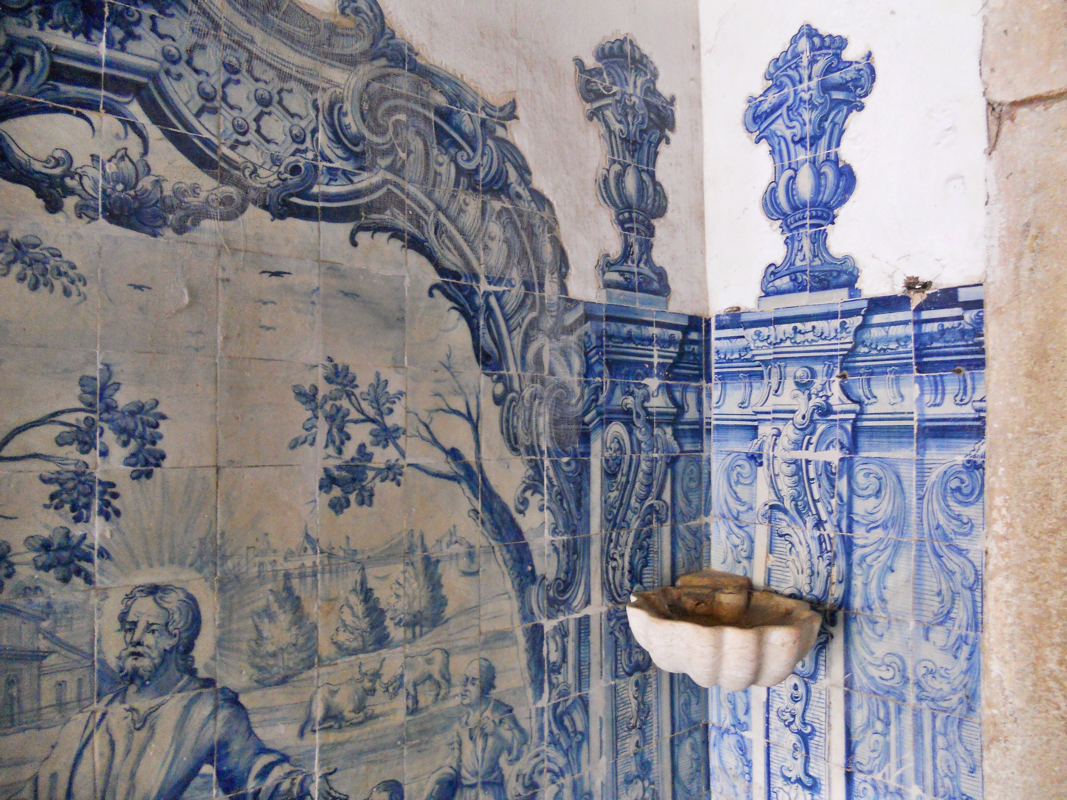
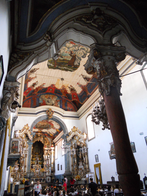
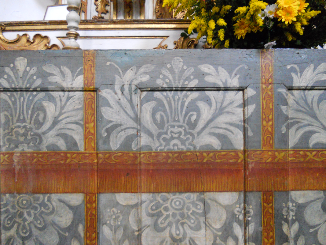
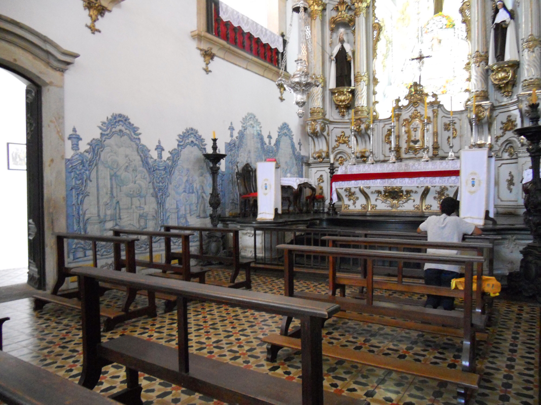
On my first day in Salvador, nothing could tear me away from the historic zone that was the center of so much of this history, the Pelourinho, which takes its name from the "pelourinho" or whipping post where enslaved blacks were exposed and beaten. From my pousada at the north end of the historic city center, I wound southward, stopping at every museum and church that I could on my way down the Largo do Carmo, the Rua São Francisco, and finally the main praça, Terreiro de Jesus. Igreja Nossa Senhora do Rosário dos Pretos, begun in 1704 and built over the next 100 years, was a worship space for the enslaved and freed black population in Salvador. The beautiful azulejos and the painted ceiling reminded me of churches I had seen in Minas Gerais.
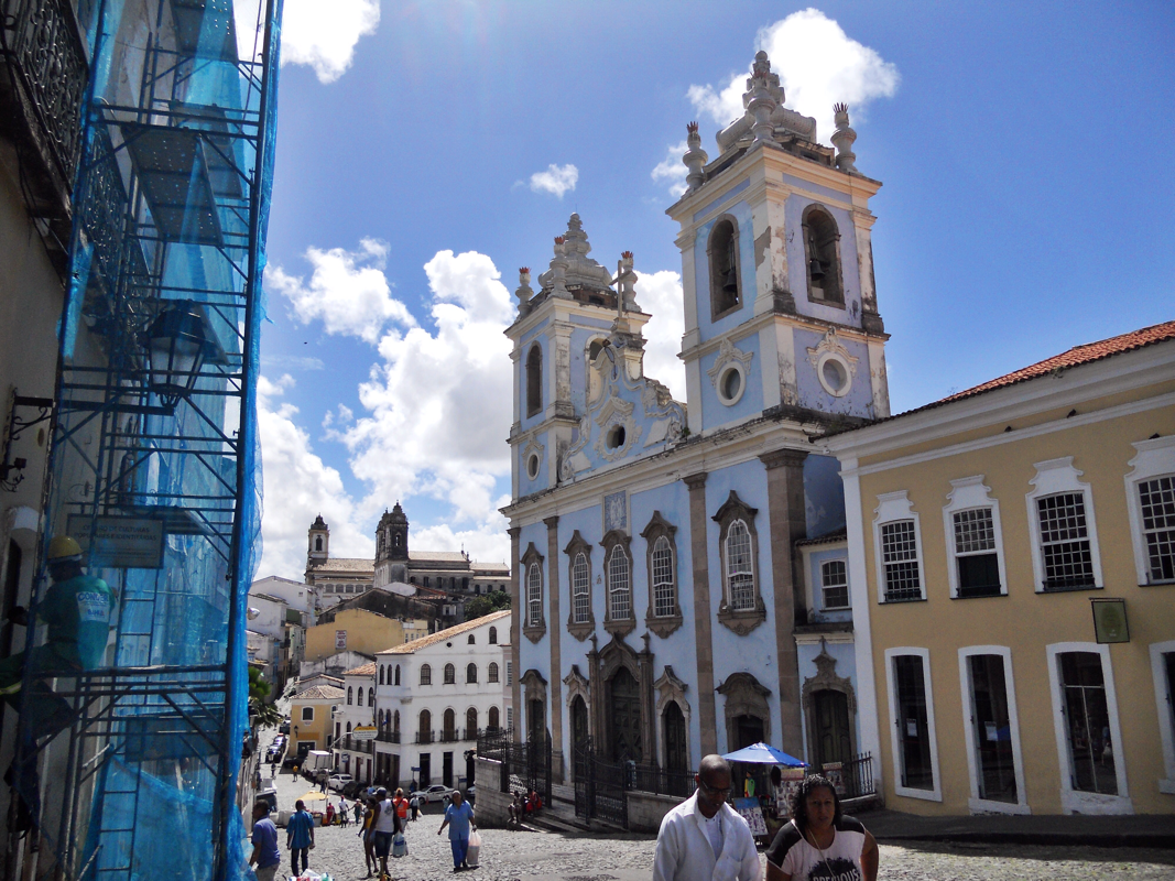
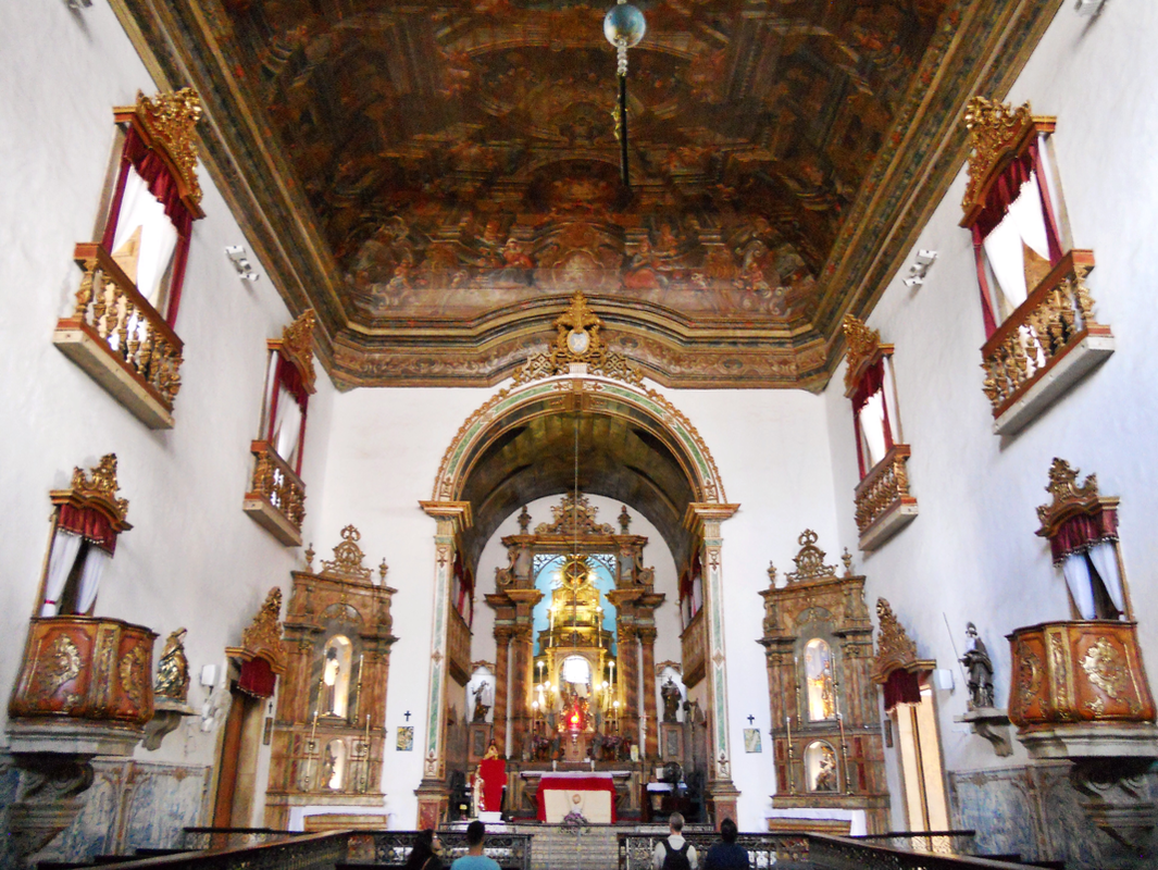
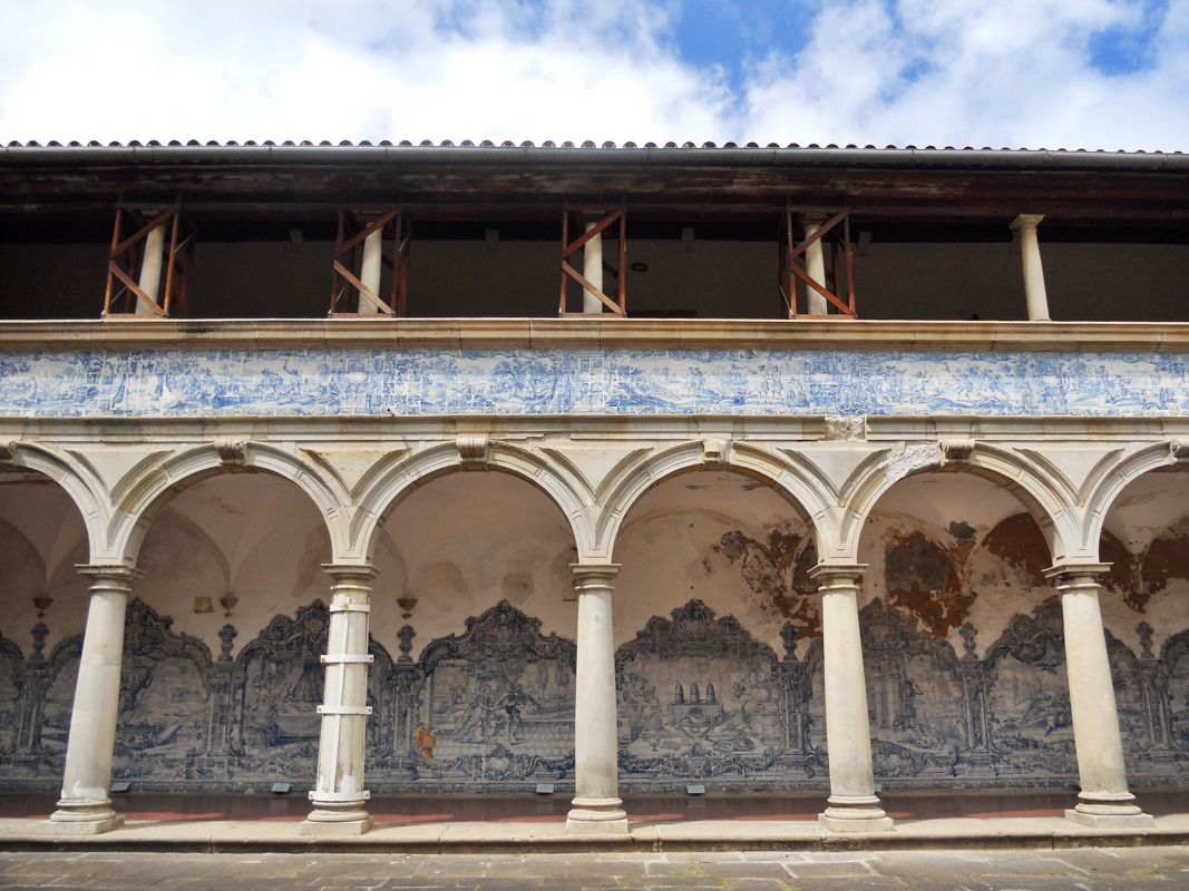
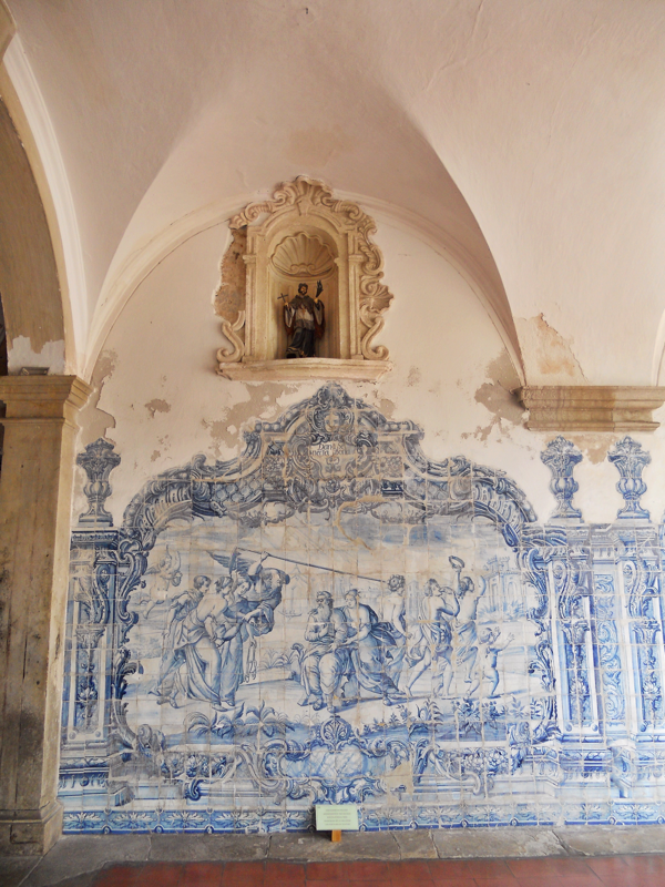
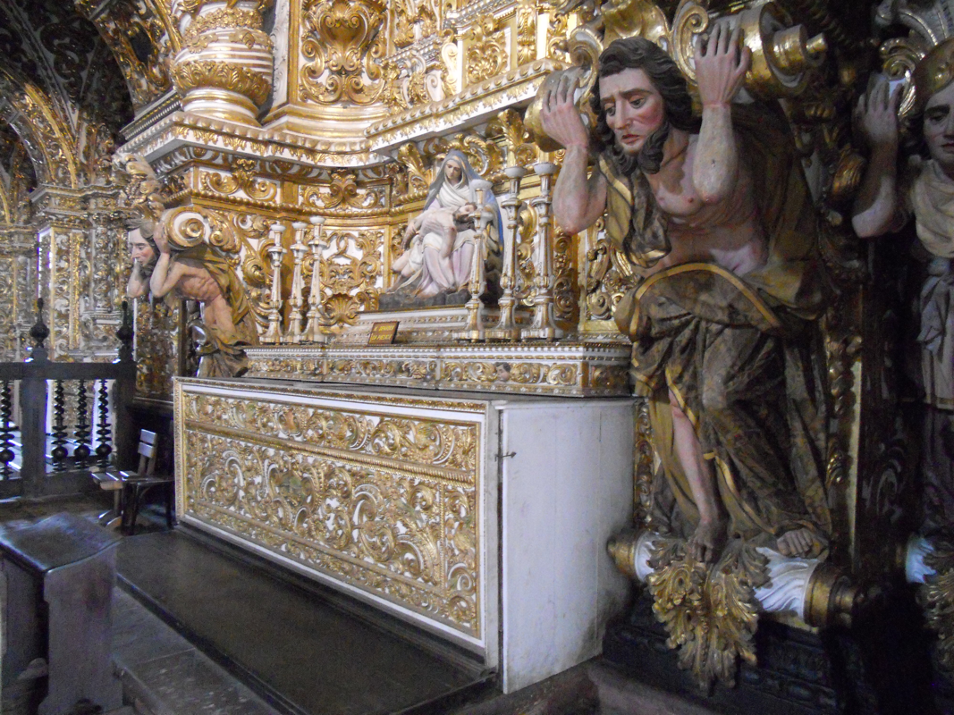
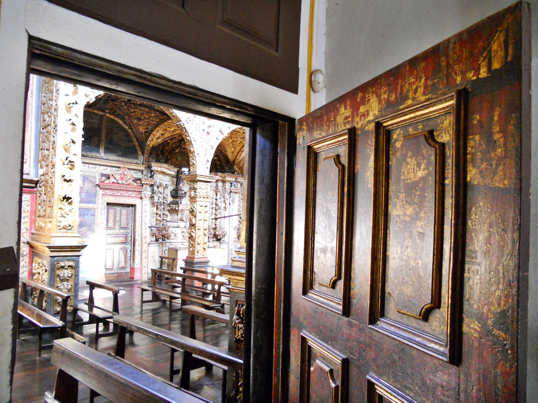
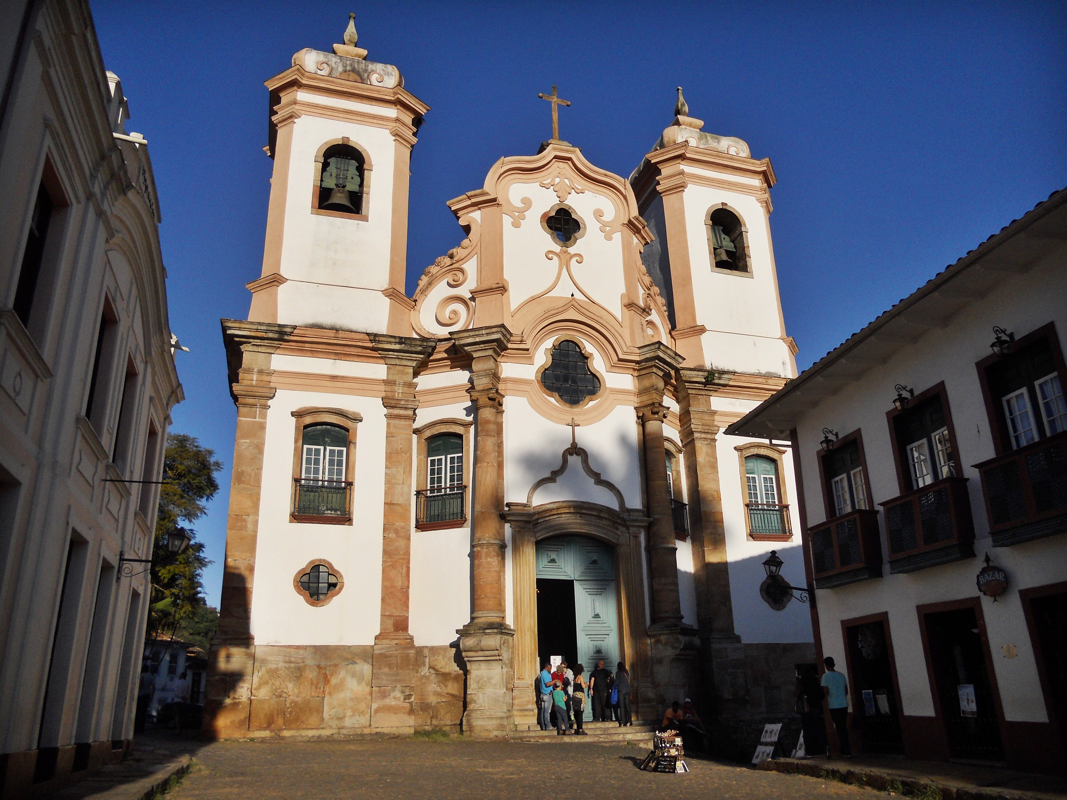
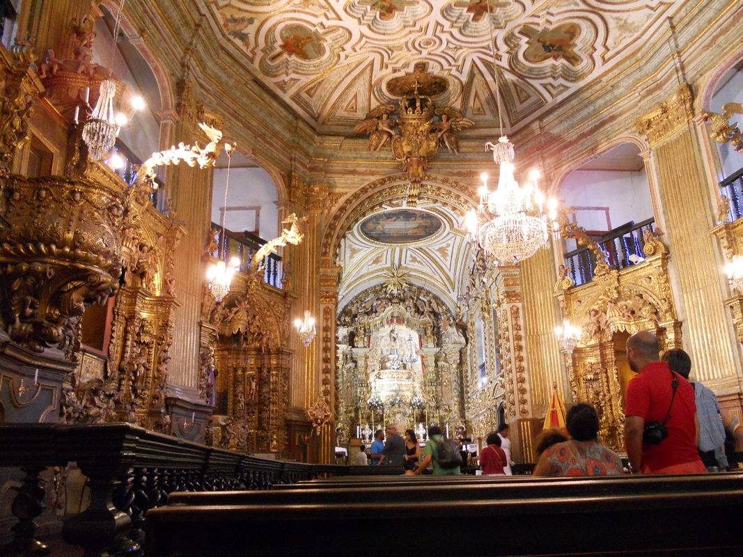
Further south in the Pelourinho, or Pelô for short, was the church and convent of São Francisco, the ultimate showpiece of Bahia's baroque wealth. Finished in 1723, the walls of the nave and chancel are covered in gold-leaf carvings, crafted by enslaved Africans who were prohibited from practicing their own religion. The courtyard displays an enveloping array of azulejos that were transported from Portugal in the 1740s. The imagery on the tiles is derived from the paintings of the Flemish artist Otto van Veen -- yet another iteration of visual forms transmitted across the Atlantic.
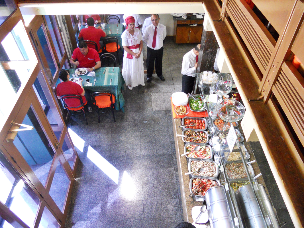
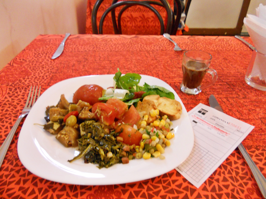
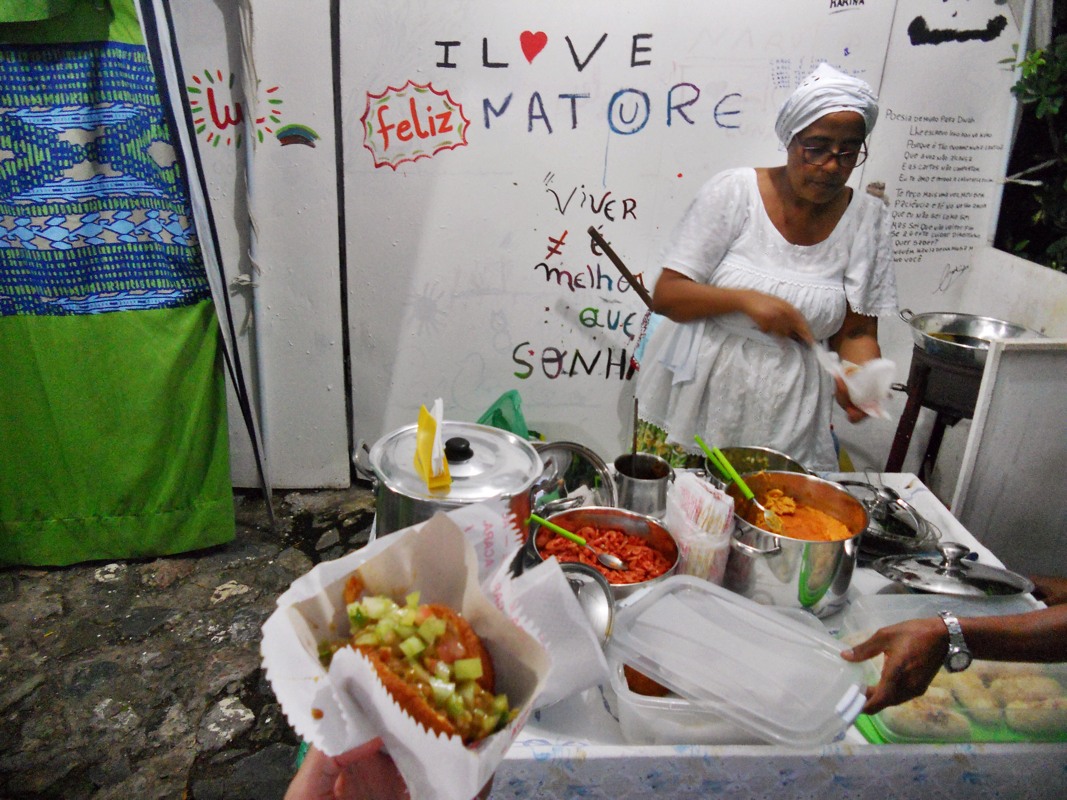
I stopped for lunch at the Senac culinary school buffet, a delicious lunch option for just about $6. Senac also has a small Bahian gastronomy museum, which confirmed what my tastebuds had told me -- Bahian food is a lot spicier than foods I had tried in other areas of Brazil! Traditional Bahian food has an African influence, with ingredients like coconut cream, tomato, hot malagneta peppers, coriander, and dende oil from a palm that grows in Brazil and in West and Central African countries.
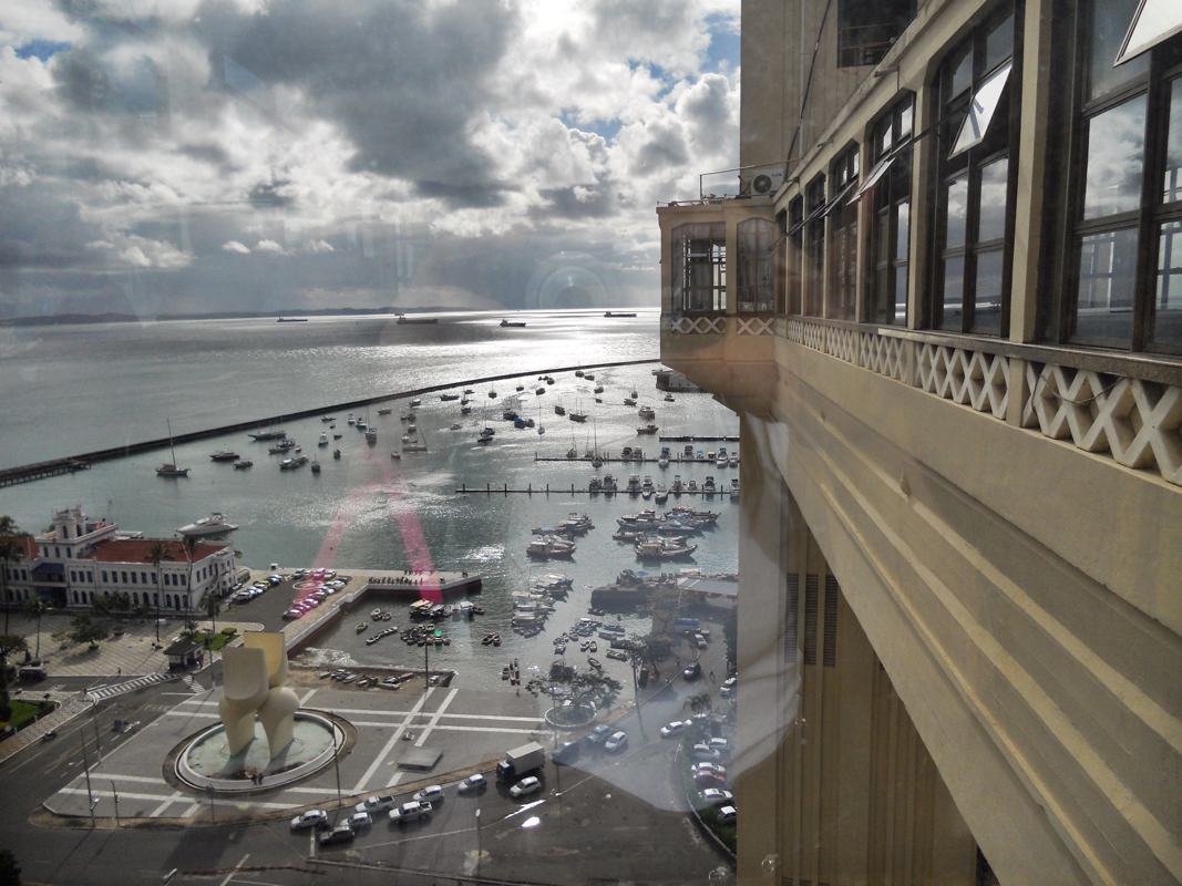
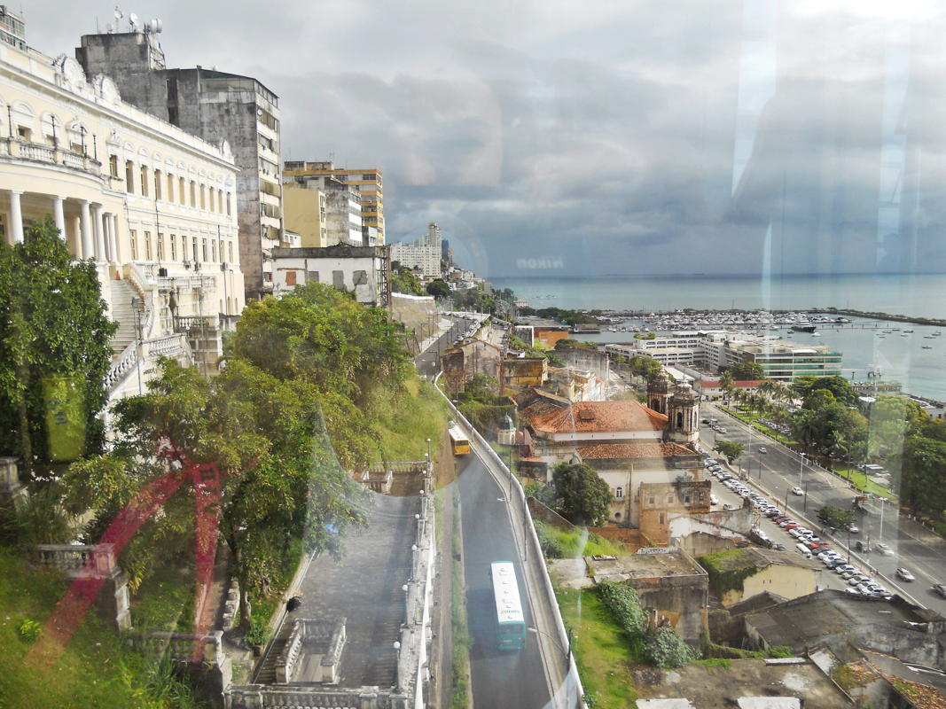
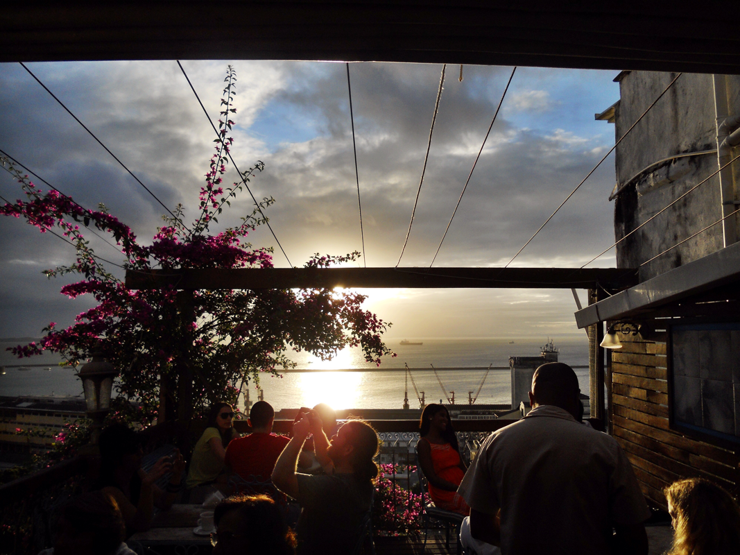
Salvador is situated on a cliff overlooking the Baía de Todos os Santos, or the Bay of All Saints. The geography divides the city into an upper and a lower portion, and from the cidade alta, or upper city, there are stunning views at sunset -- the only place in Brazil where the sun appears to be setting over the water. The following images show the lower city from the top of the impressive art deco Elevador Lacerda, and the sunset from a lovely cafe in the Pelô called Cafélier.
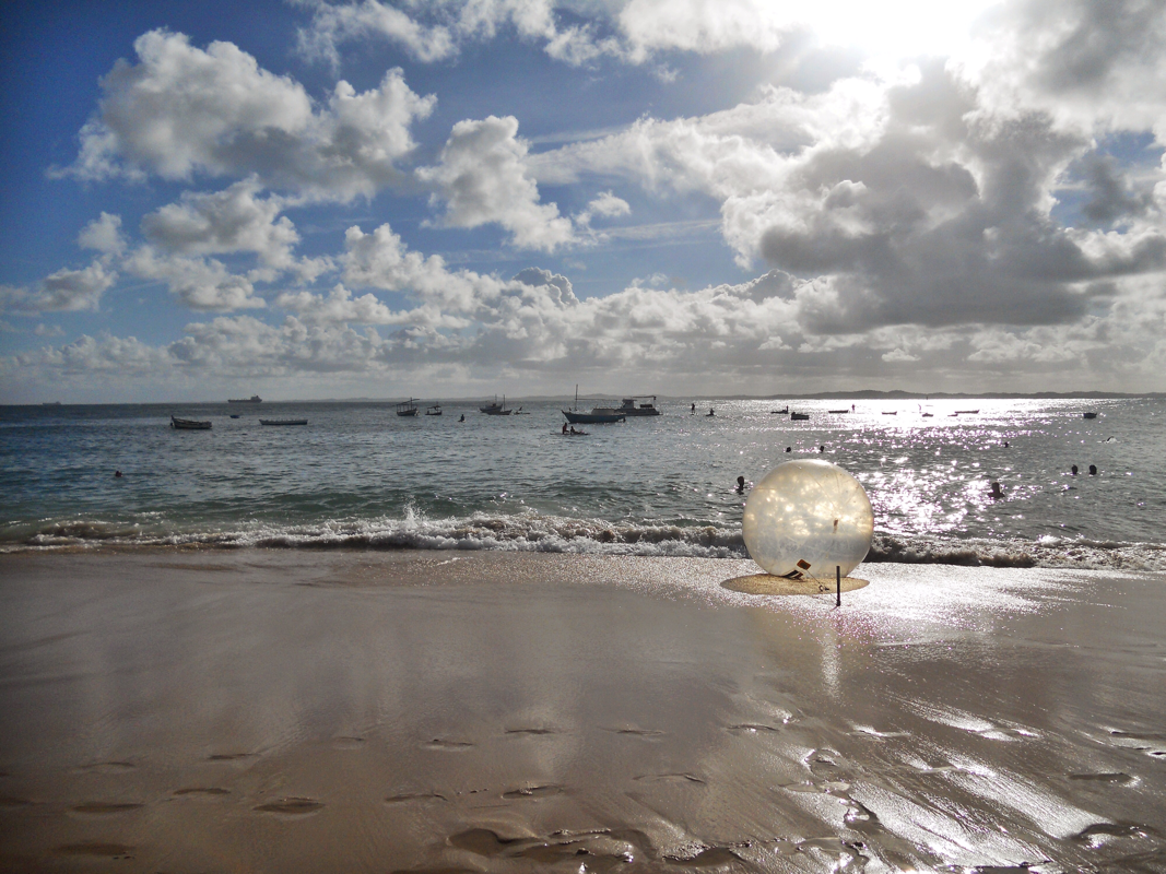
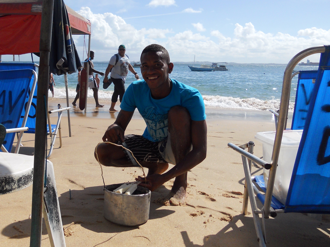
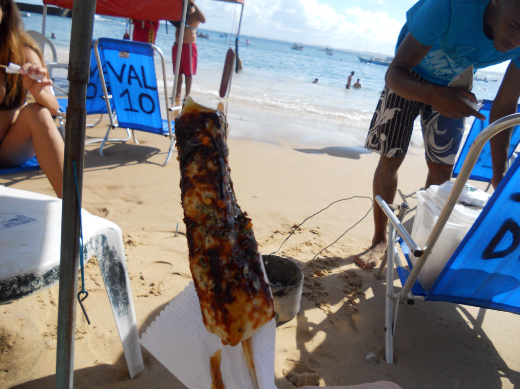
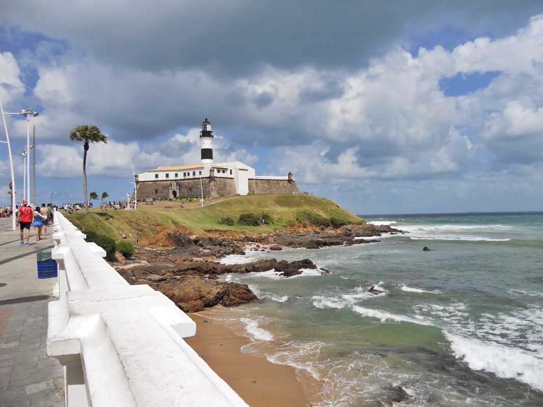
Here is that famous sunset from the Praia Porto da Barra, where my new Bahian friends, Lara and Davi, introduced me to acarajé (shrimp and bean fritters), and beach cheese -- a delicious, delicious snack of queijo fresco that is roasted over coals, covered in oregano and molasses, and served on a stick. Brazil's oldest lighthouse, the Farol da Barra which dates to 1698, guards this shore.
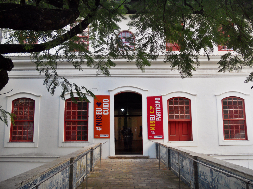
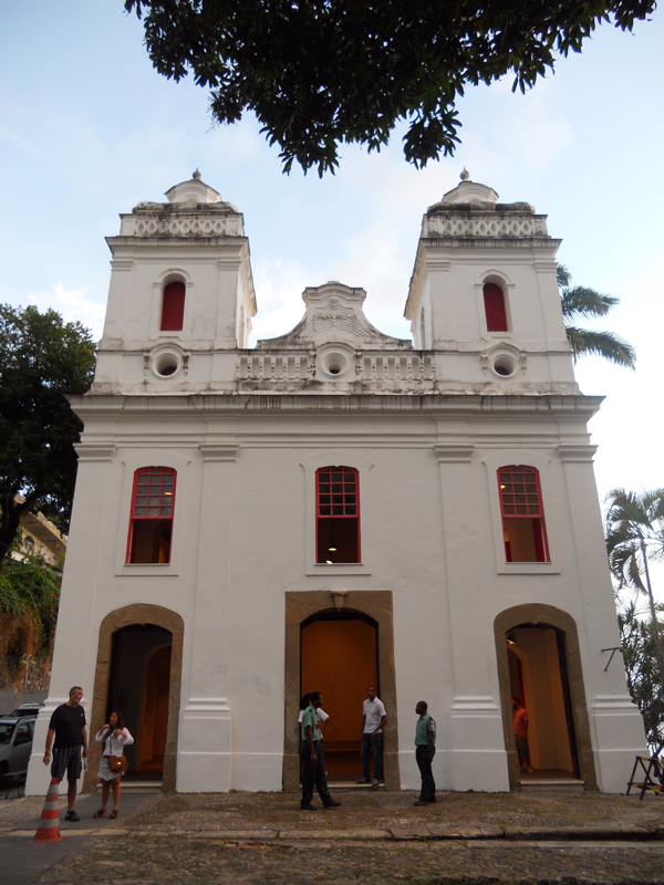
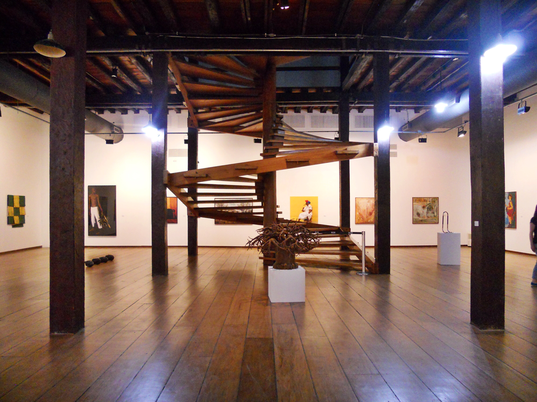
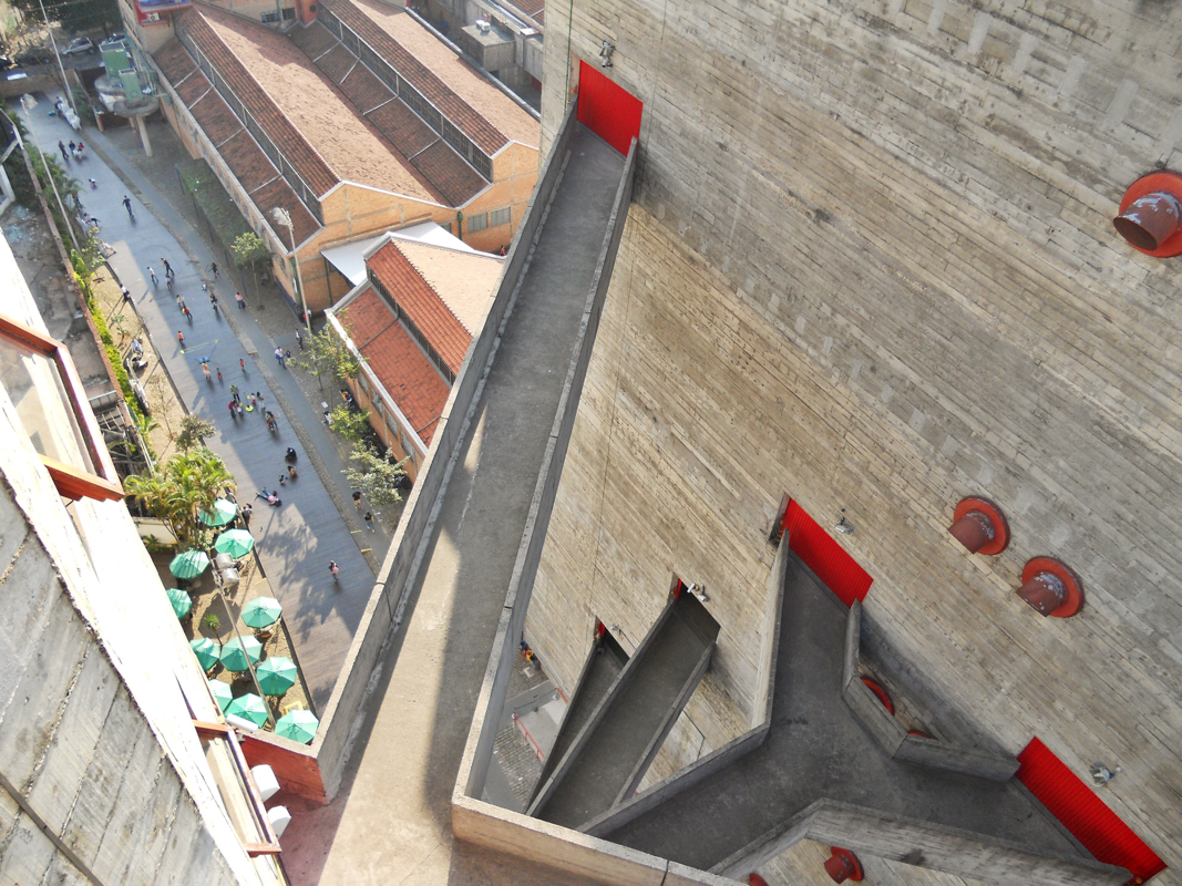
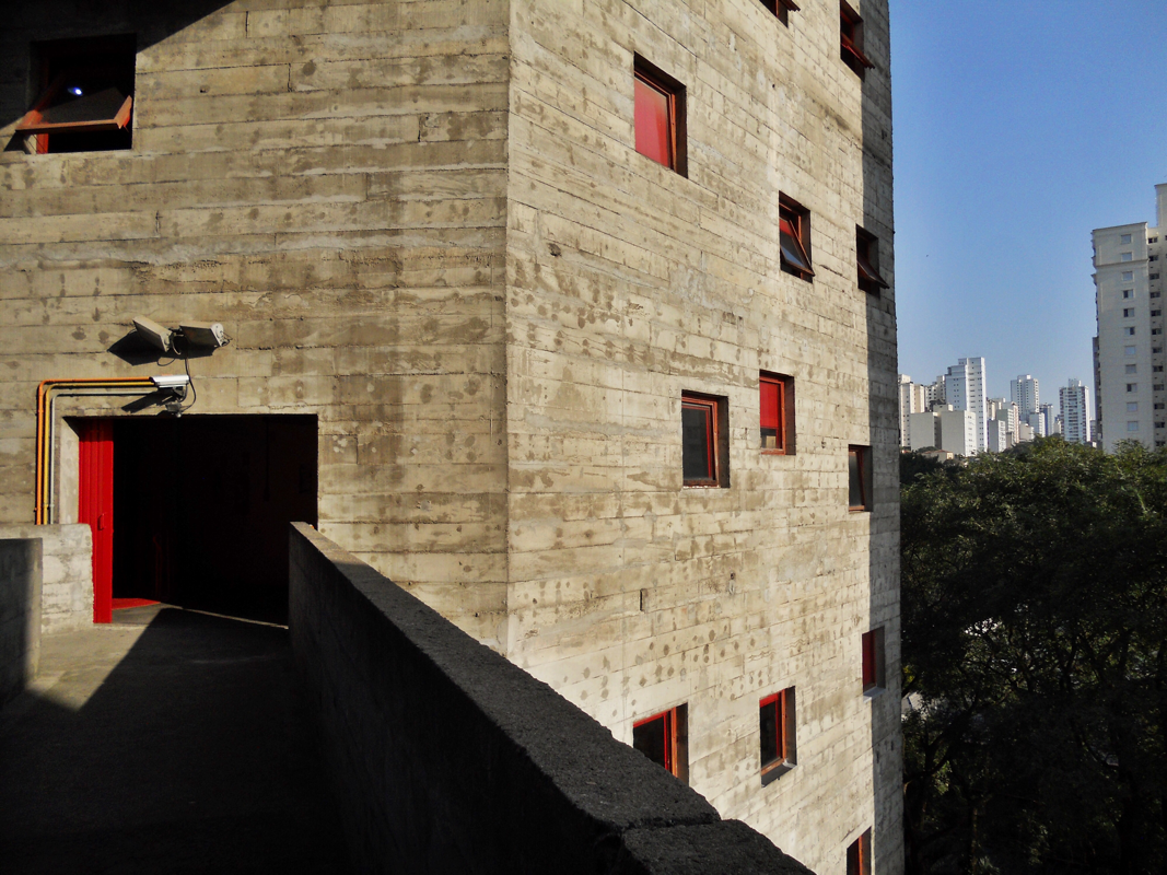
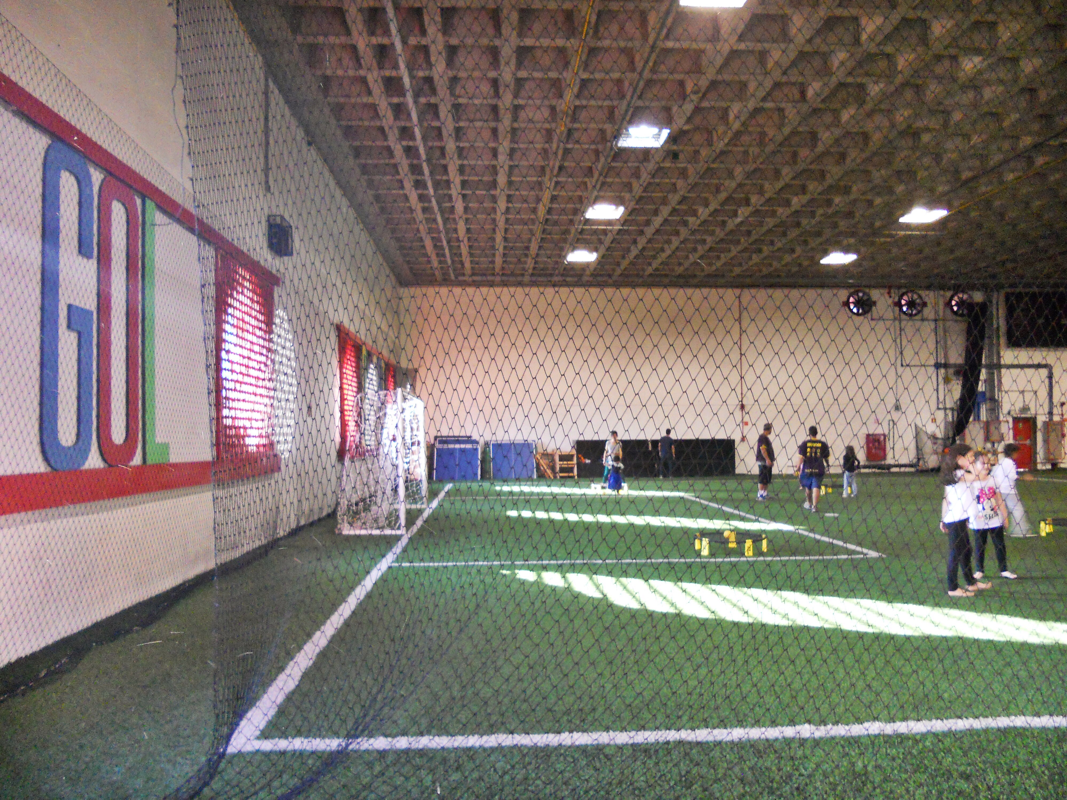
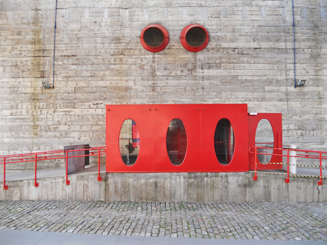
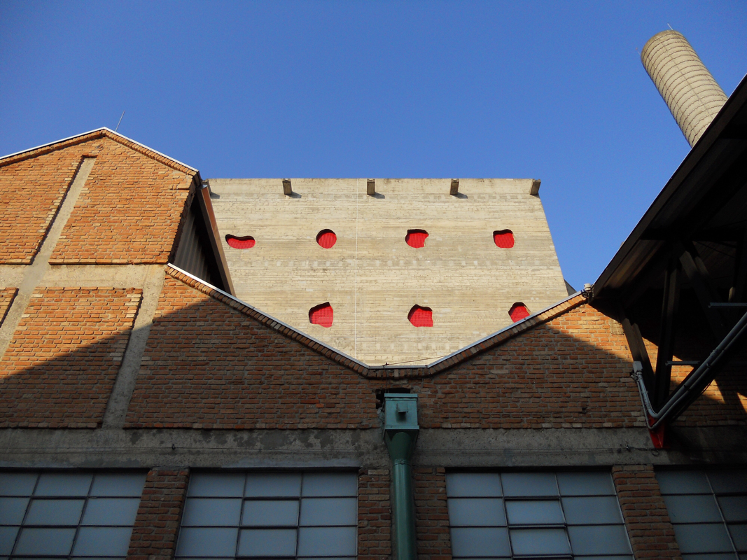
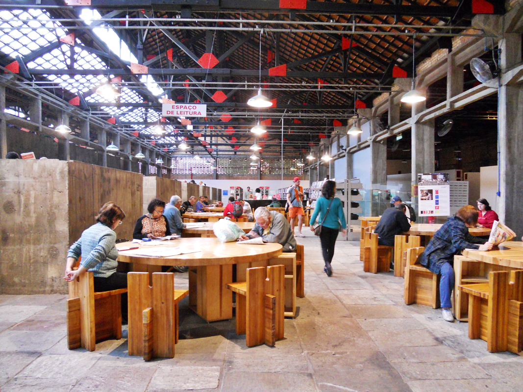
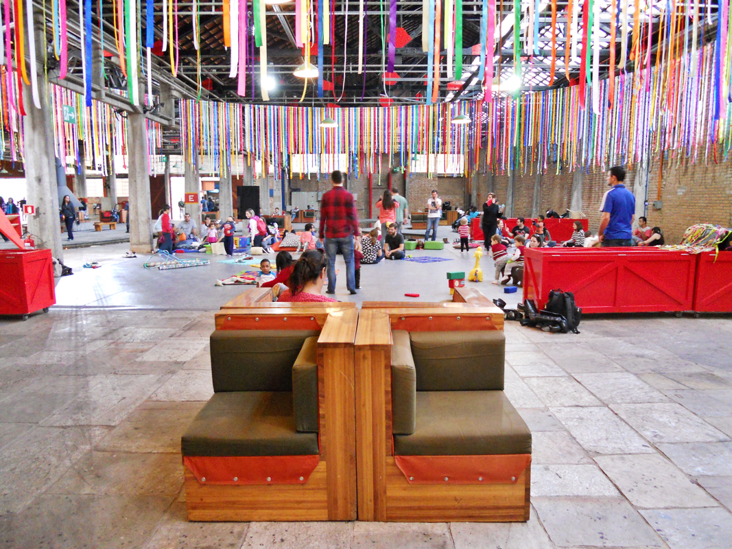
Seemingly no weekend in Salvador is complete without Saturday night jazz and bossa nova concerts at the Museu de Arte Moderna, also known as "JAM no MAM." I went with Lara and Davi, who graciously set aside extra time for me to explore the building -- originally an 18th-century factory called Solar do Unhão. Lina Bo Bardi rehabbed this colonial complex in the early 1960s. She inserted a giant spiraling stair into one of the galleries, left rails in the cobblestones on the lower level, and tied everything together with her characteristic red details.
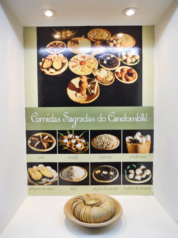
Salvador is the center of Afro-Brazilian culture in Brazil -- from music to religion to dance and martial-arts traditions. Candomblé is practiced here, a Bahian religion developed from a synthesis of Yoruba, Fon, and Bantu beliefs brought from West Africa, with elements of Catholicism. Capoeira, a Brazilian martial-art dating to the 16th century, also comes from Bahia. Capoeira's origins are debated among scholars, but it is agreed that enslaved Afro-Brazilians played a critical role in the development of the art form that combines dance, acrobatics, and music. Capoeira was banned at different points during Brazil's history until as recently as the 1920s. In 2014, UNESCO granted capoeira protected status as "intangible cultural heritage."
Here is a glimpse at one of the many drumming groups that dazzle tourists like me in the Pelô. The video cannot fully convey the experience of seeing one of these groups in person -- how the drum beats seem to pound inside you, and the way in which the sounds multiply in force, ricocheting off the centuries-old walls. I attended the fabulous Balé Folclórico, too, but naturally, photos weren't allowed during the performance. I got to see several Candomblé dances as well as some jaw-dropping capoeira -- back flips on the small stage!
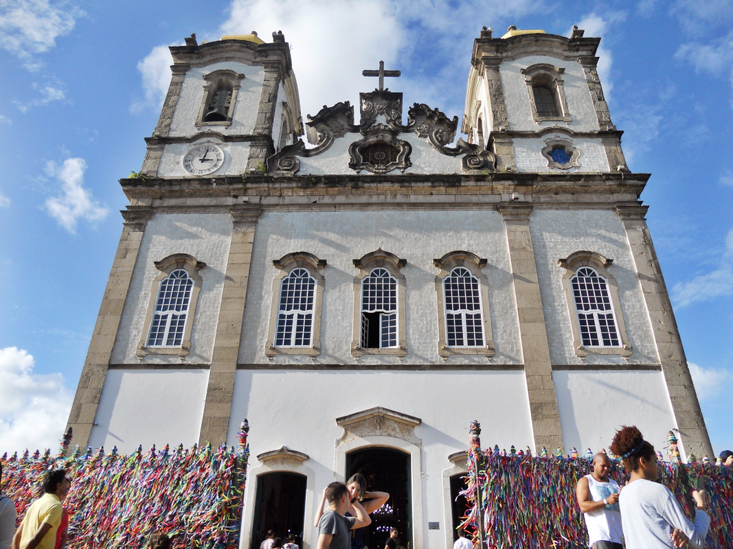
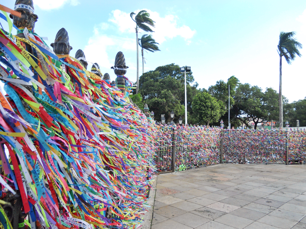
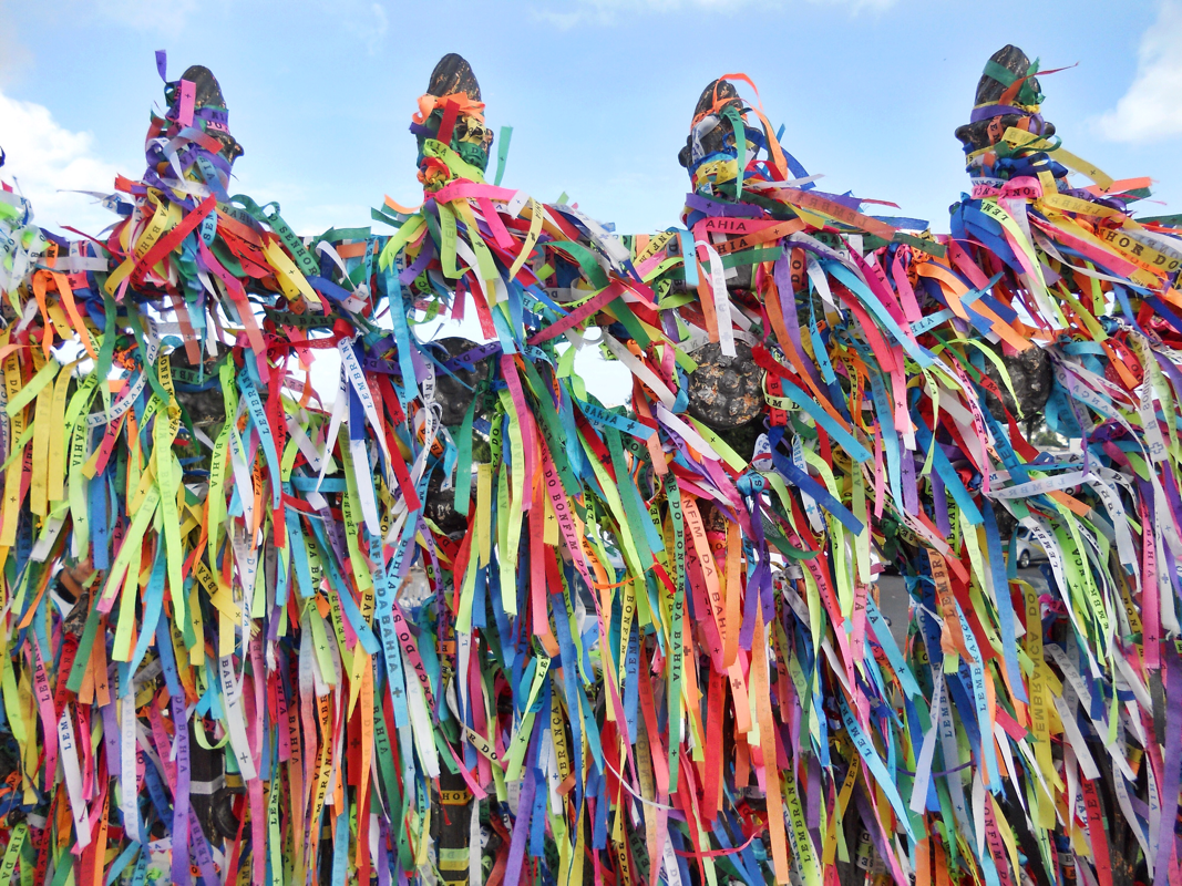
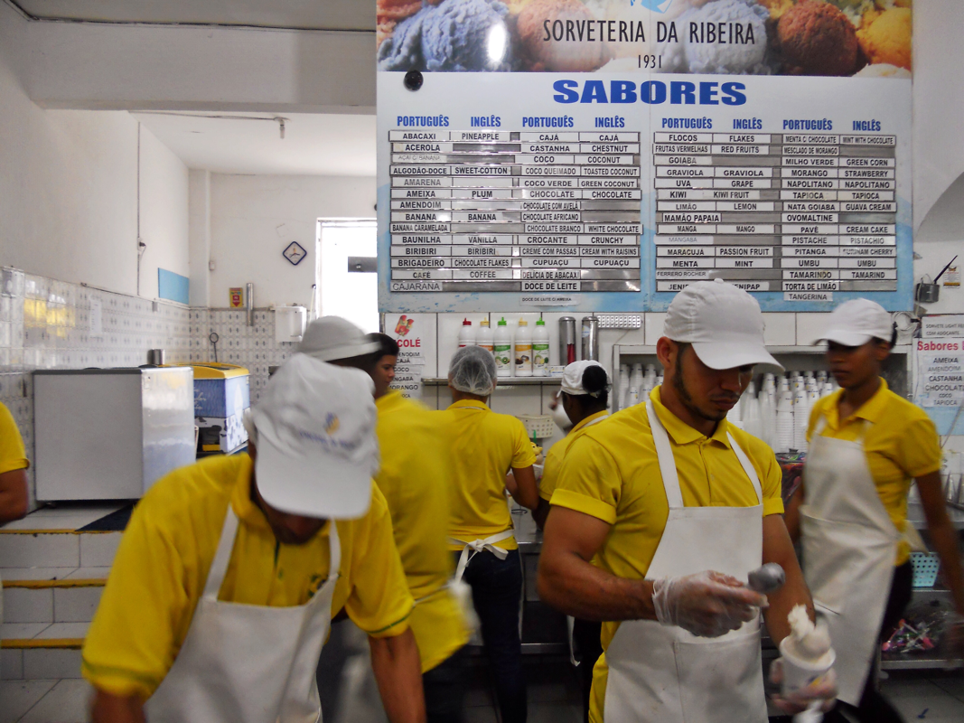
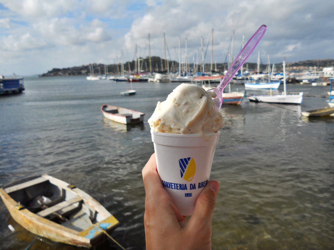
I capped off my time in Salvador with a visit to the church of Nosso Senhor do Bonfim, which functions as a center of Candomblé religion and Catholic syncretism. Candomblistas honor their highest deity, Oxalá, here, who they associate with Nosso Senhor do Bonfim (Our Lord of the Good End). The church of Nosso Senhor do Bonfim is know for its fitas, or colorful ribbons, that carry wishes and prayers of the faithful, adorning the church's exterior gate as well as its altar. The ribbons also serve as a souvenir from the church and are seen throughout Salvador and Brazil. The day was not complete without coconut ice cream from Sorveteria da Ribeira -- after about a dozen Bahians told me this was a must-try!
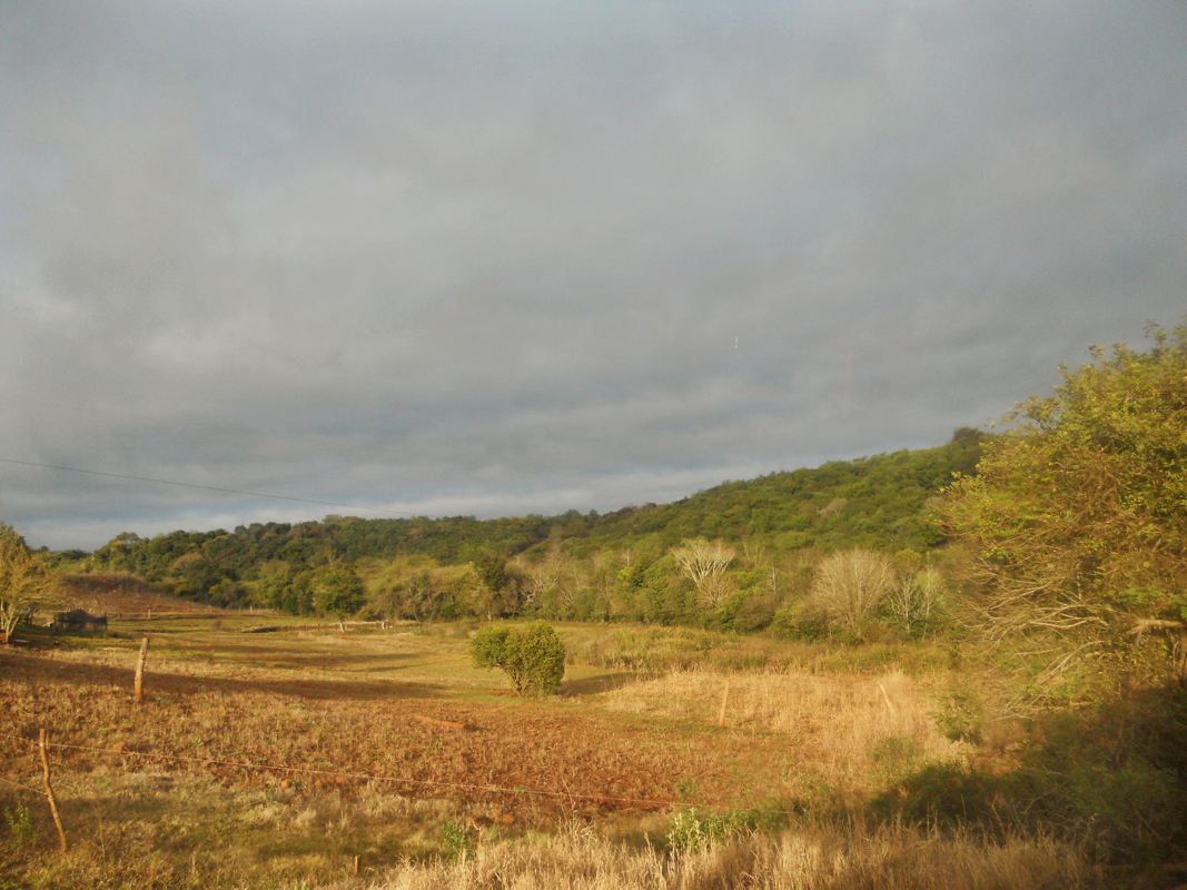
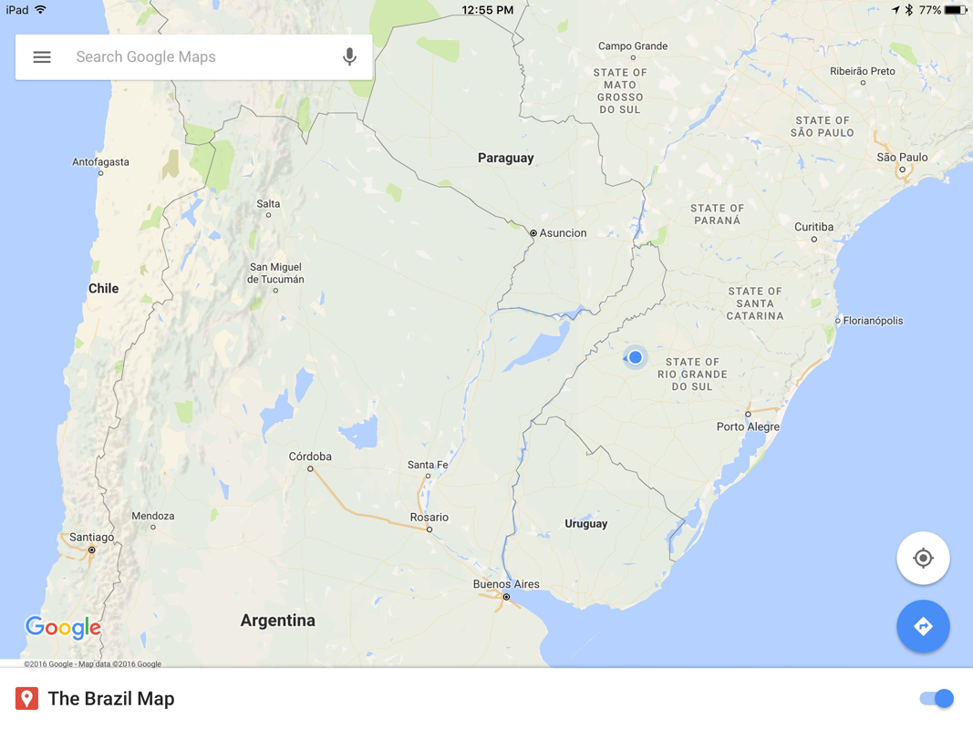
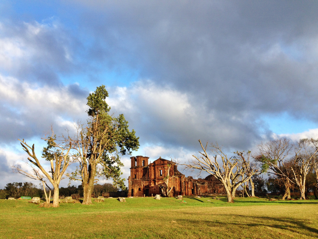
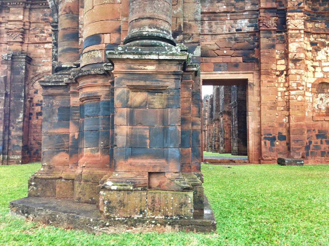
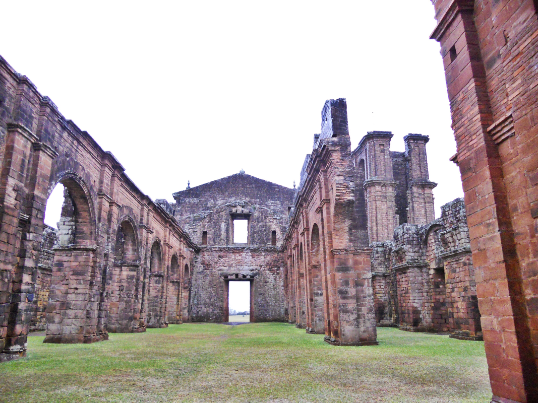
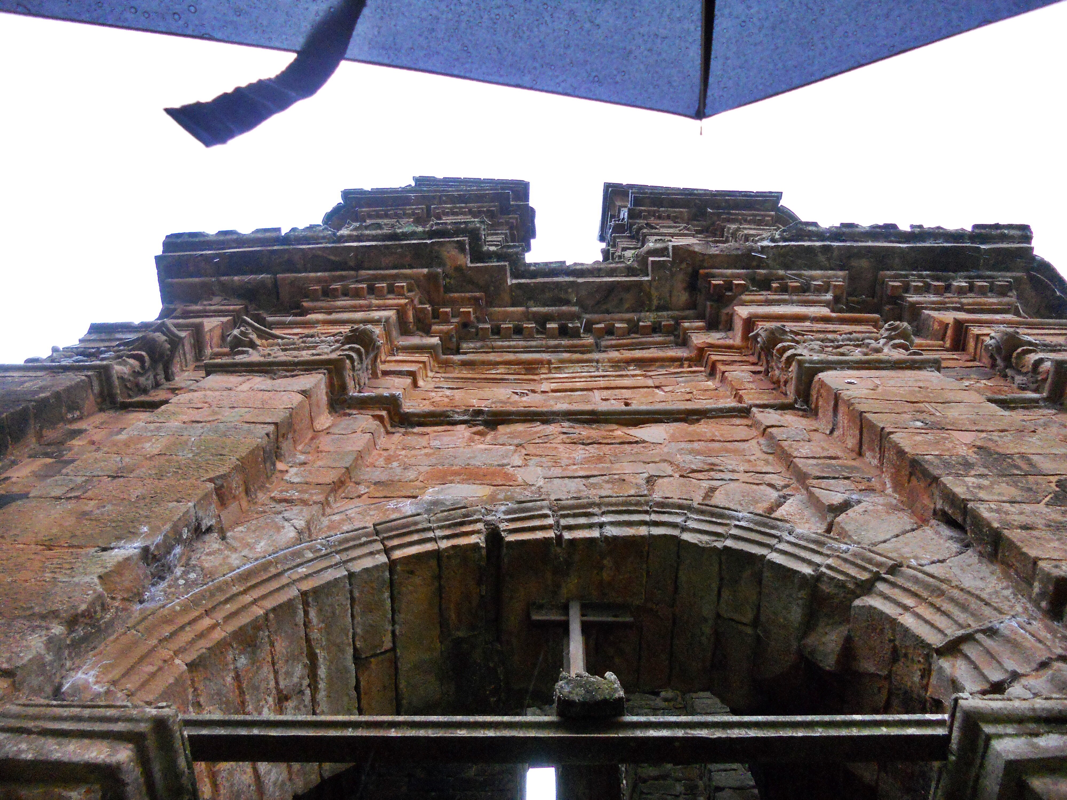
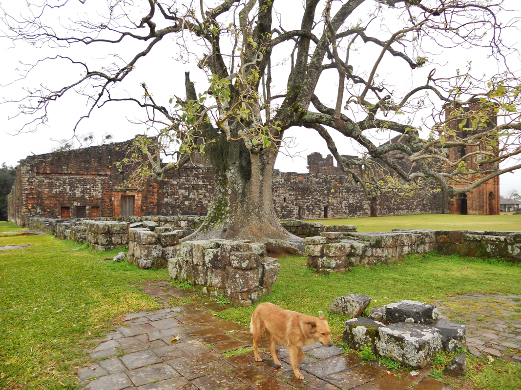
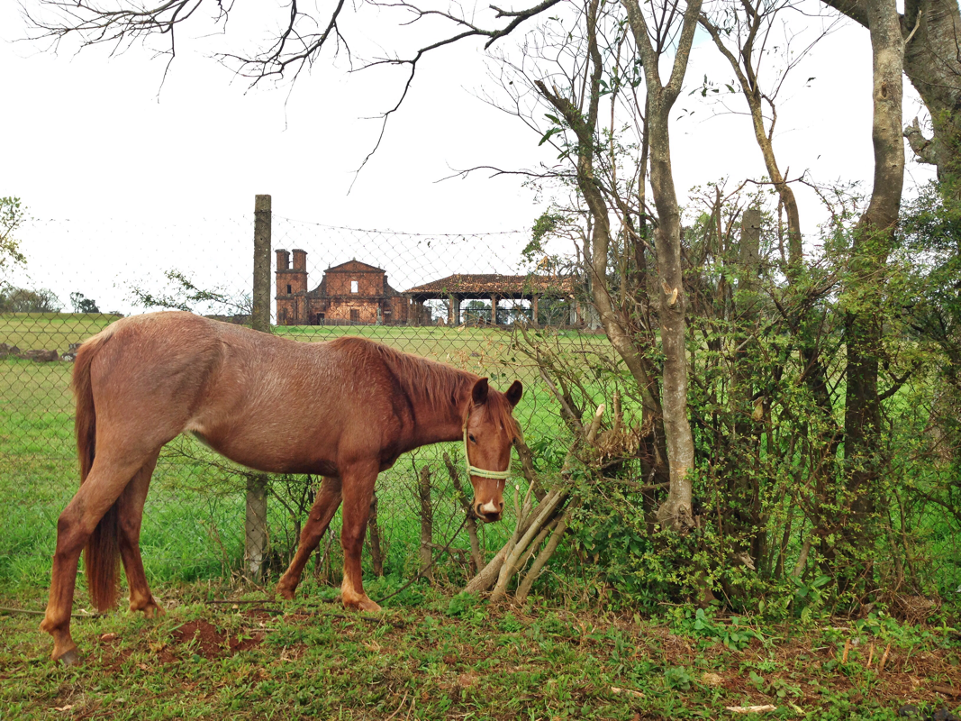
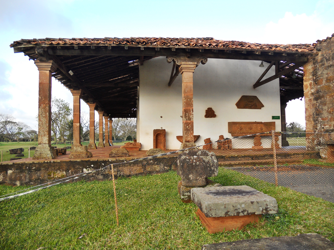
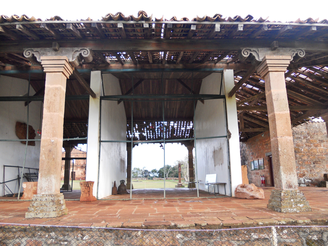
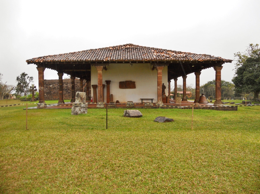
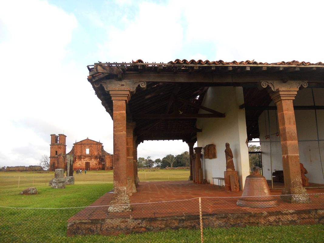
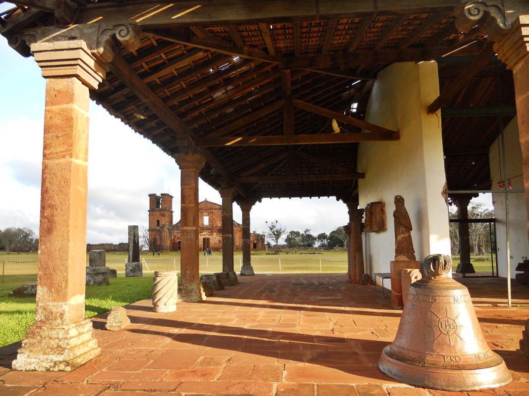
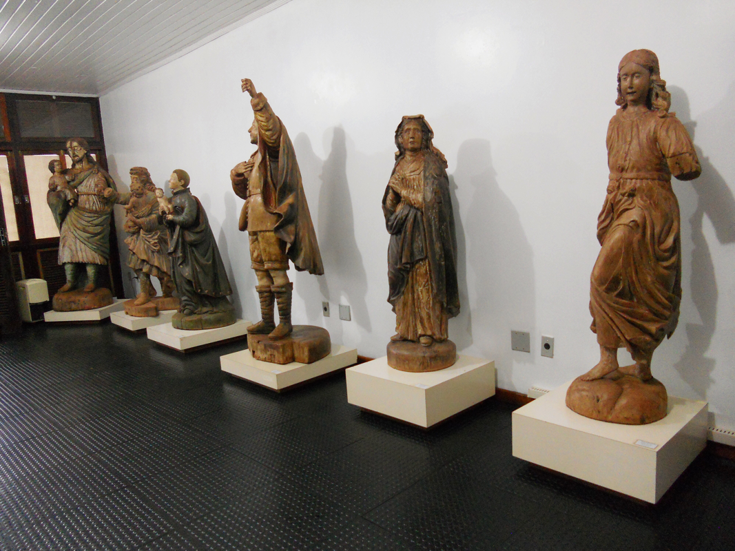
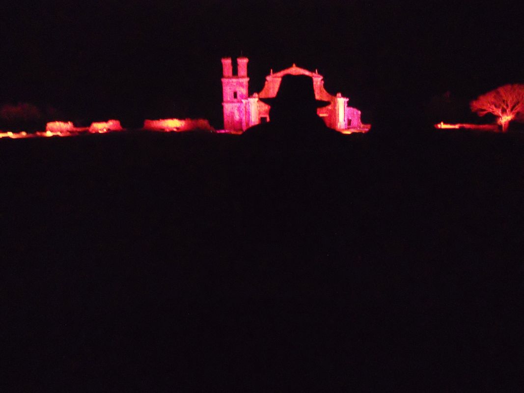
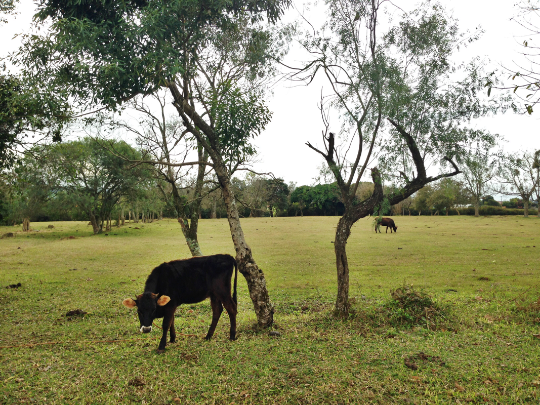
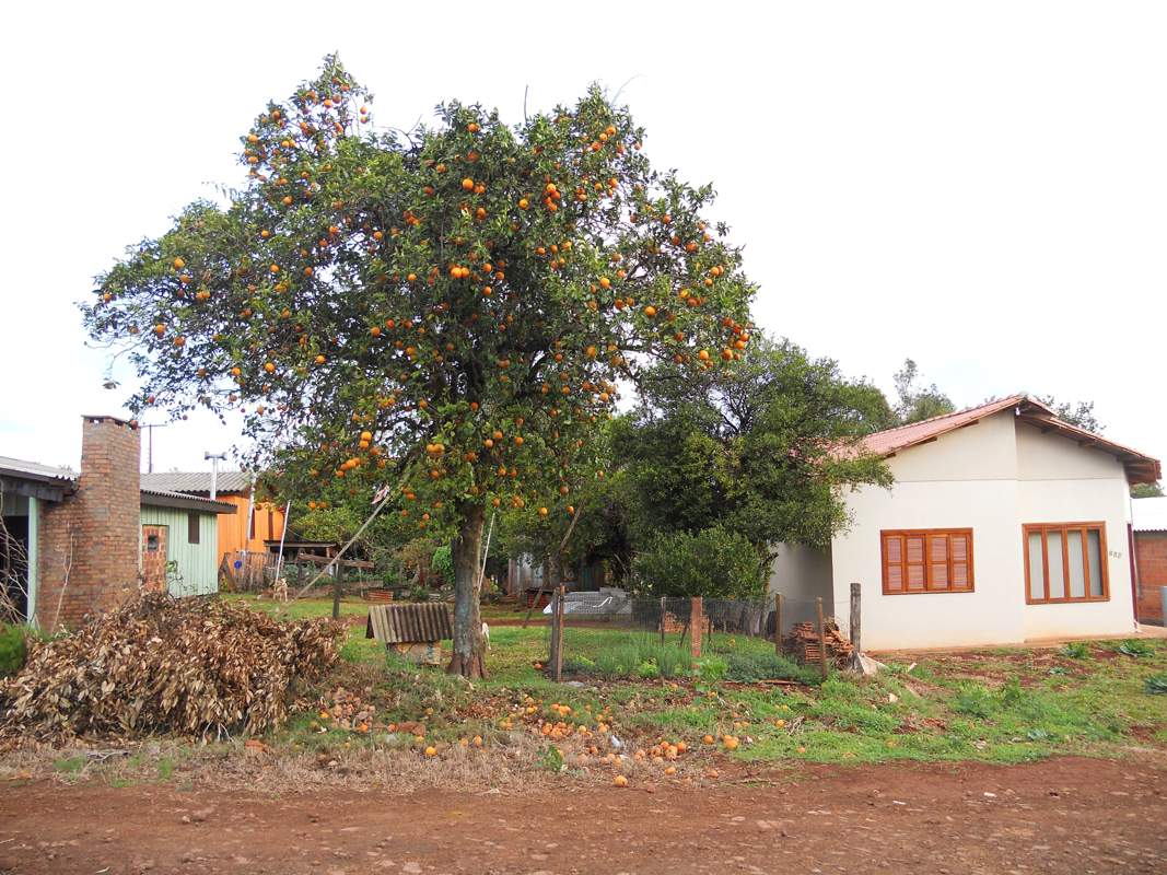
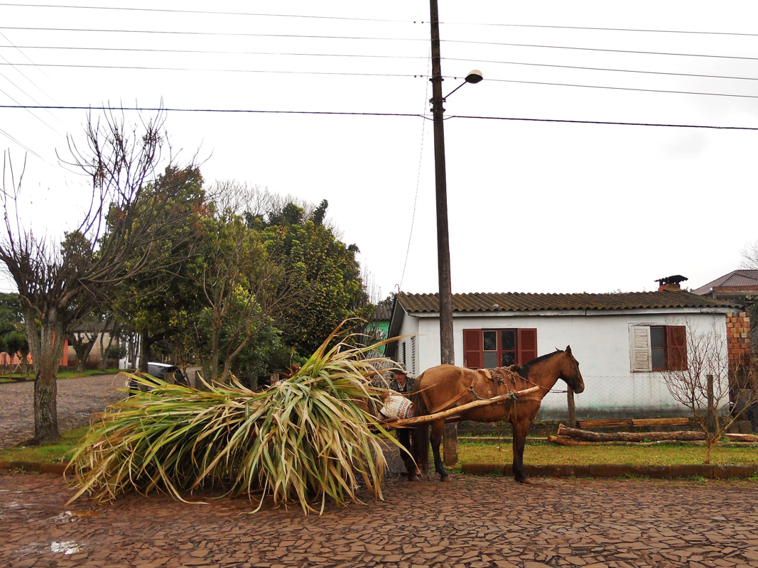
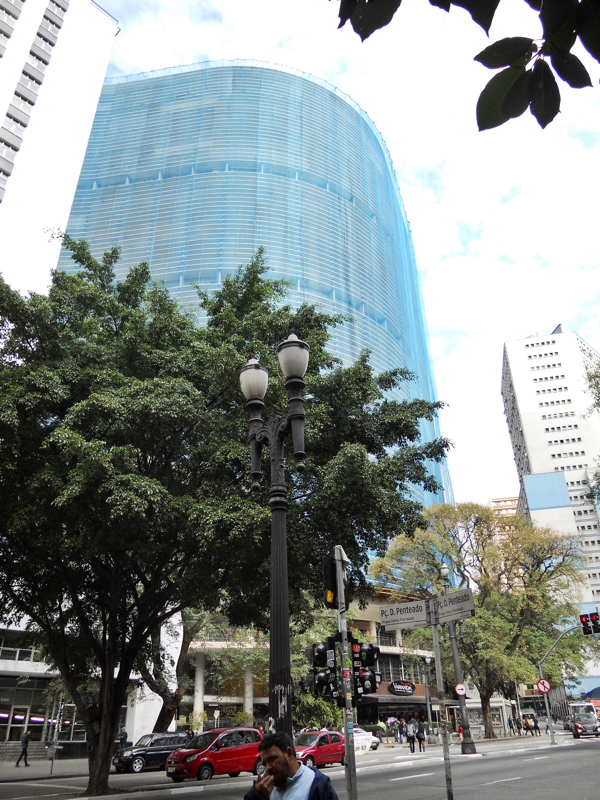
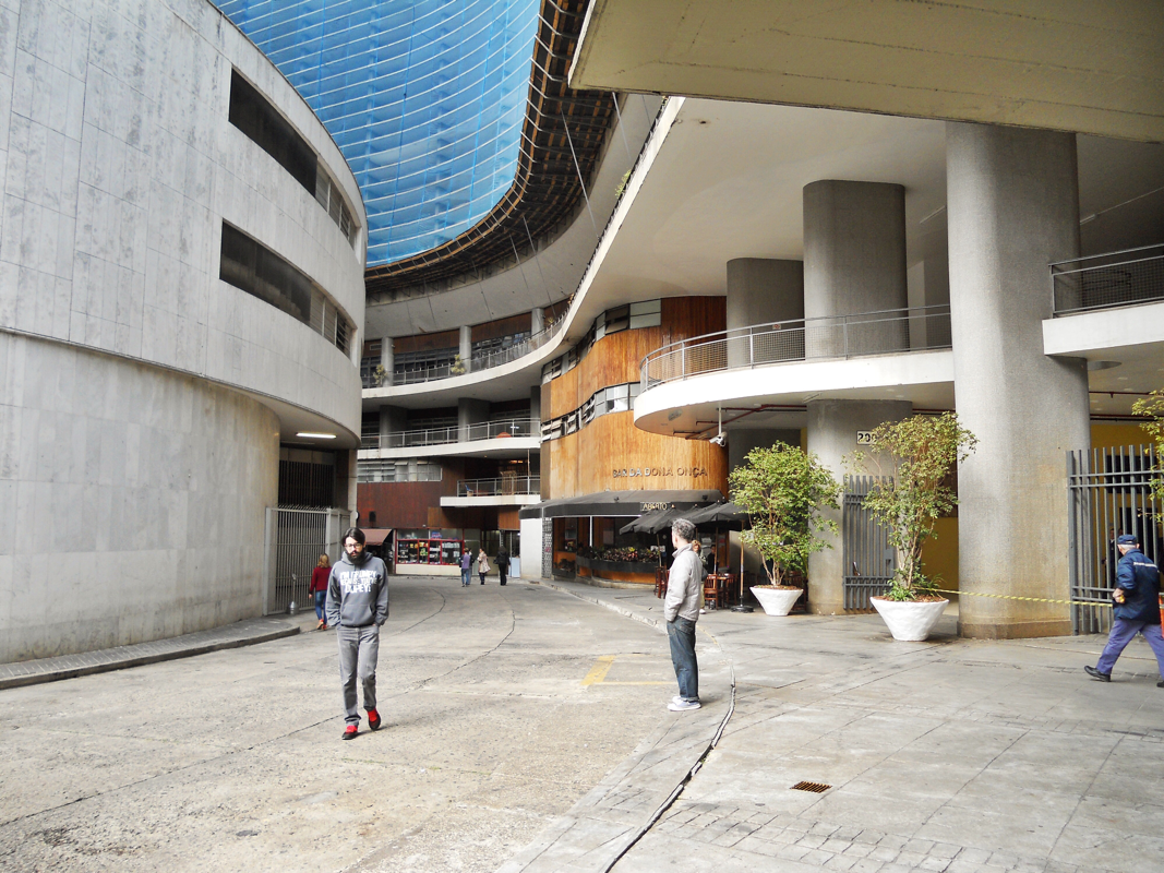
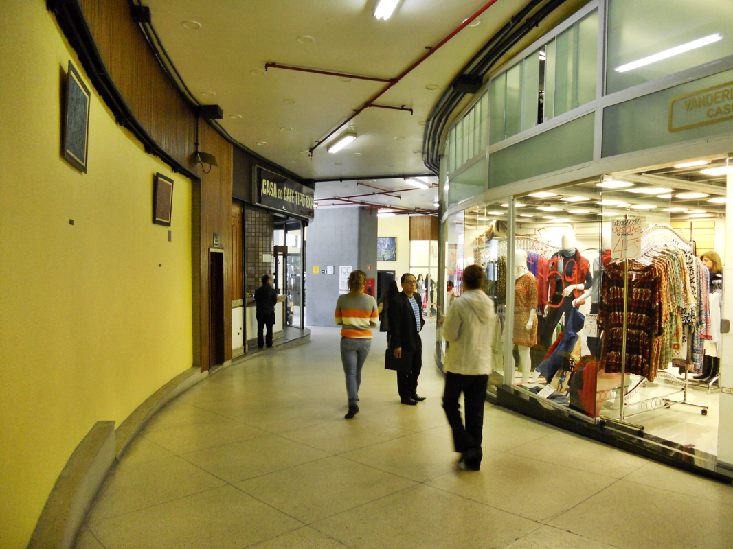
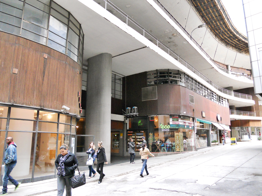
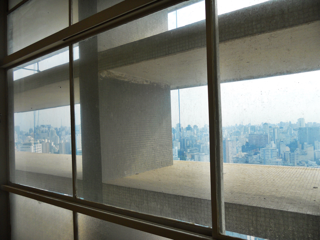
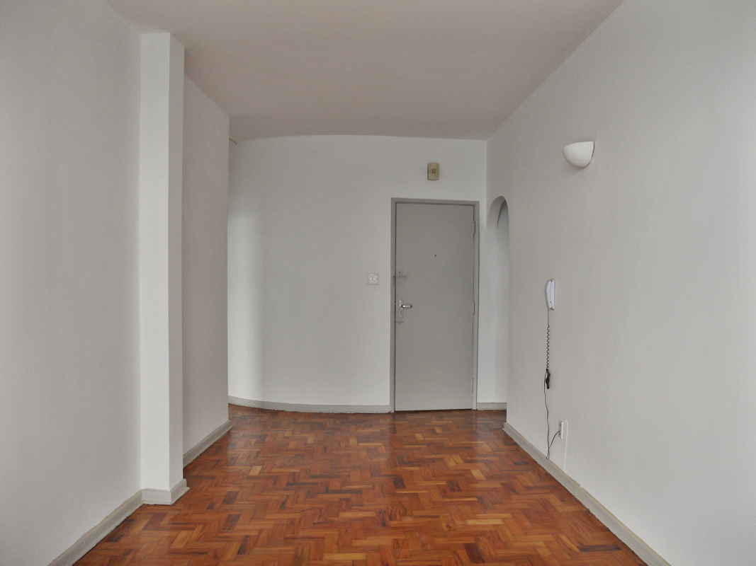
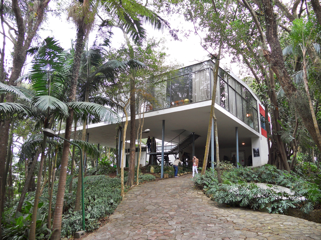
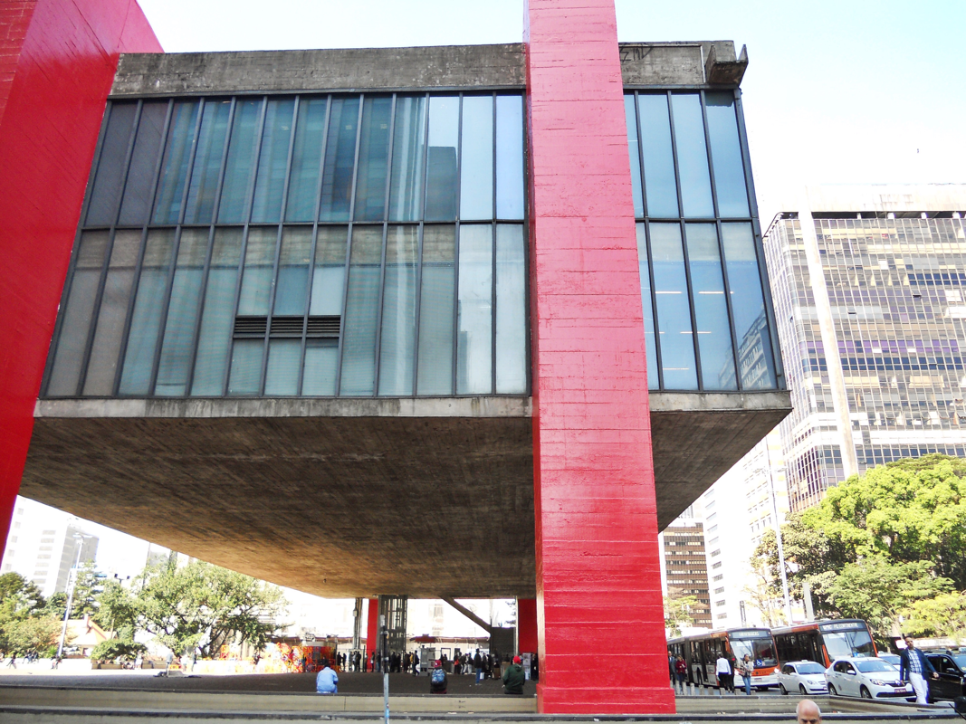
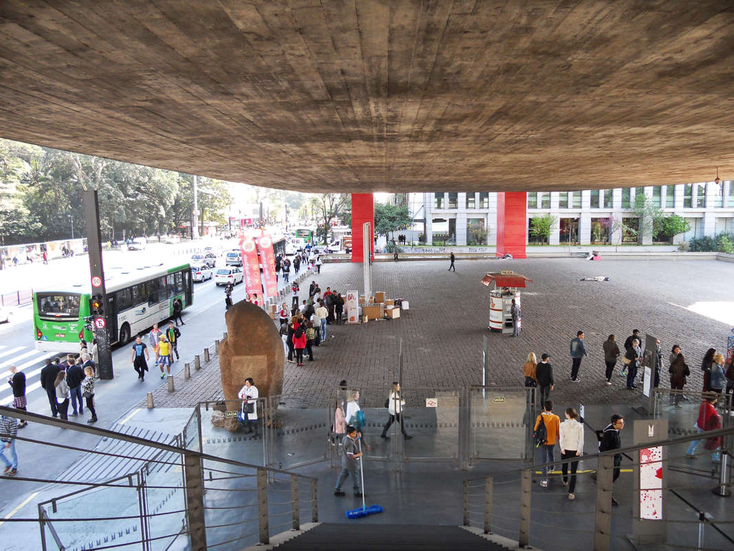
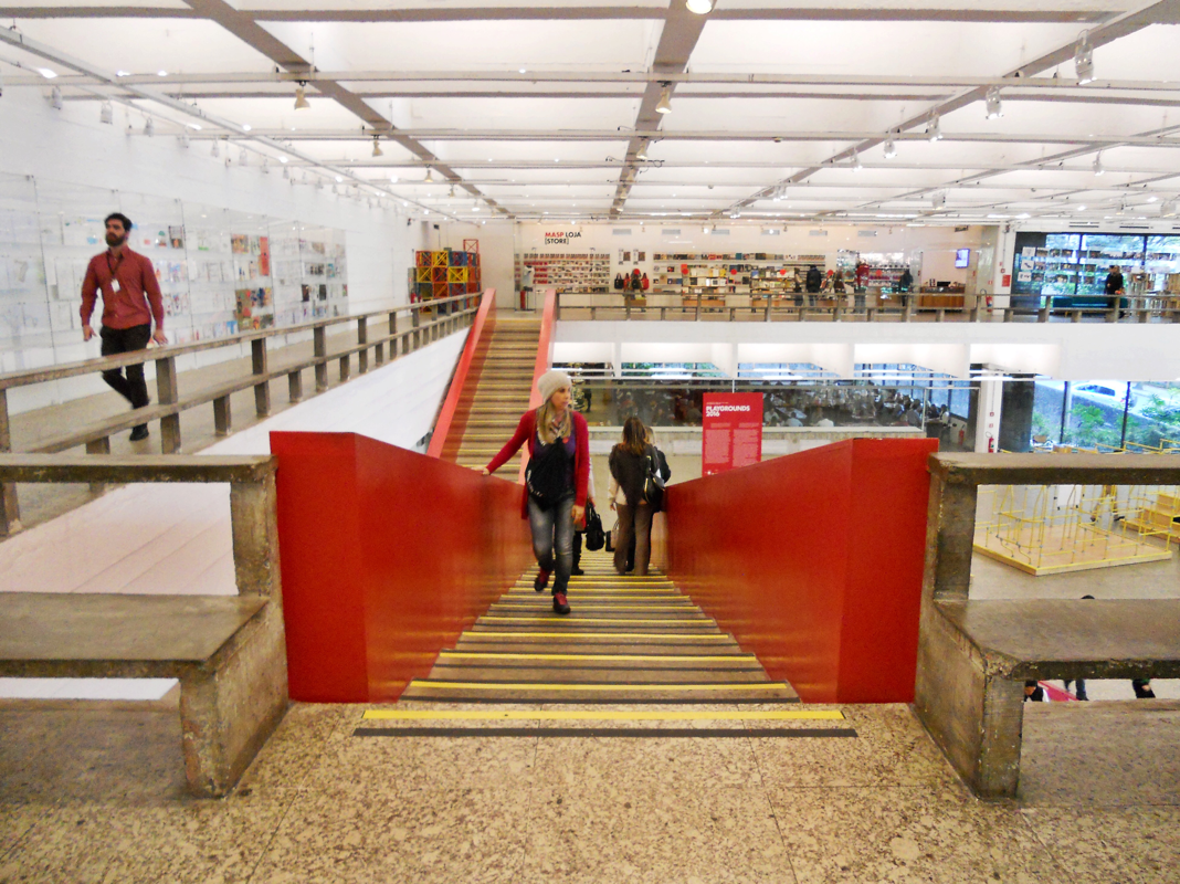
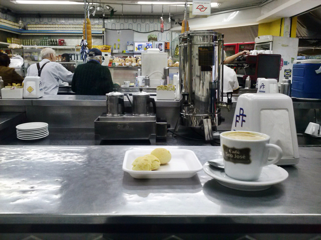
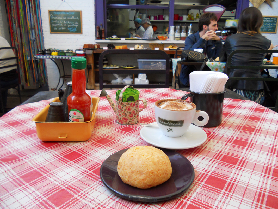
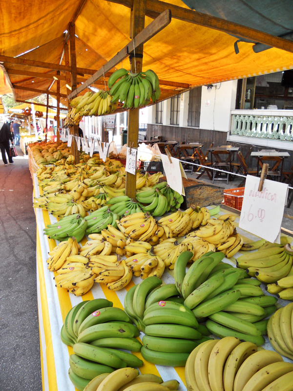
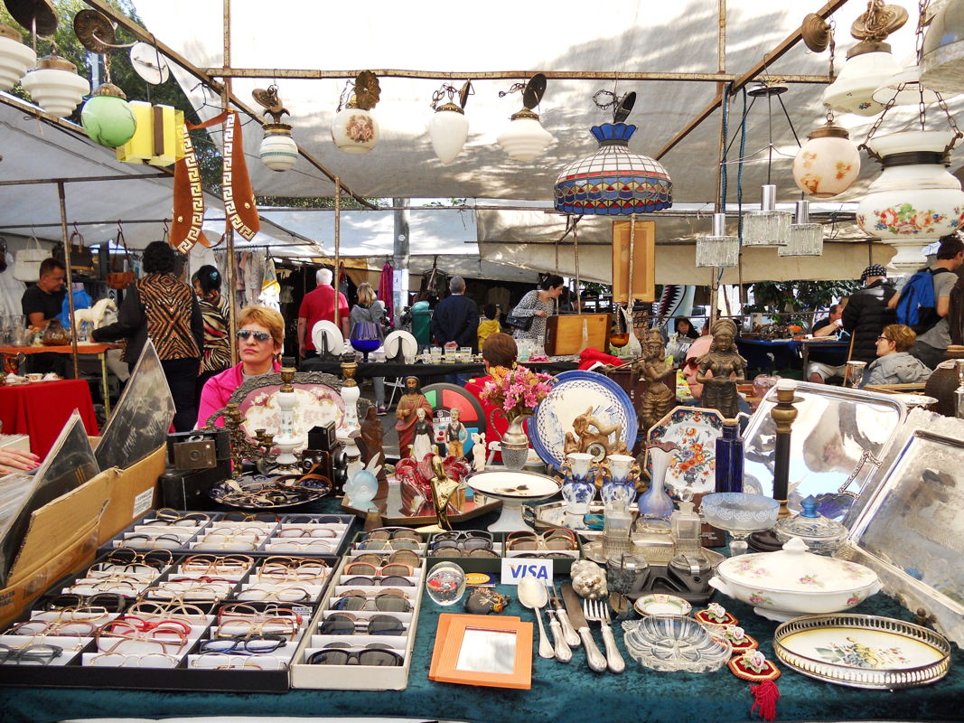
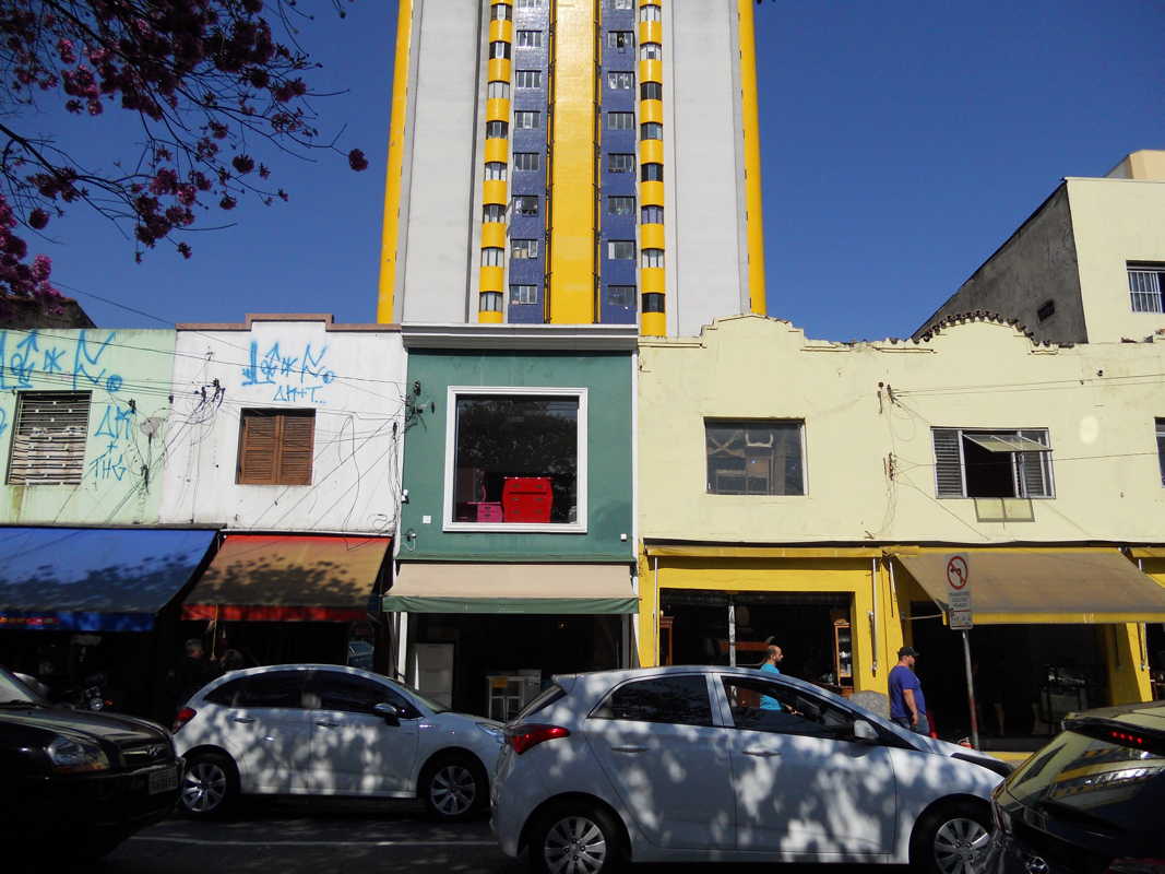
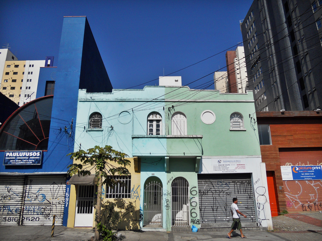
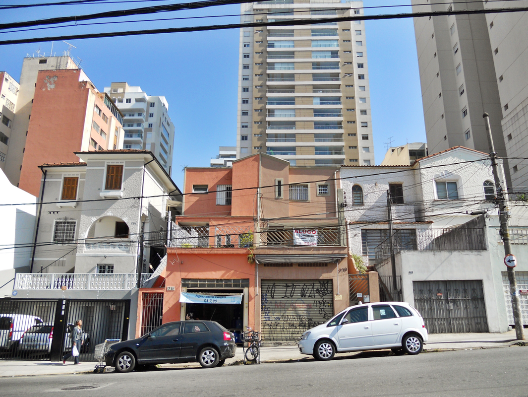
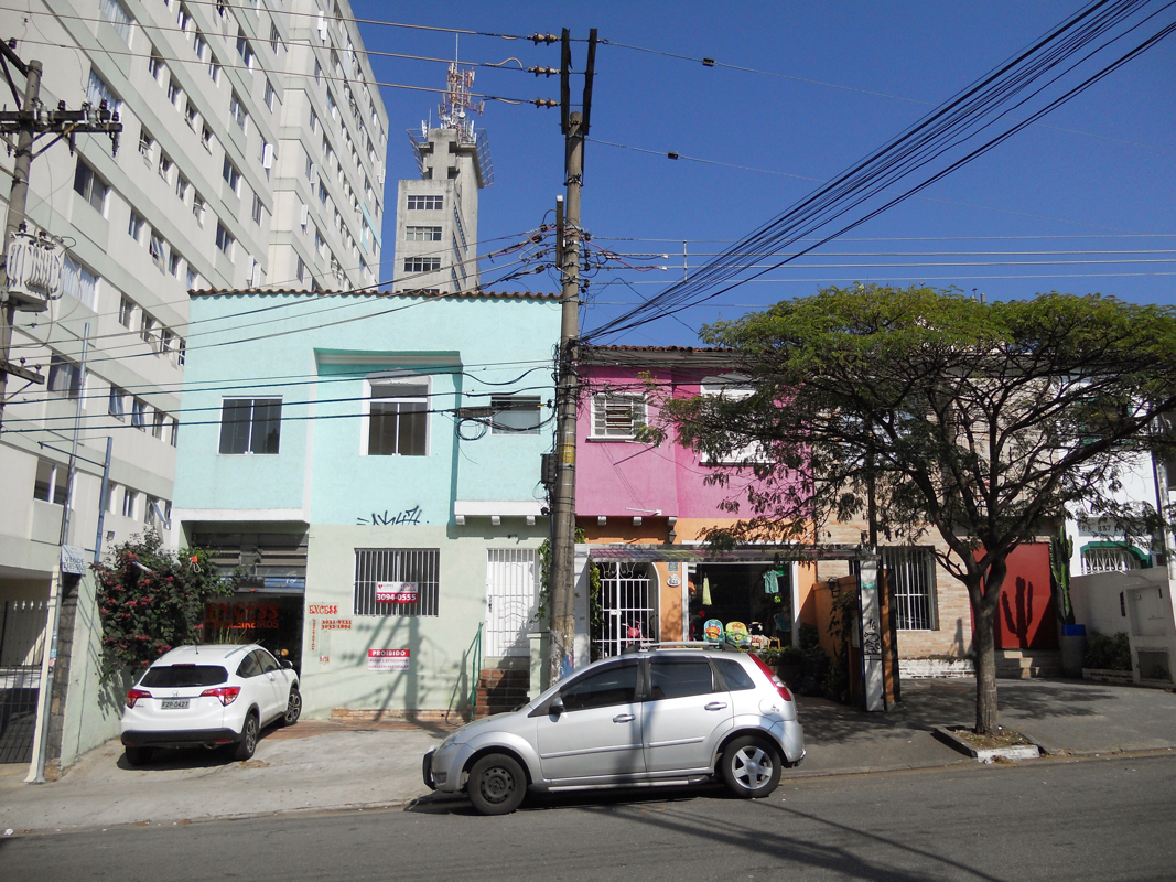
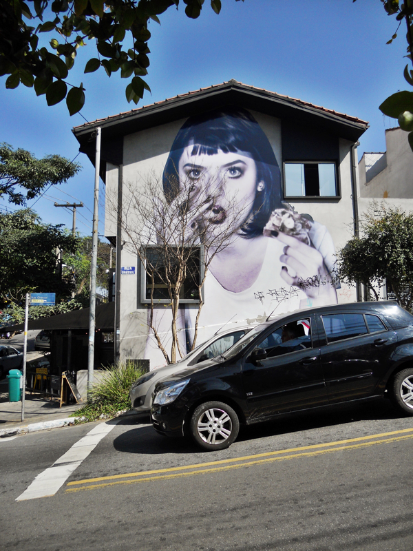
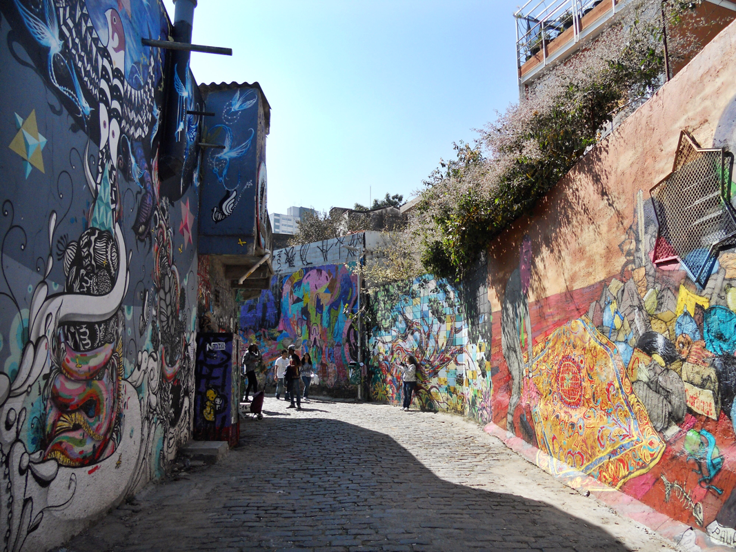
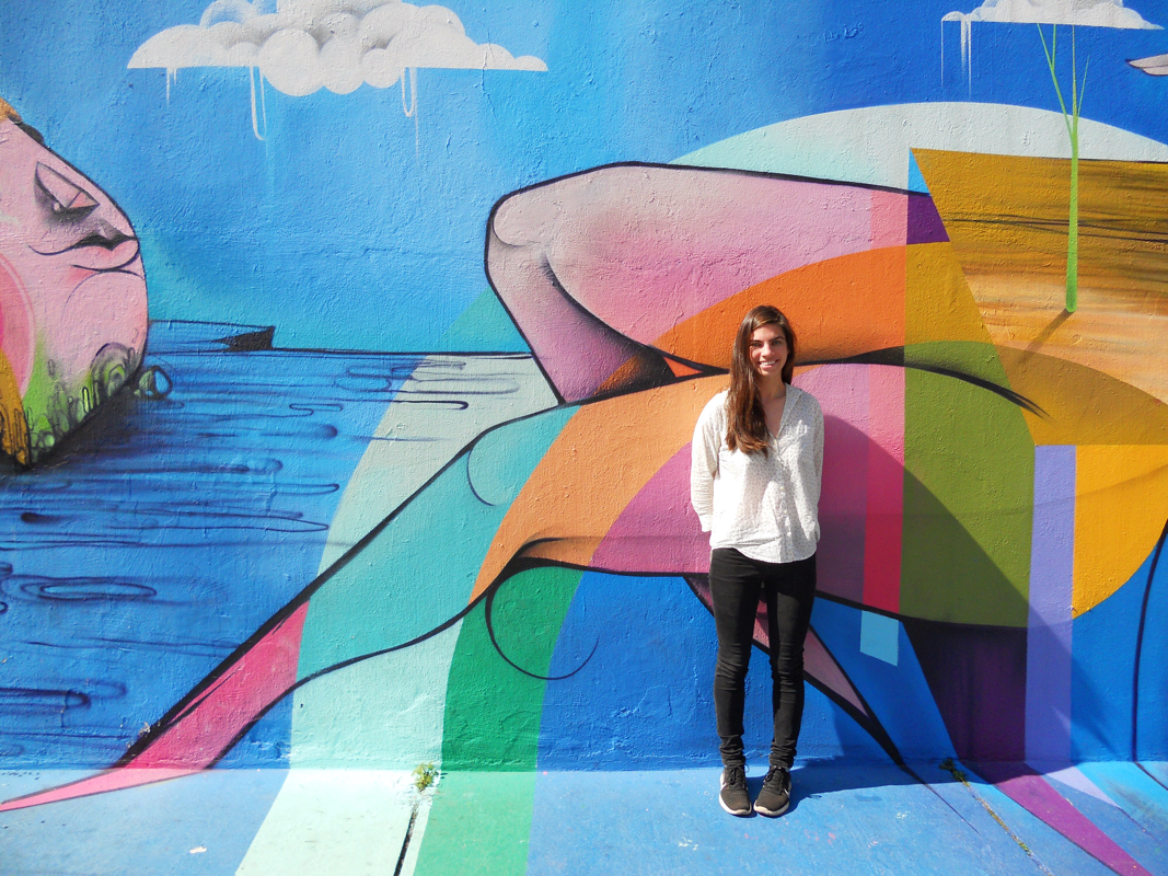
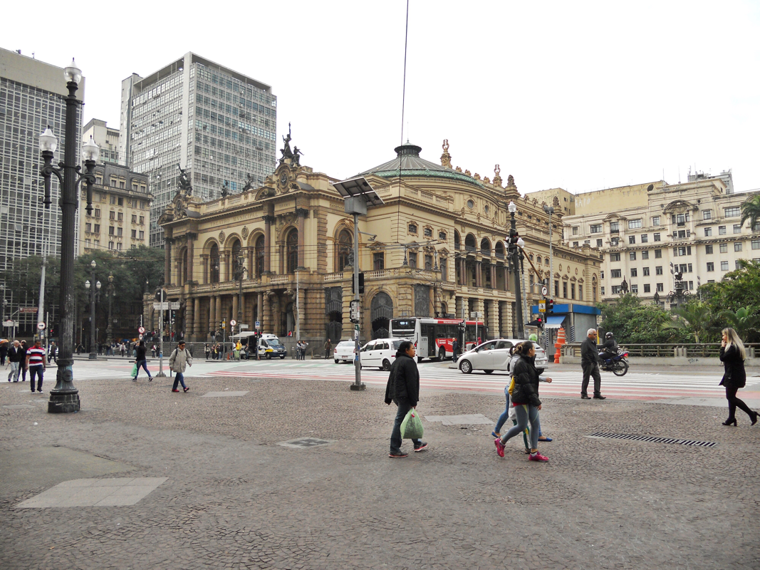
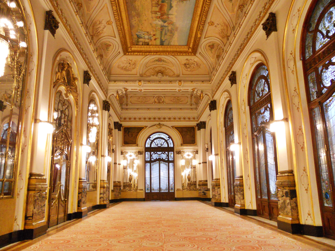
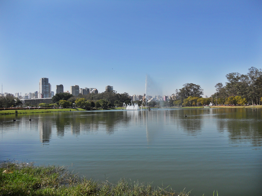
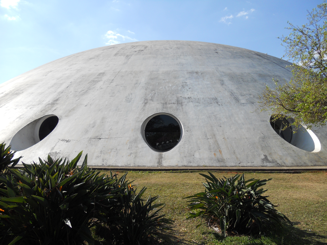
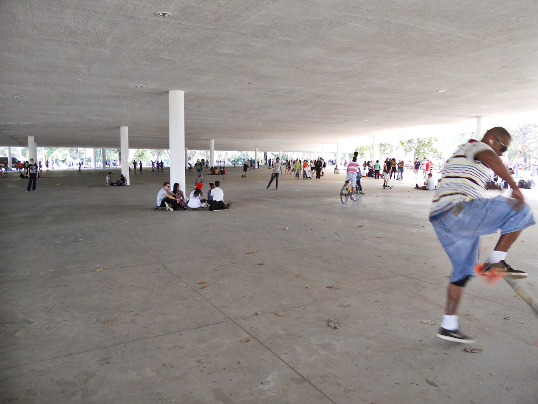
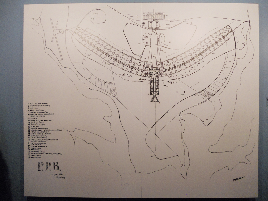
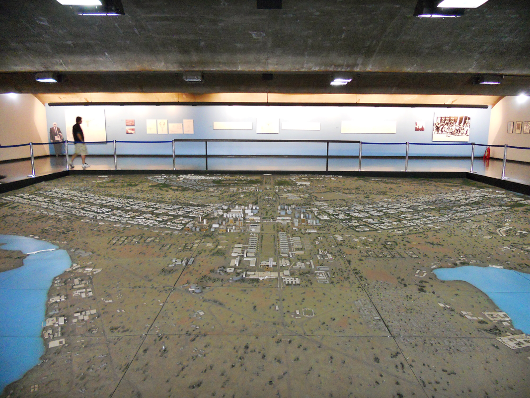
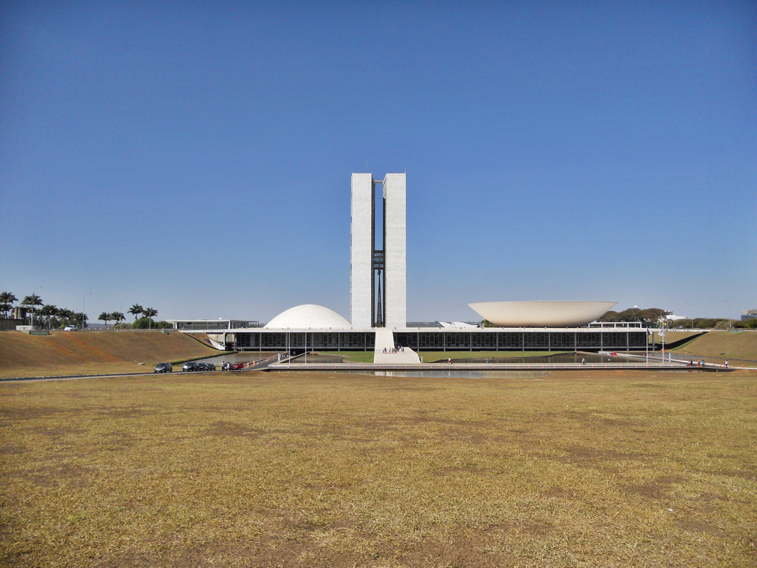
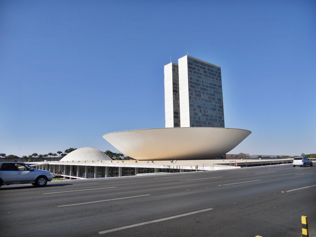
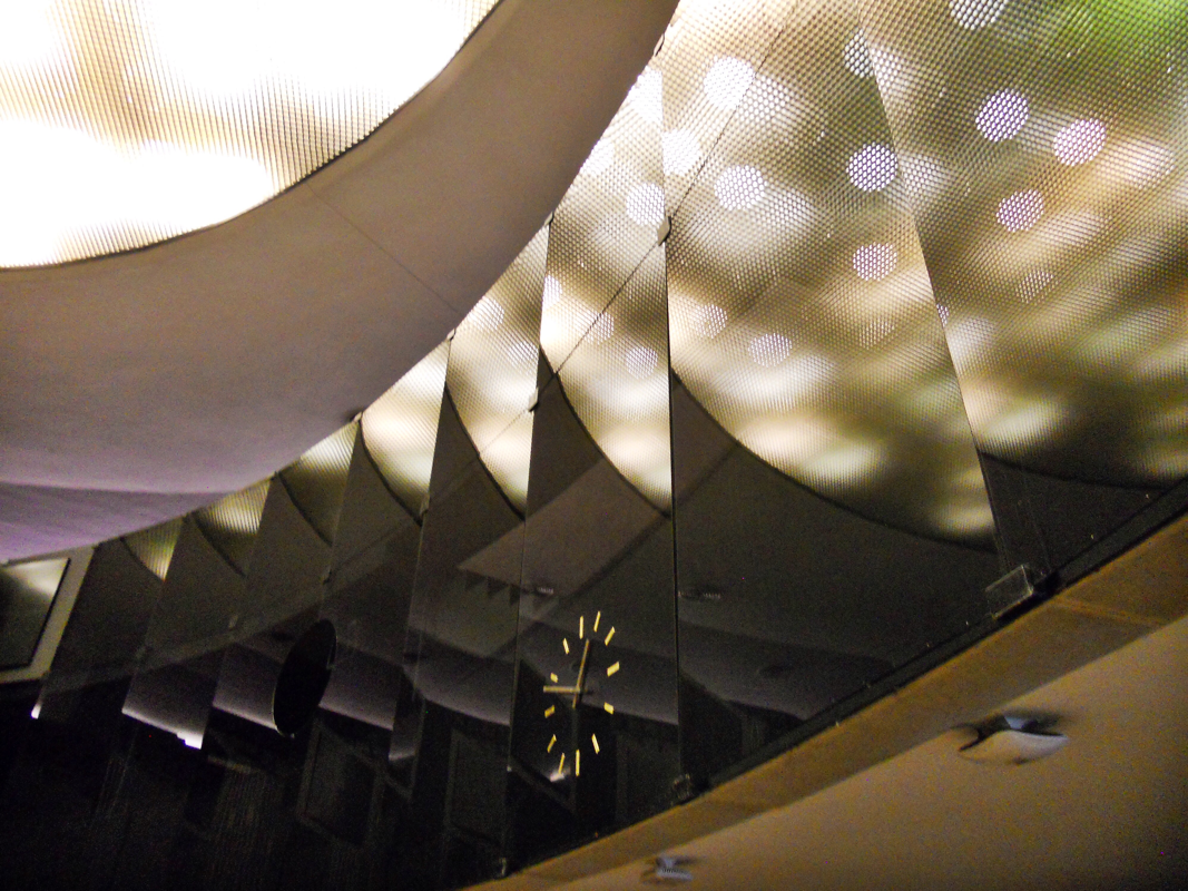
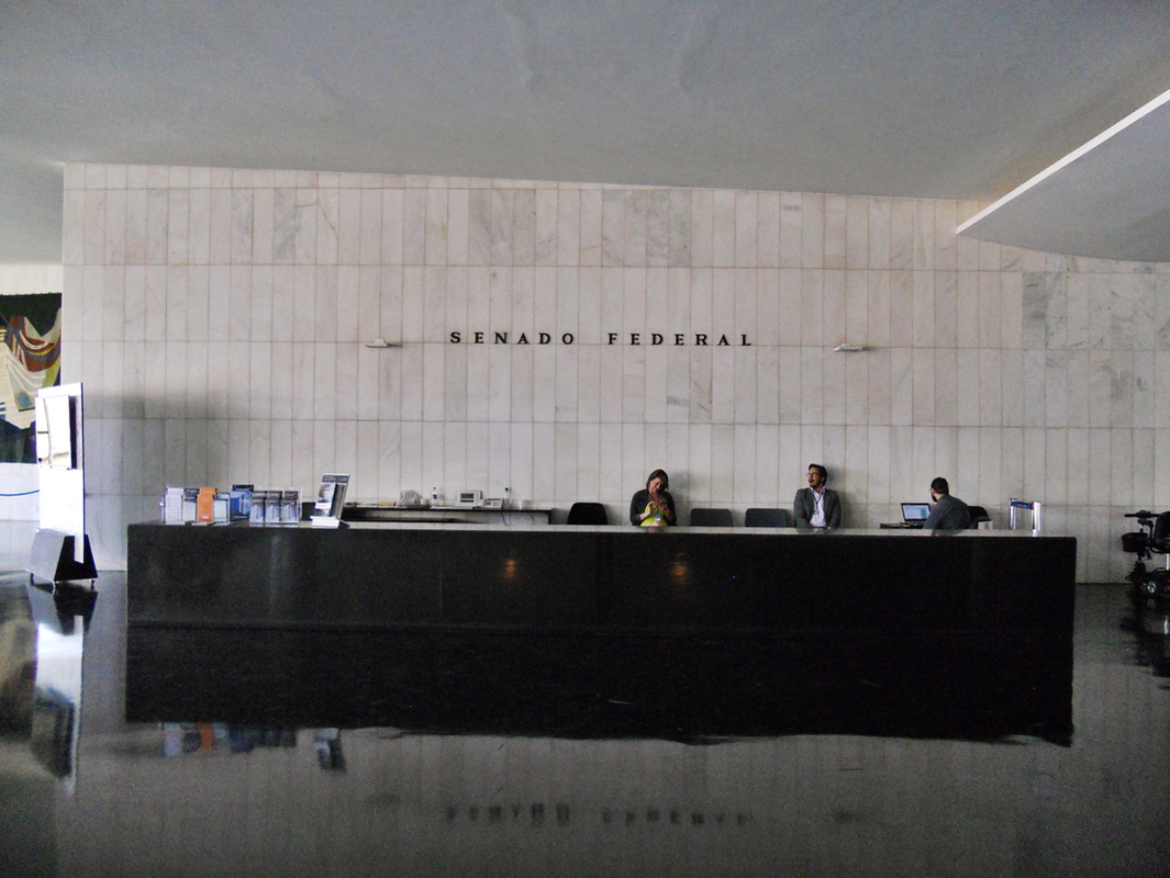
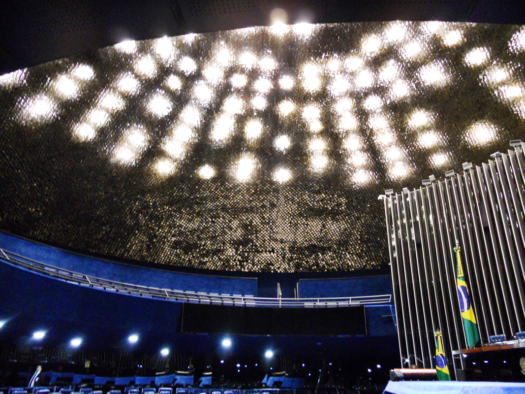
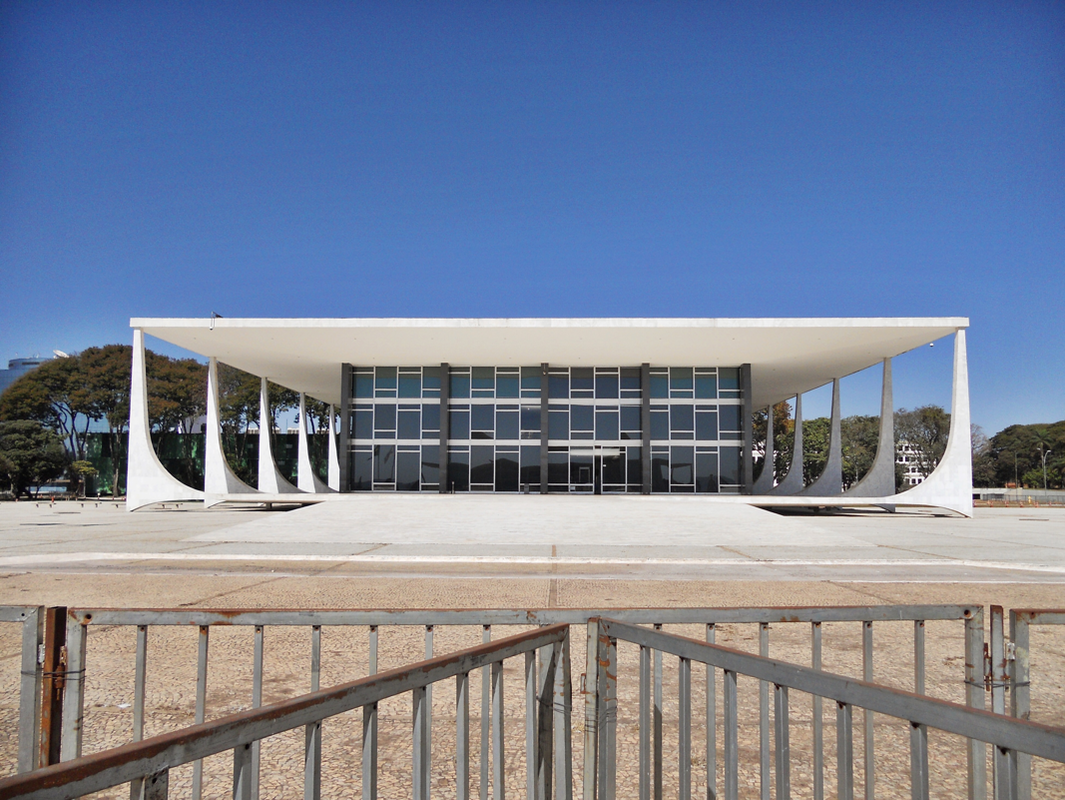
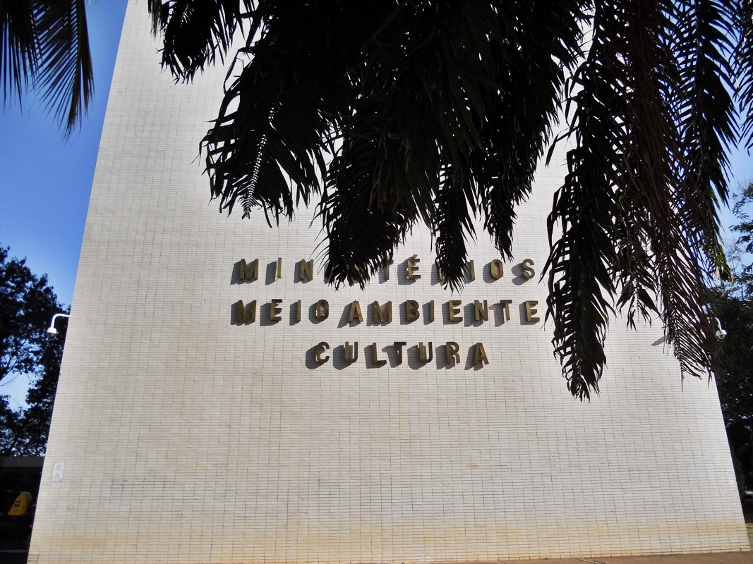
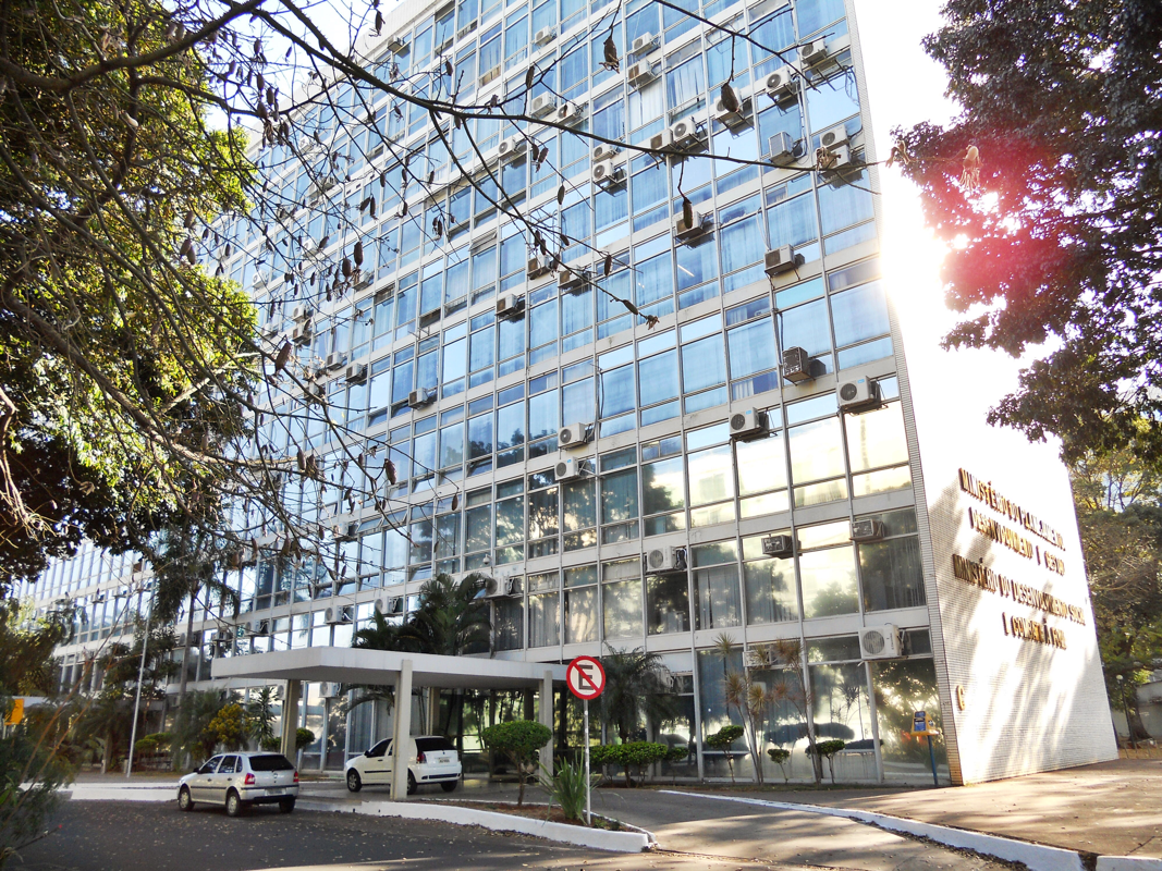
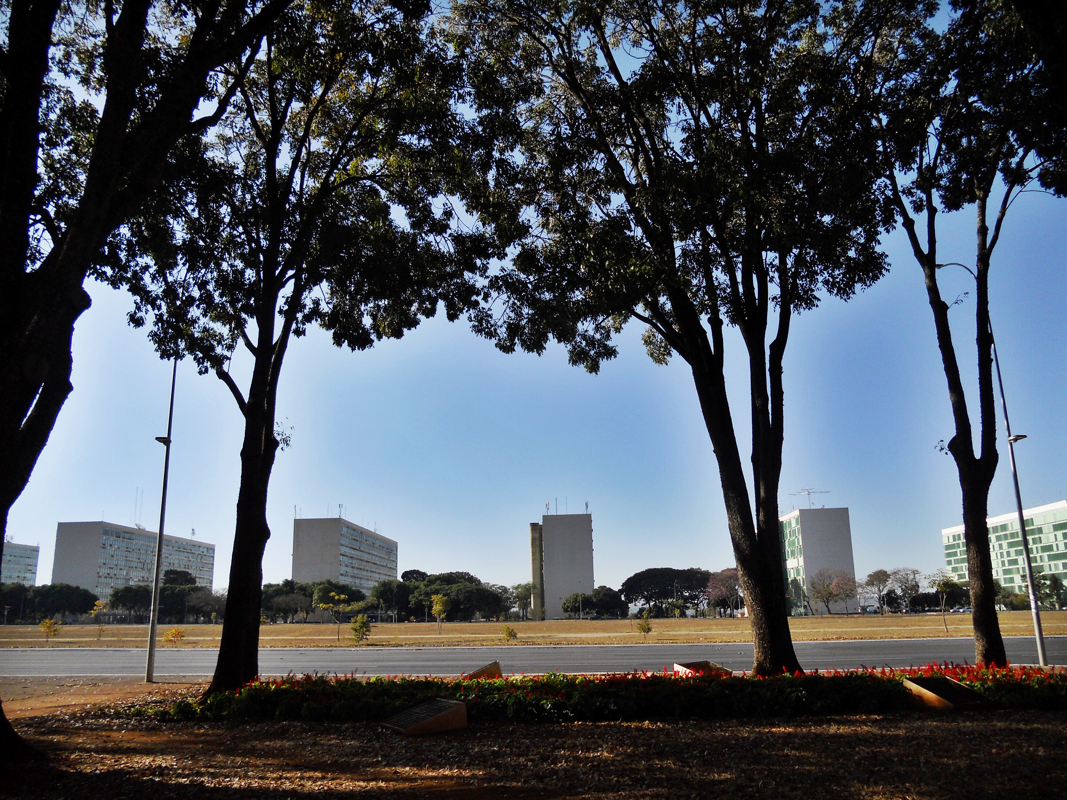
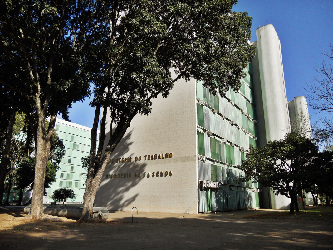
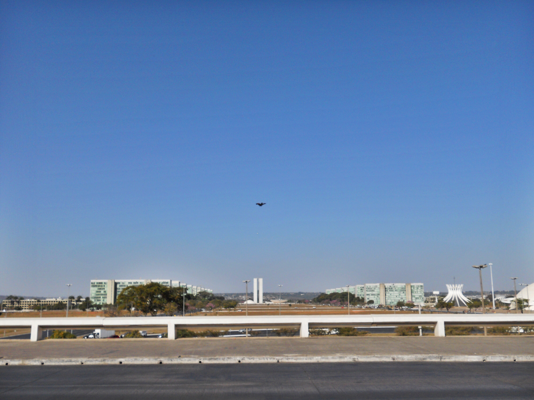
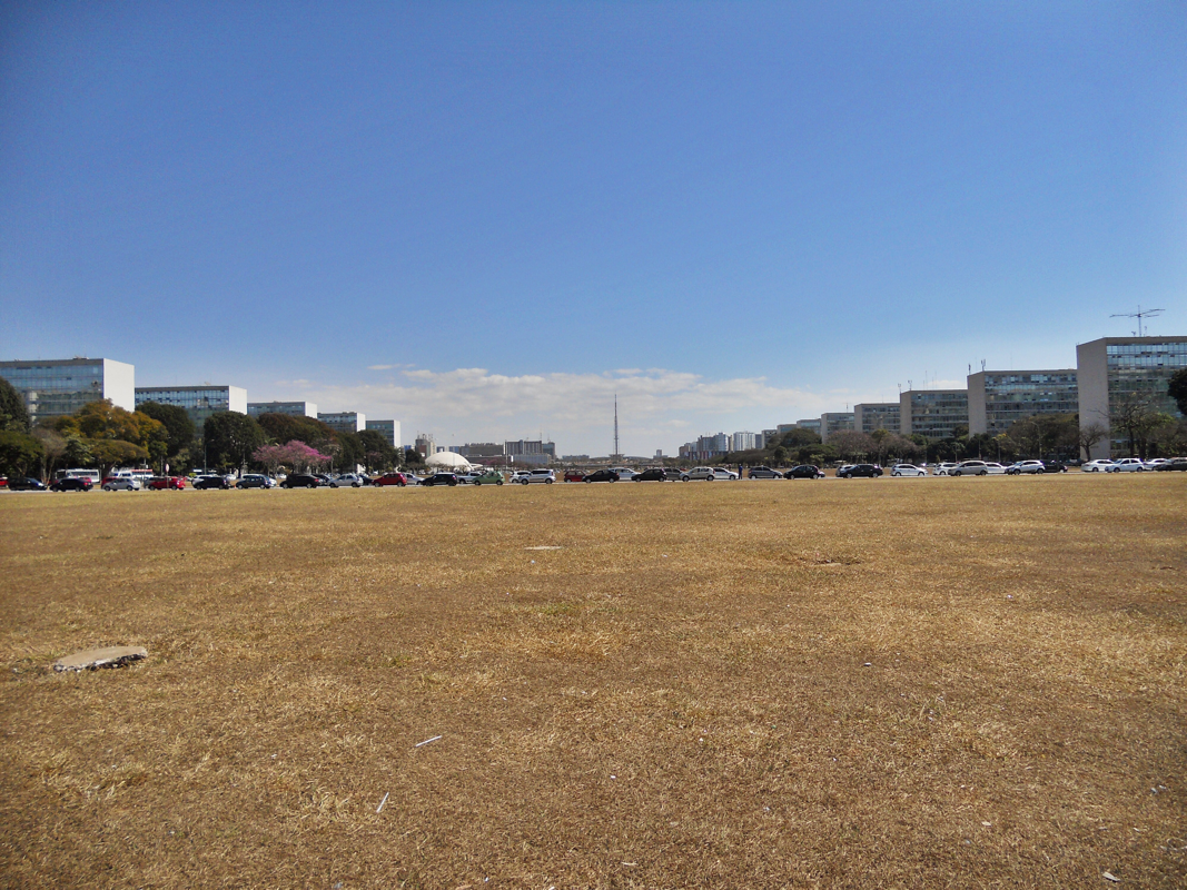
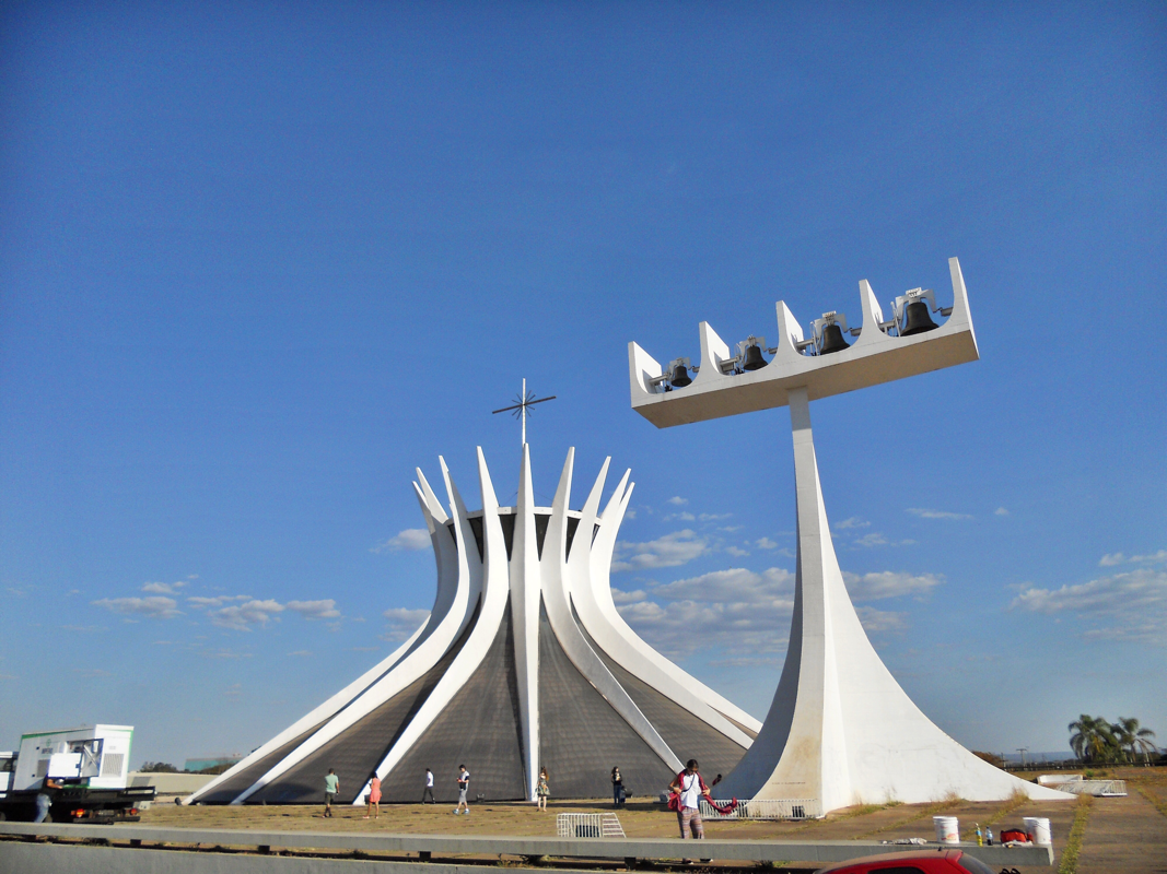
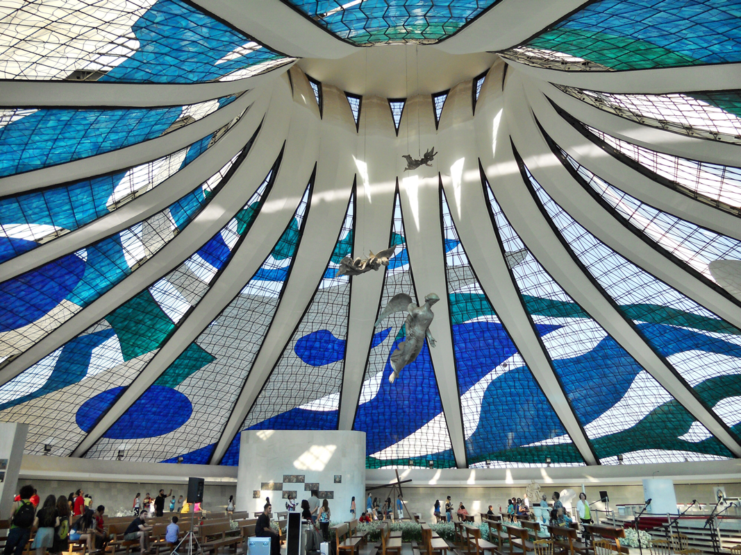
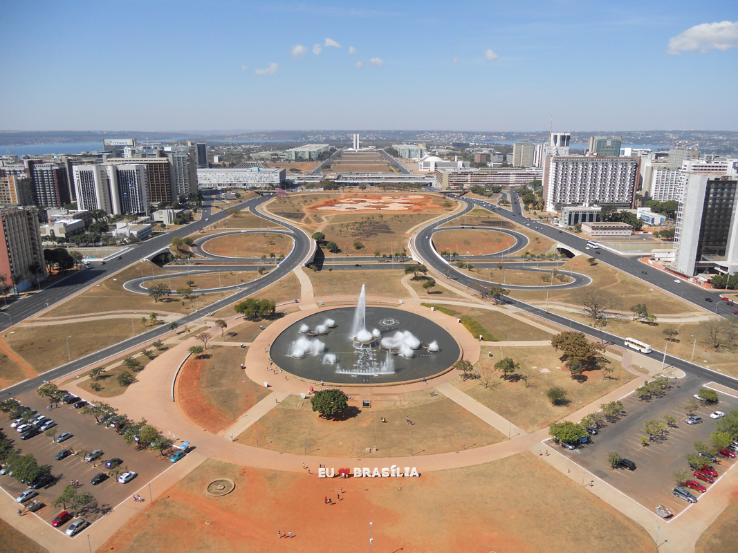
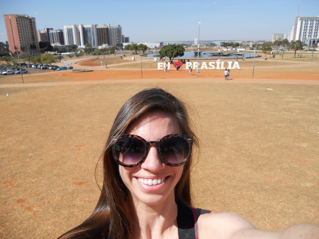
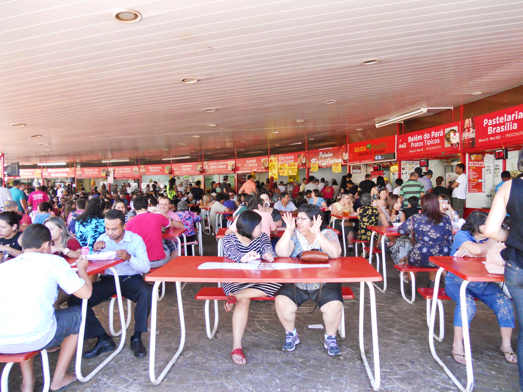
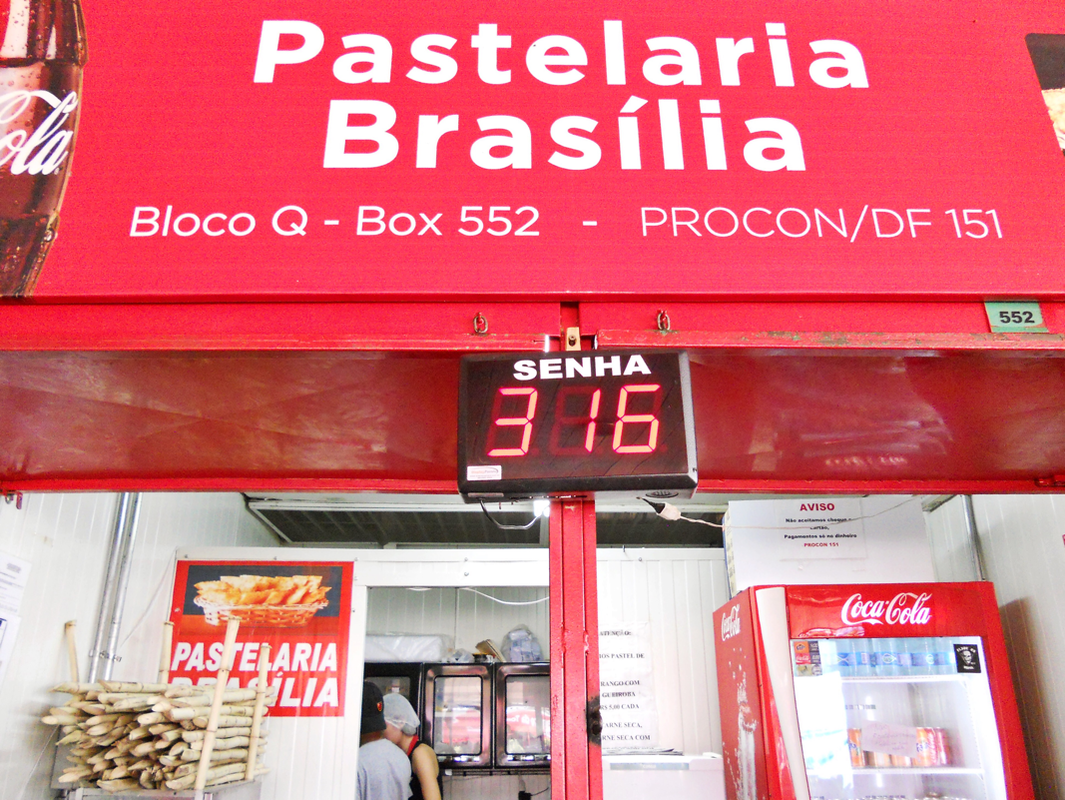
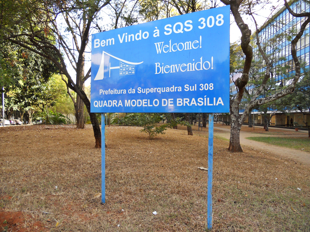
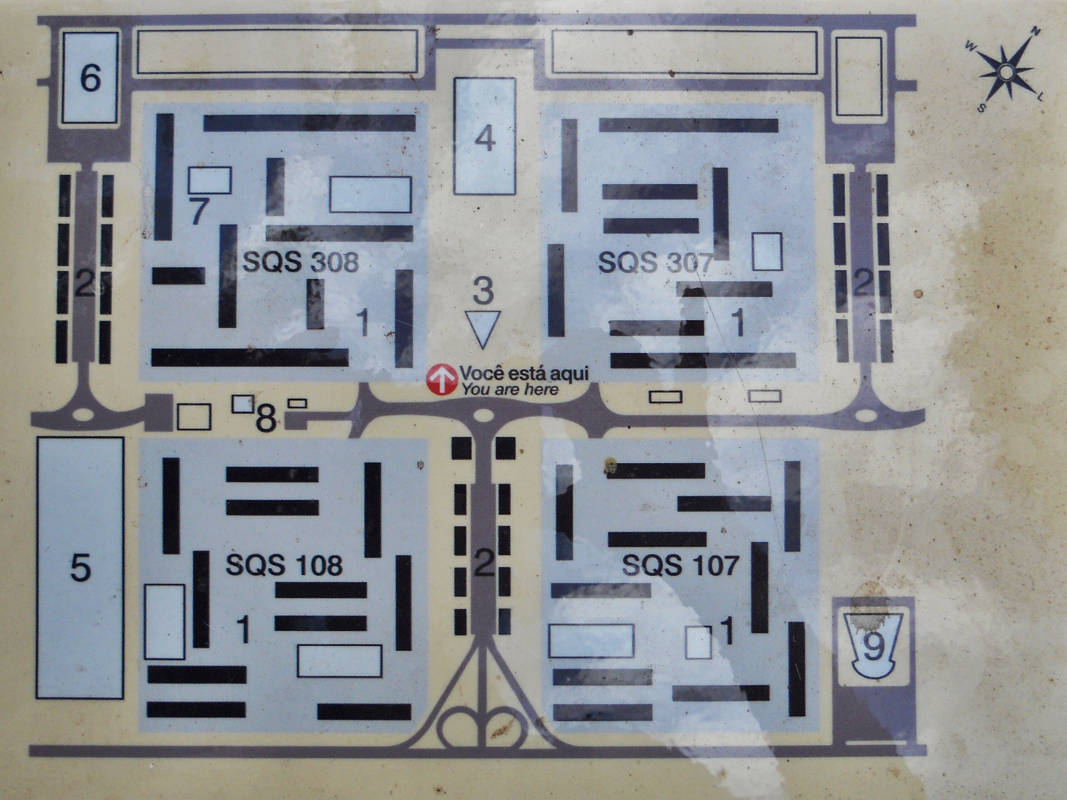
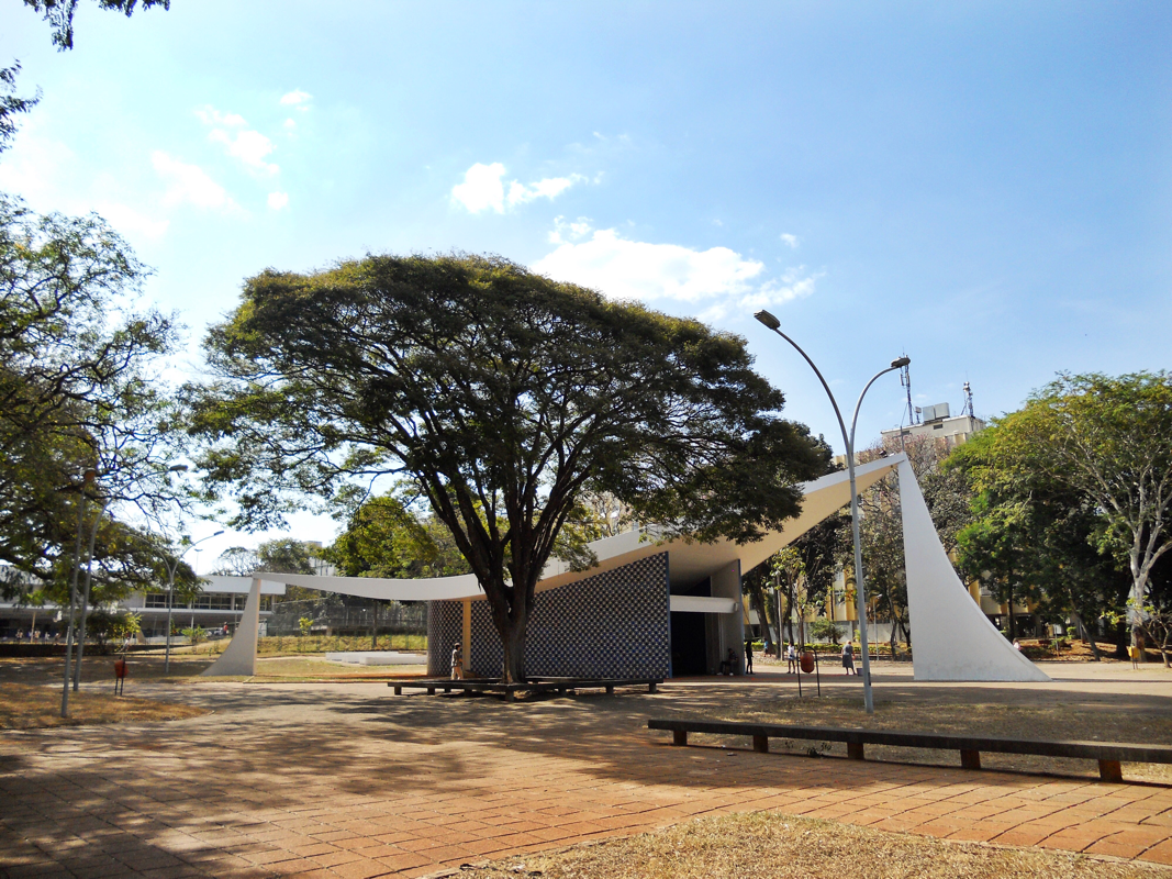
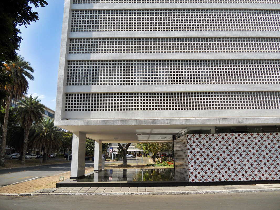
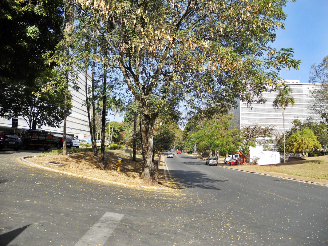
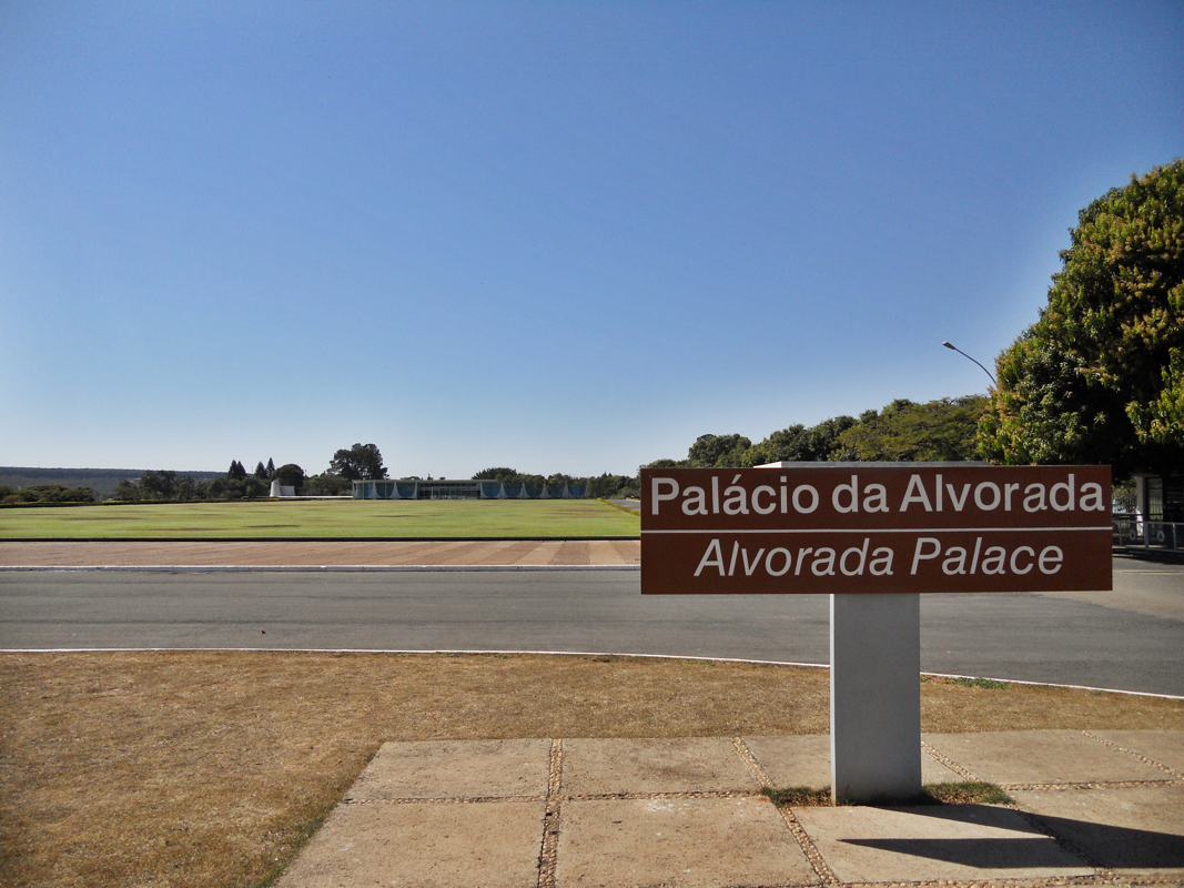
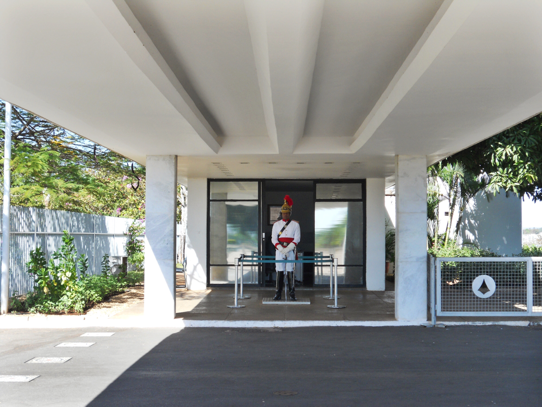
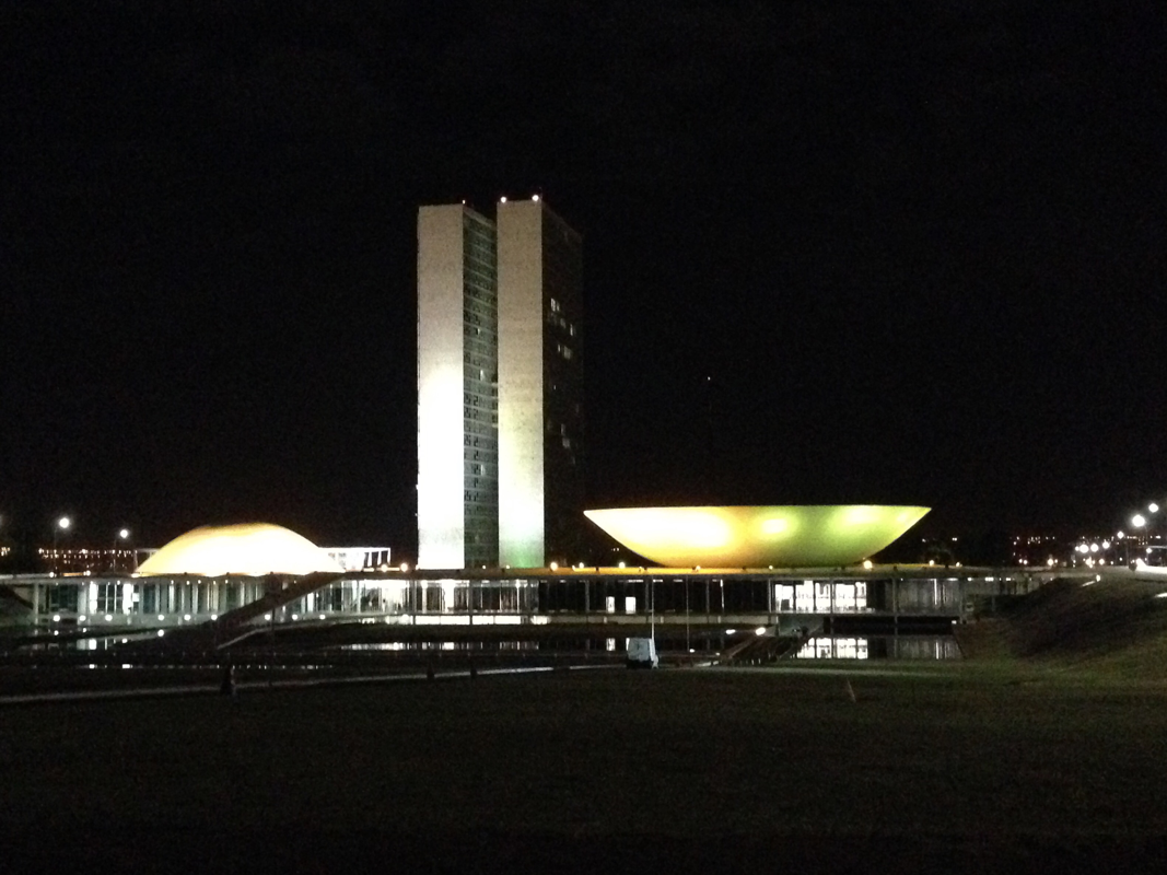
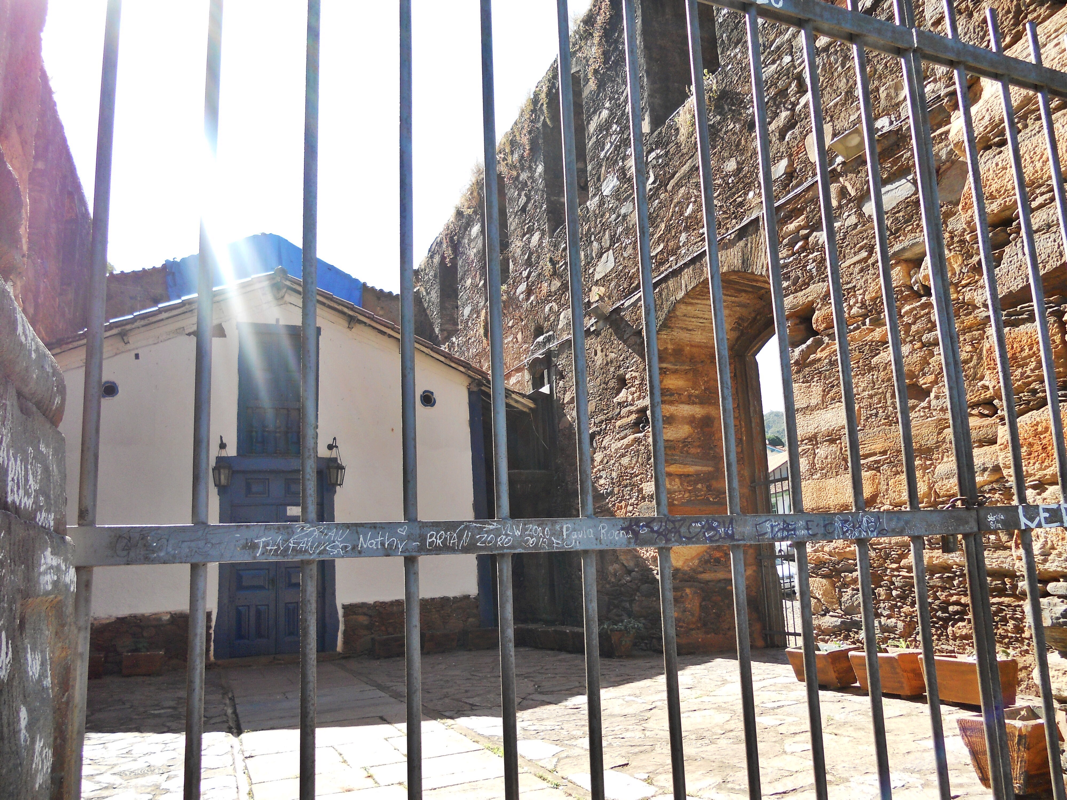
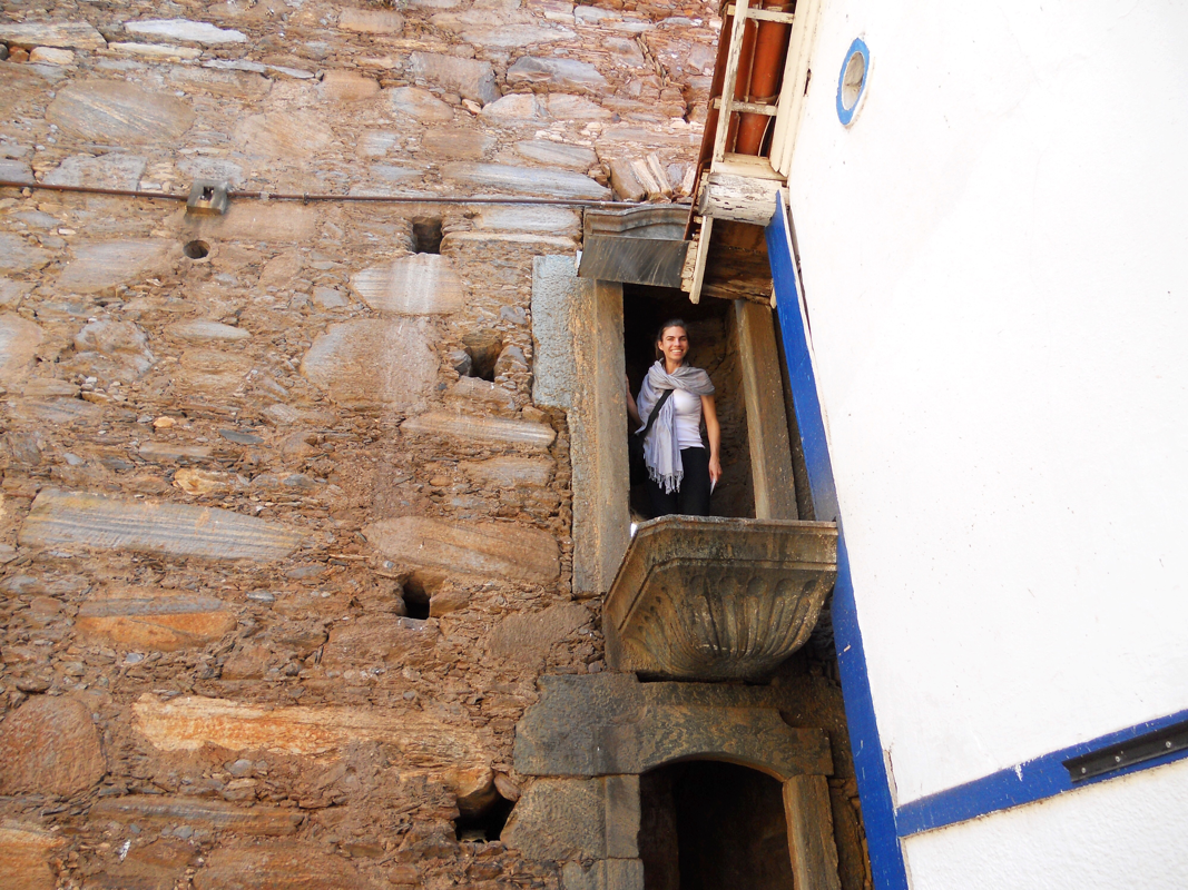
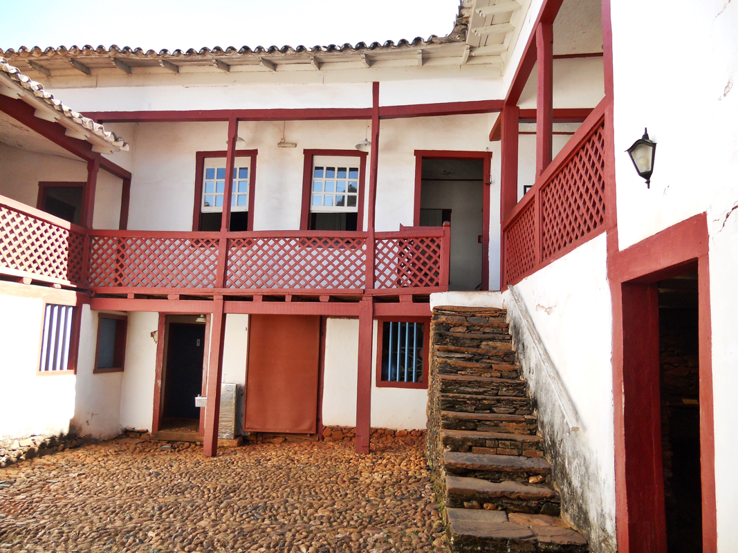
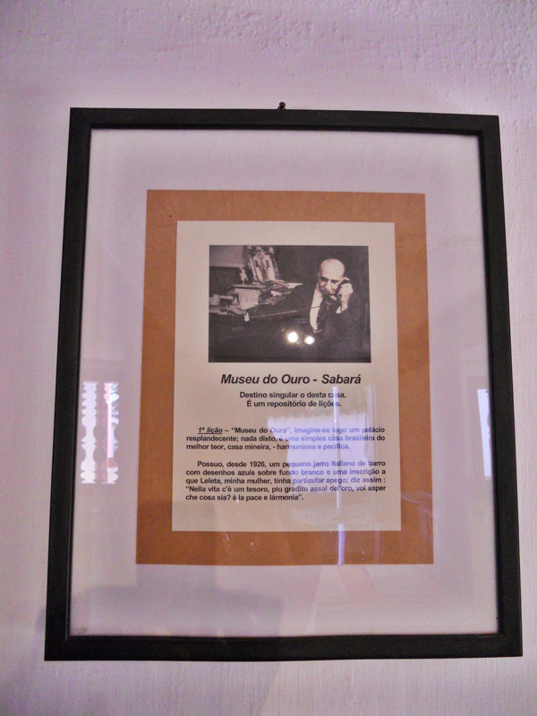
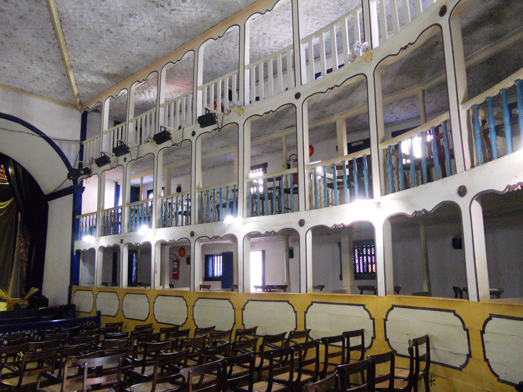
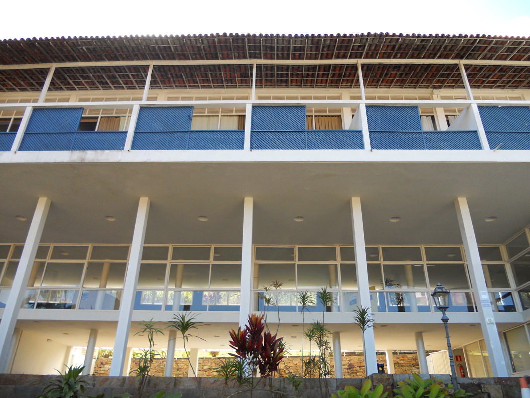
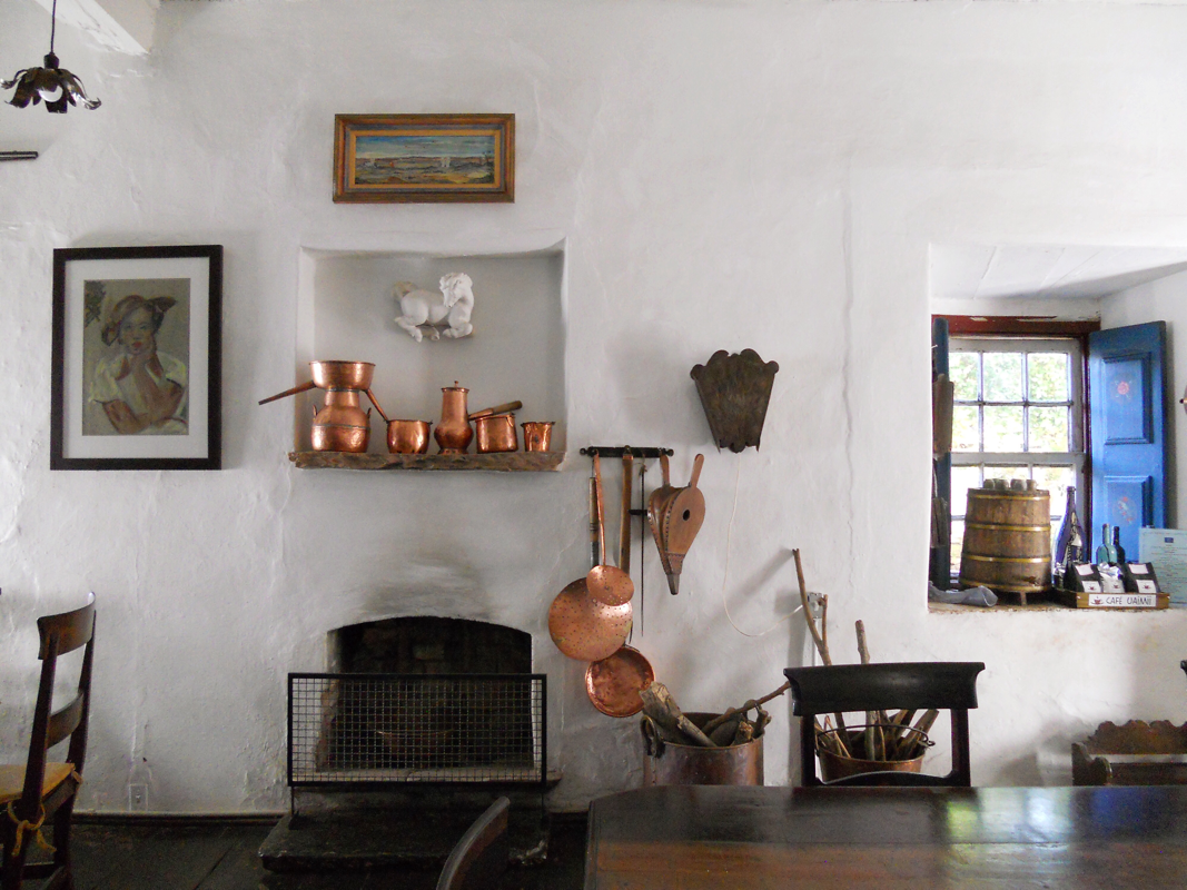
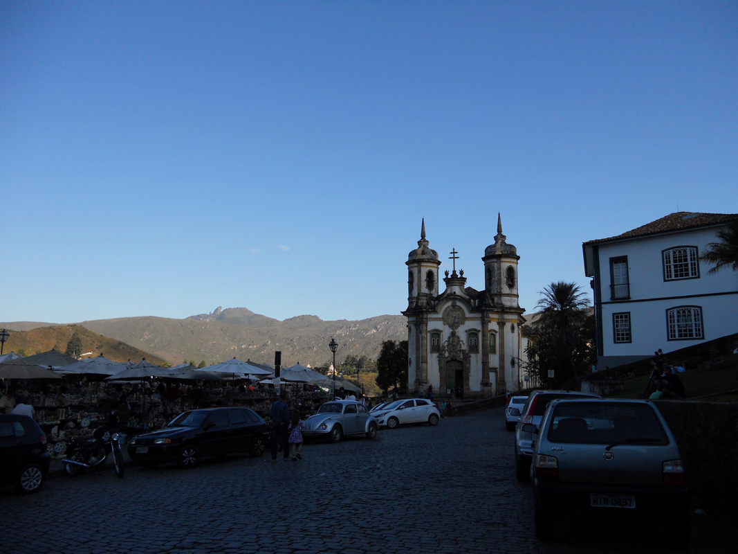
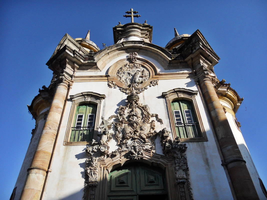
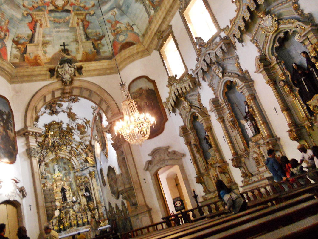
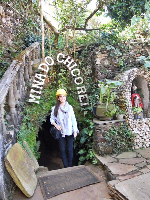
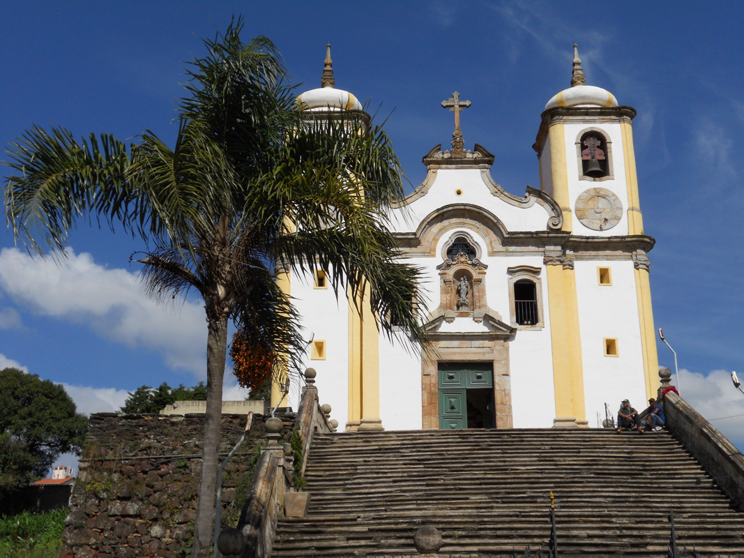
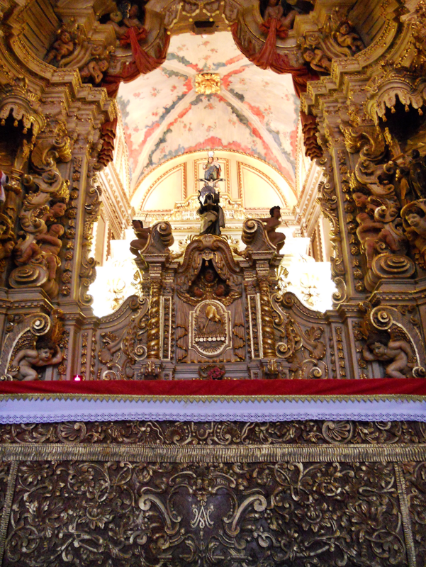
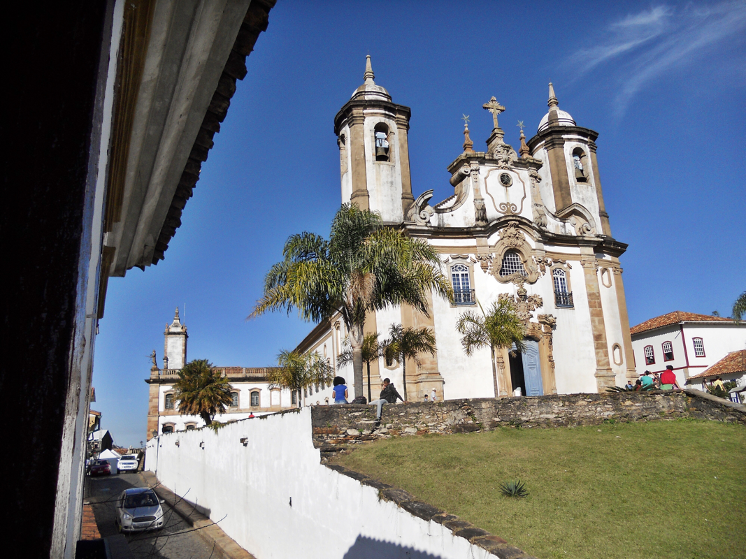
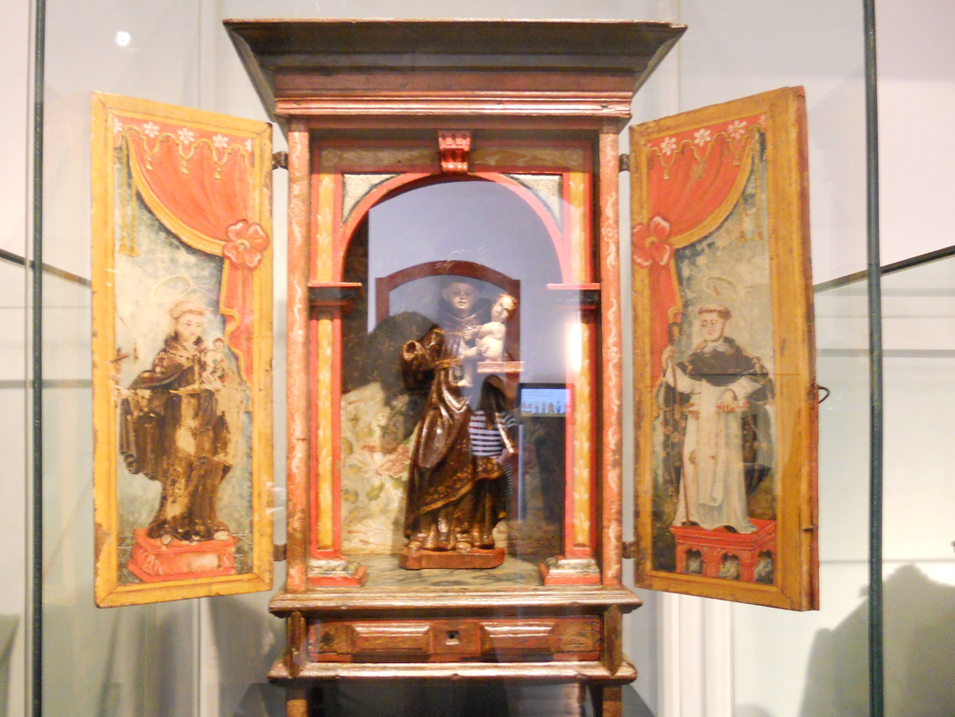
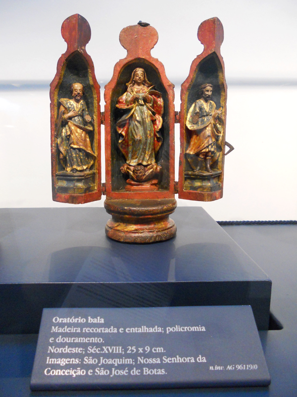
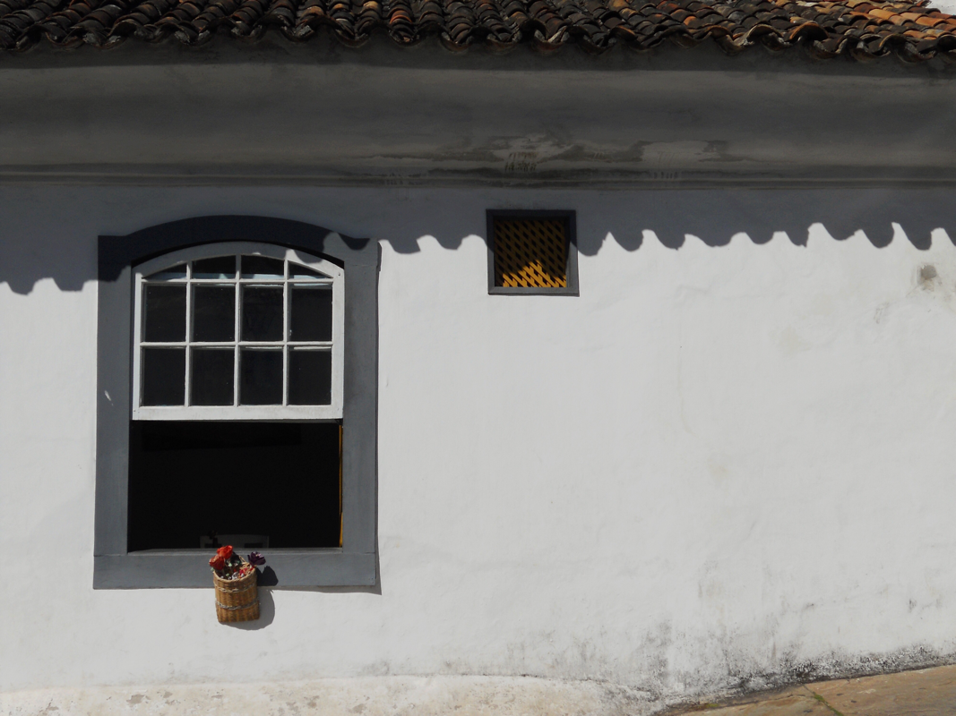
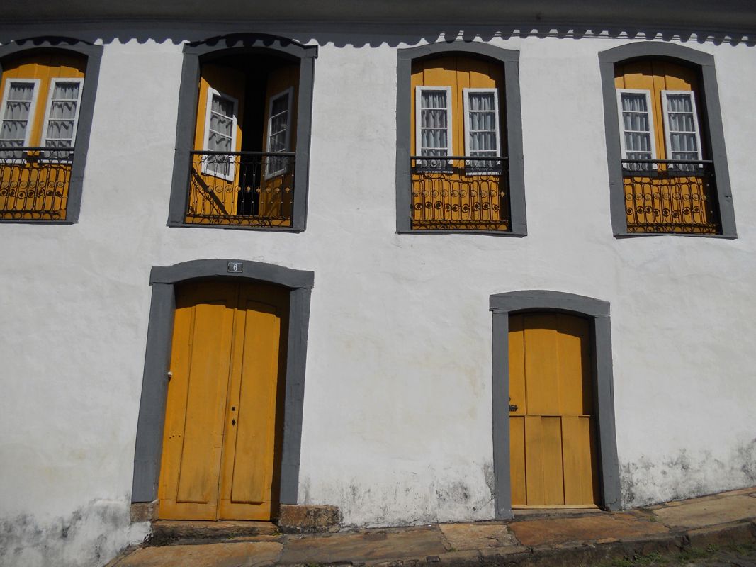
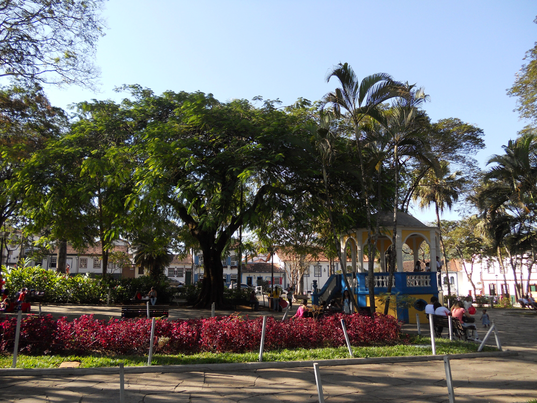
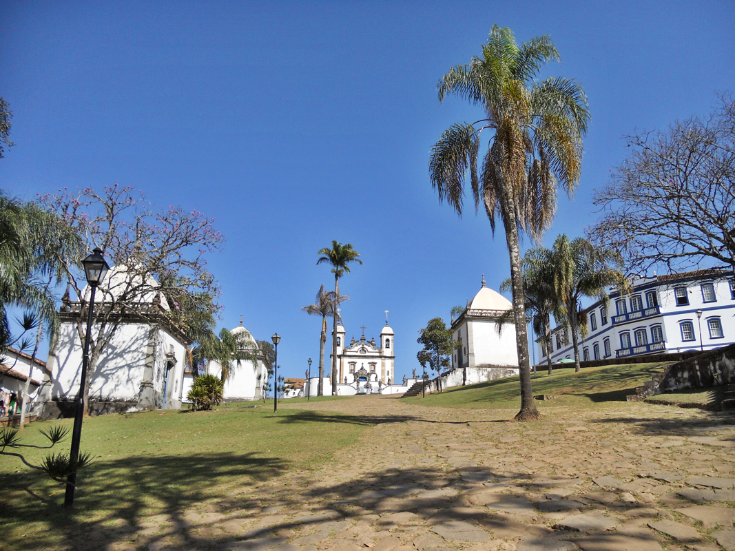
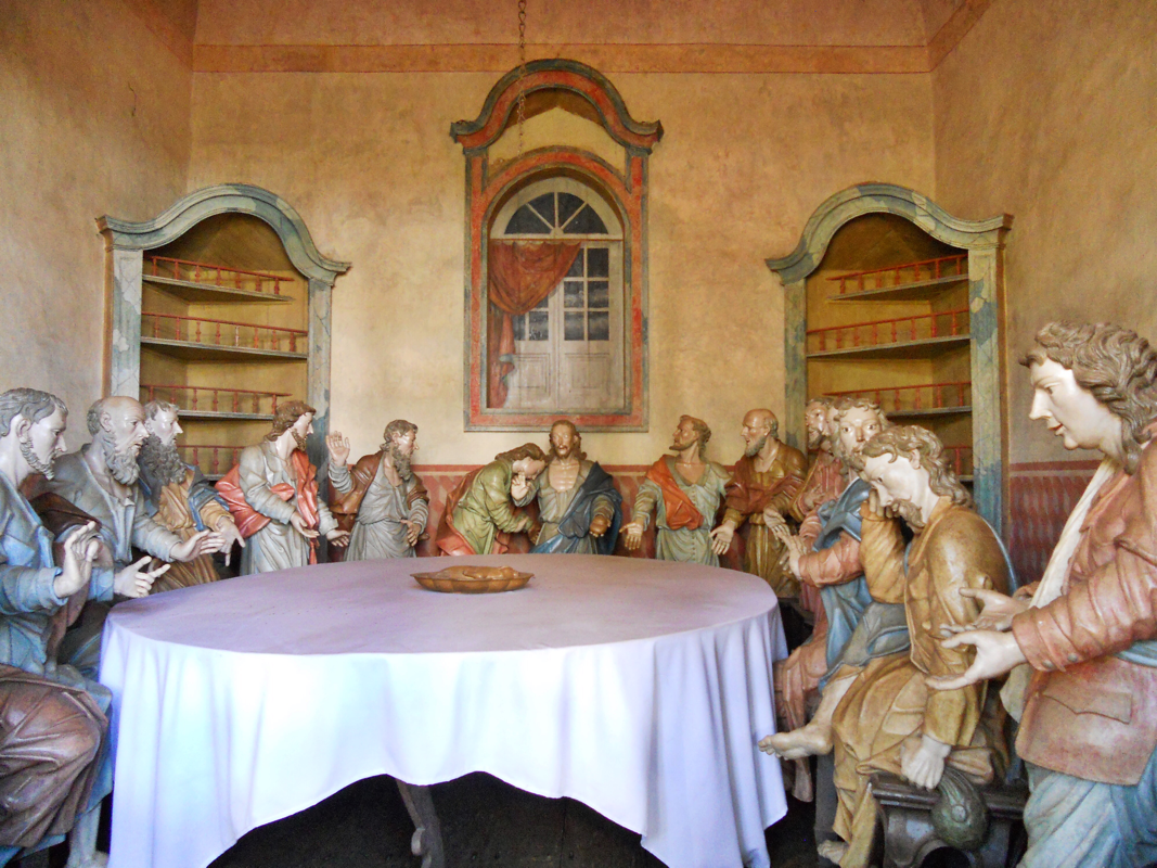
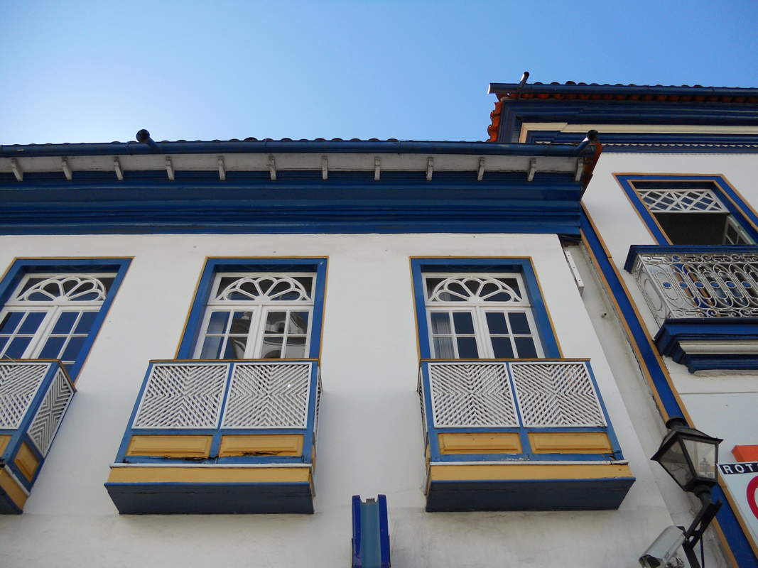
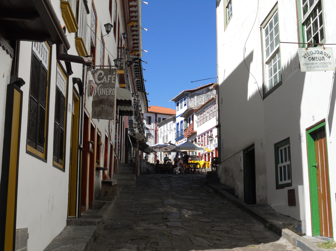
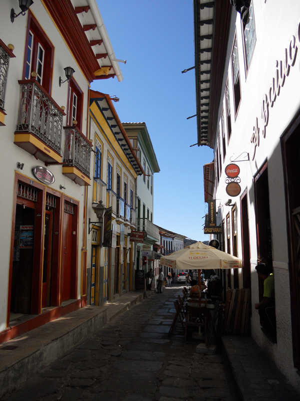
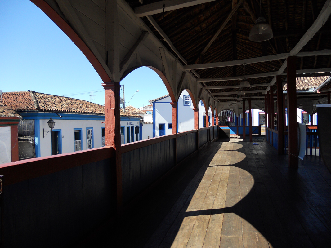
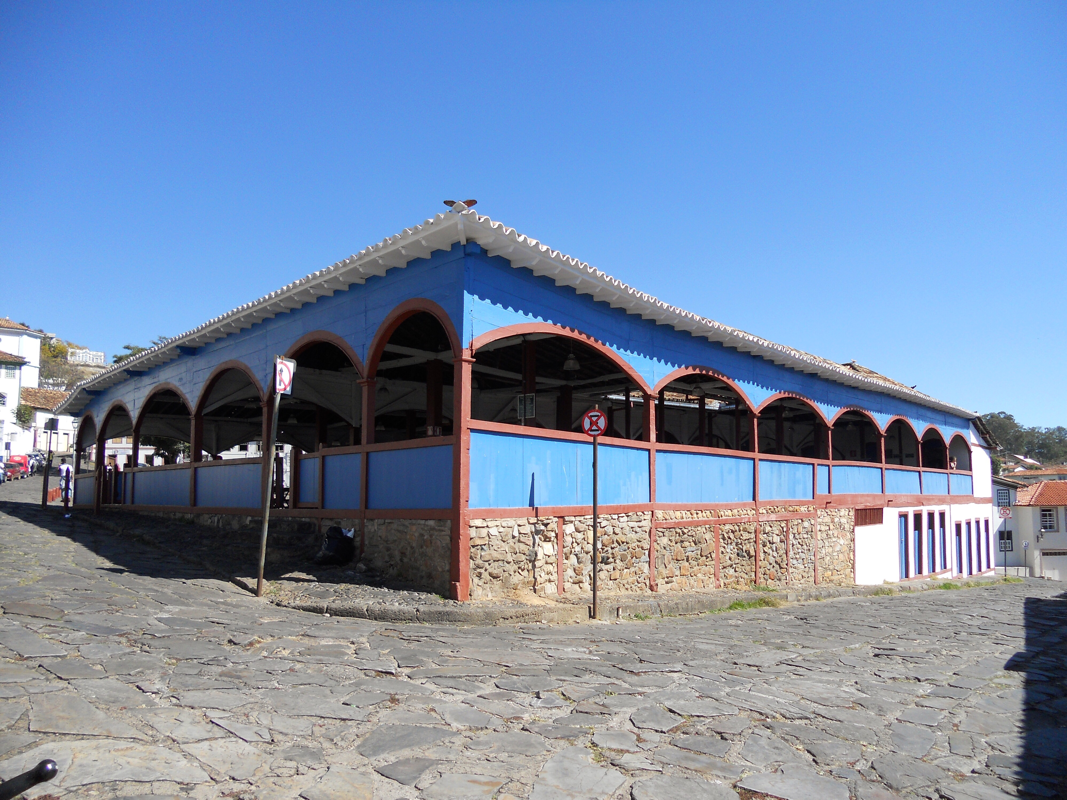
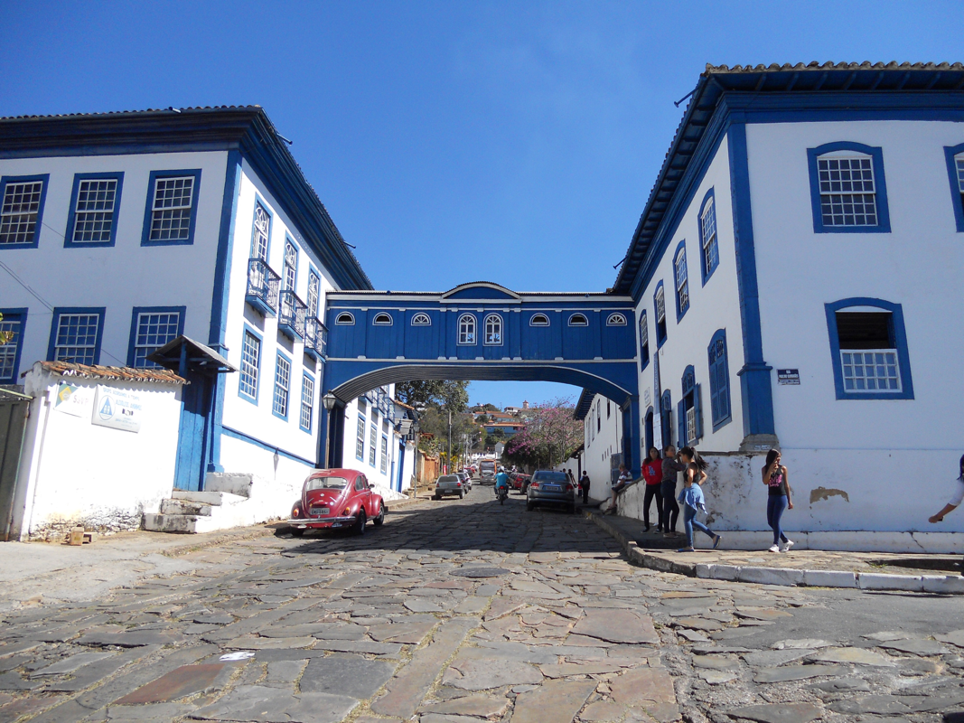
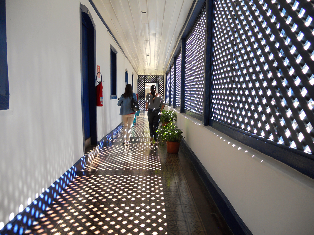
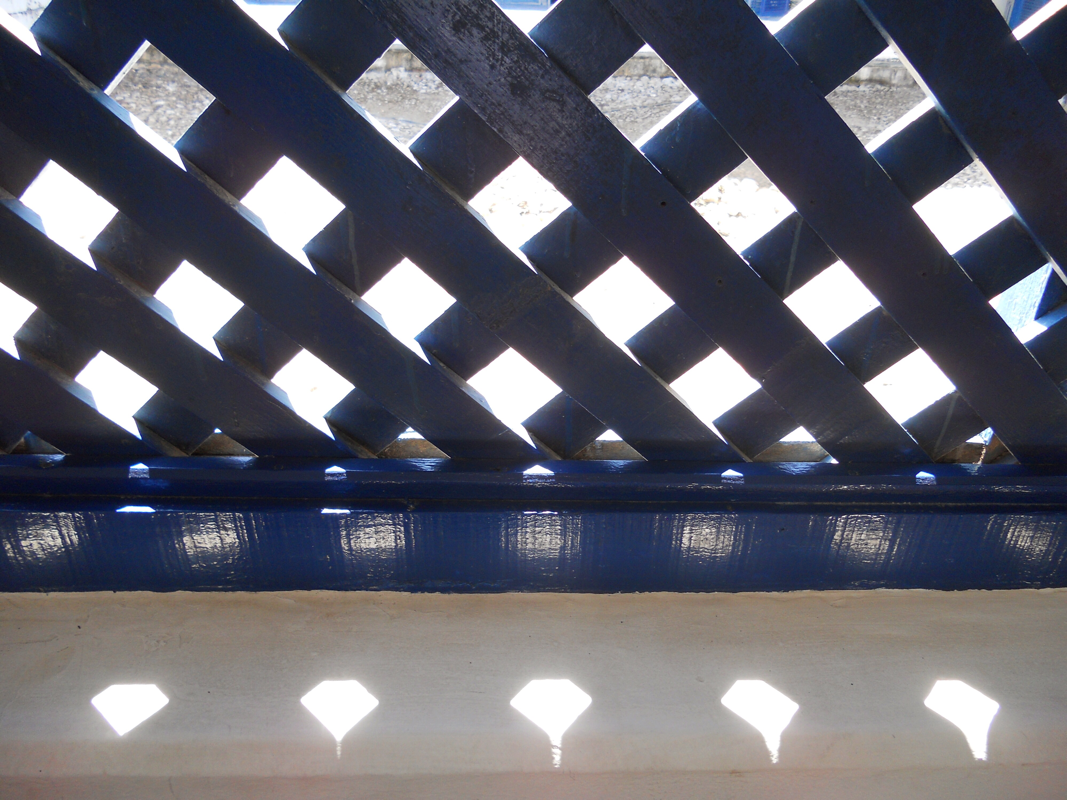
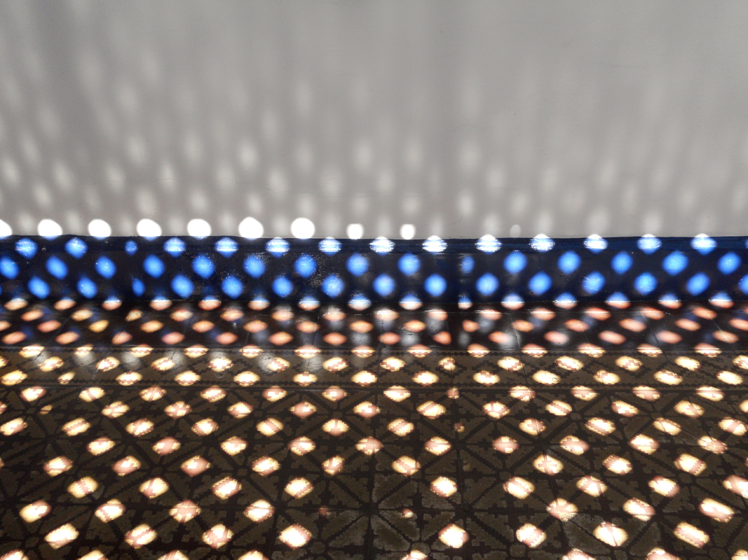
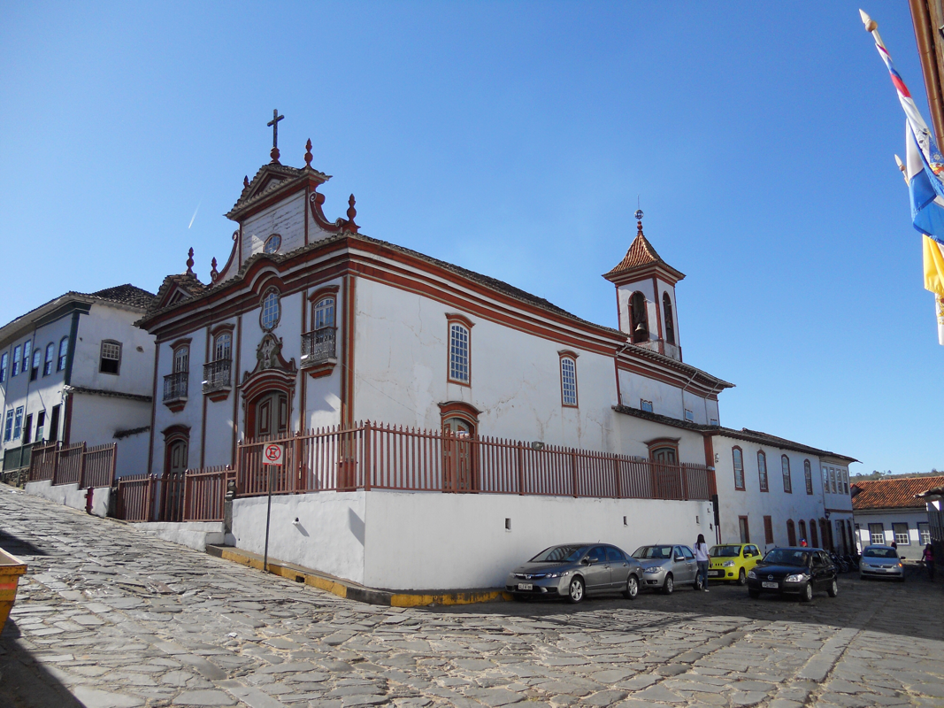
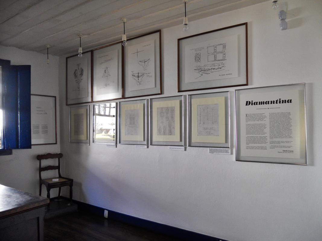
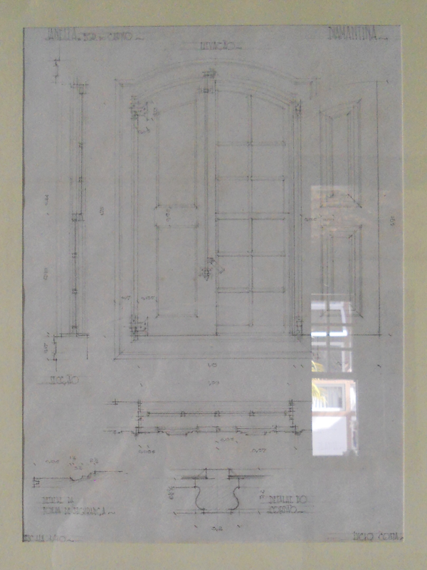
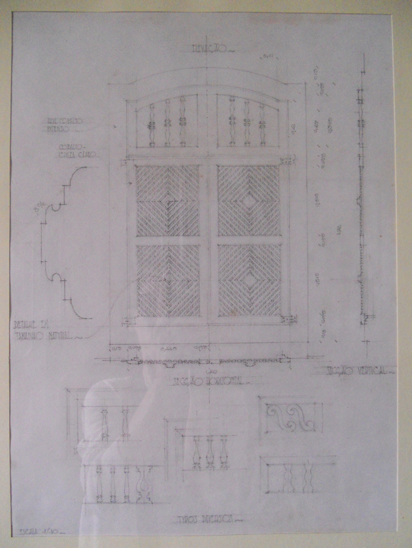
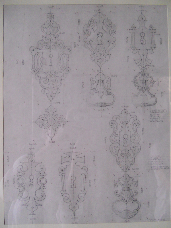
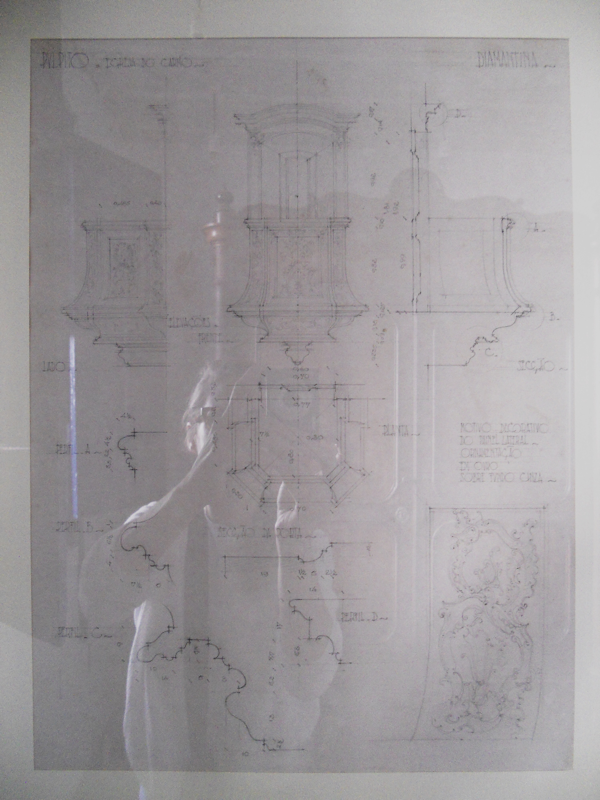
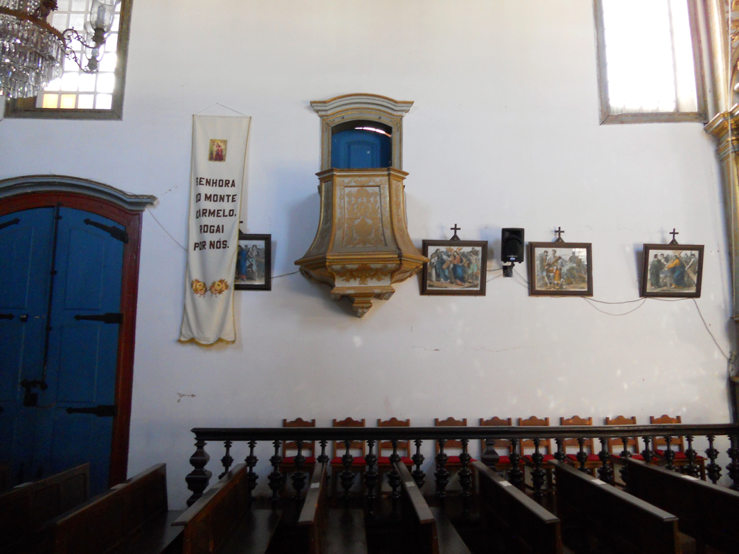
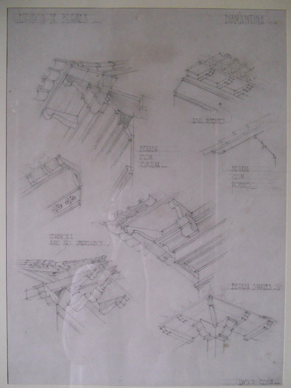
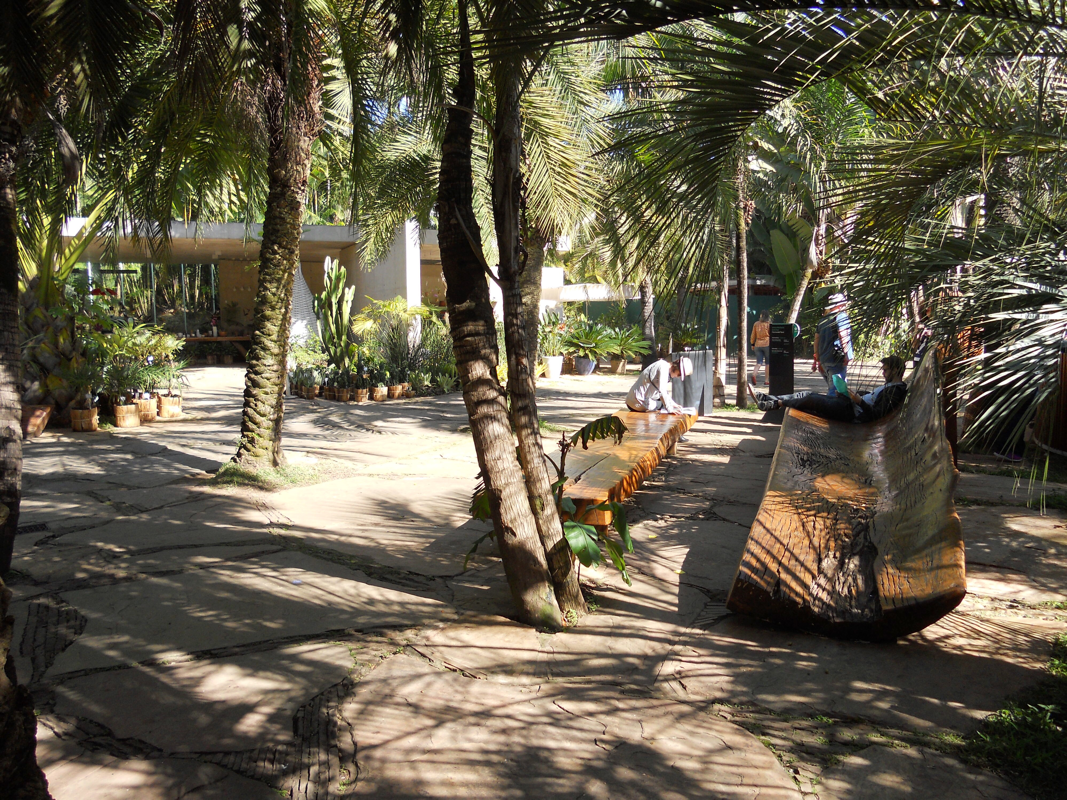
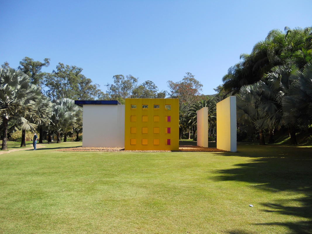
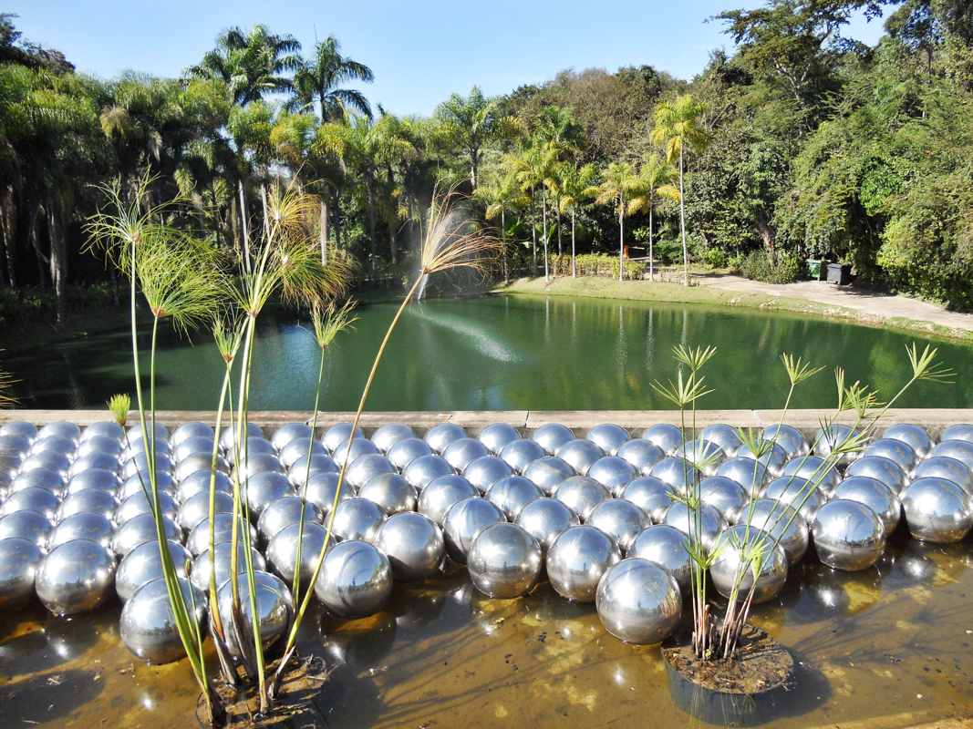
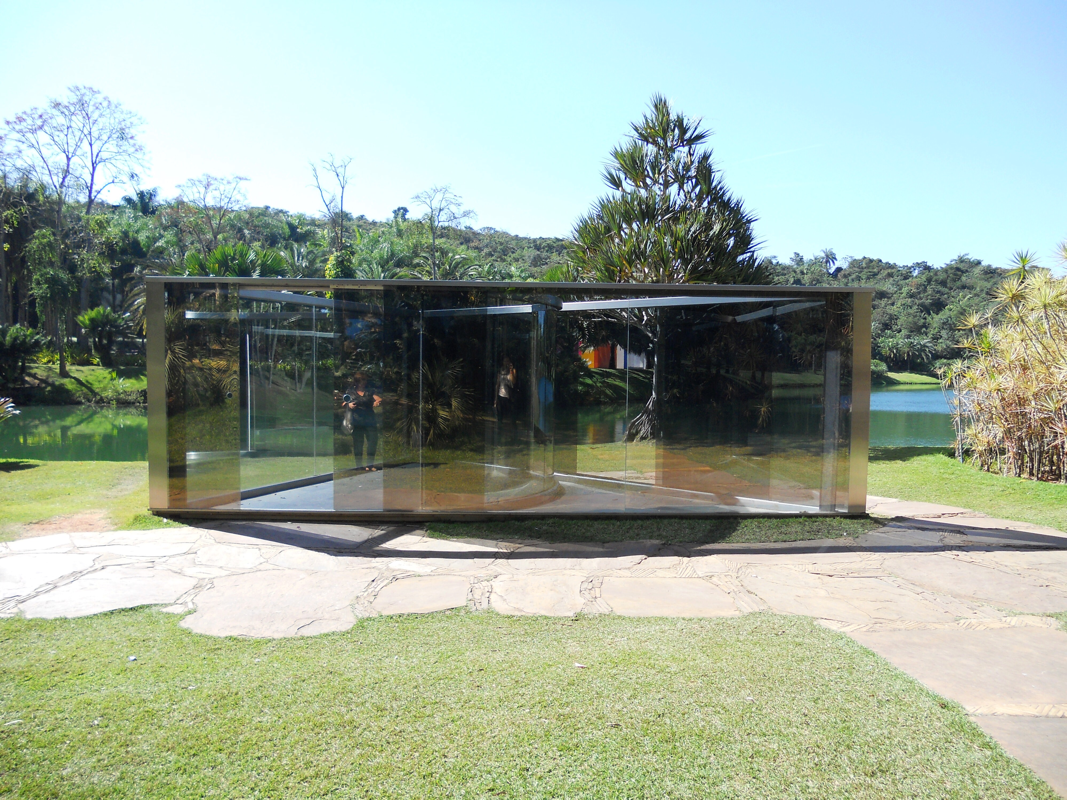
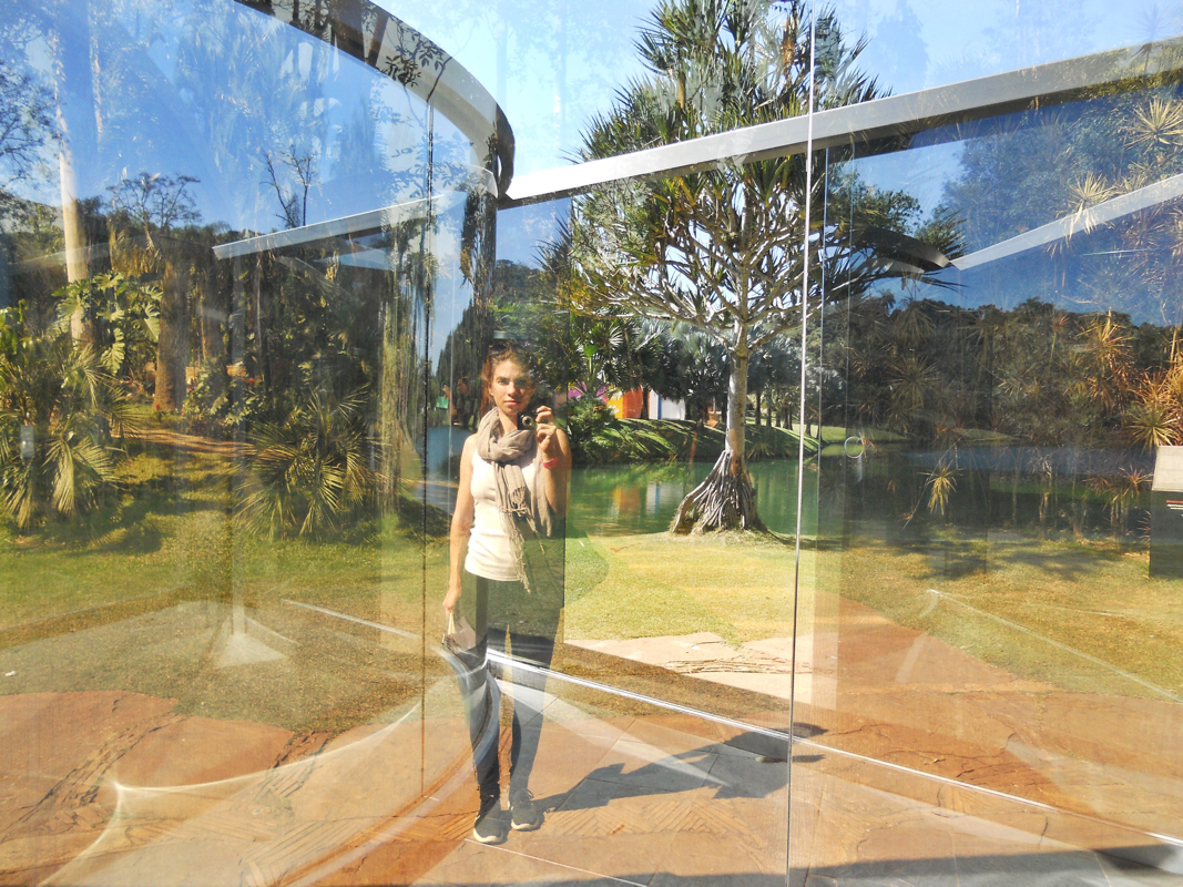
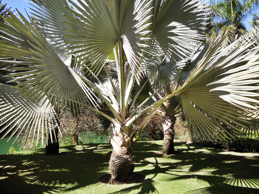
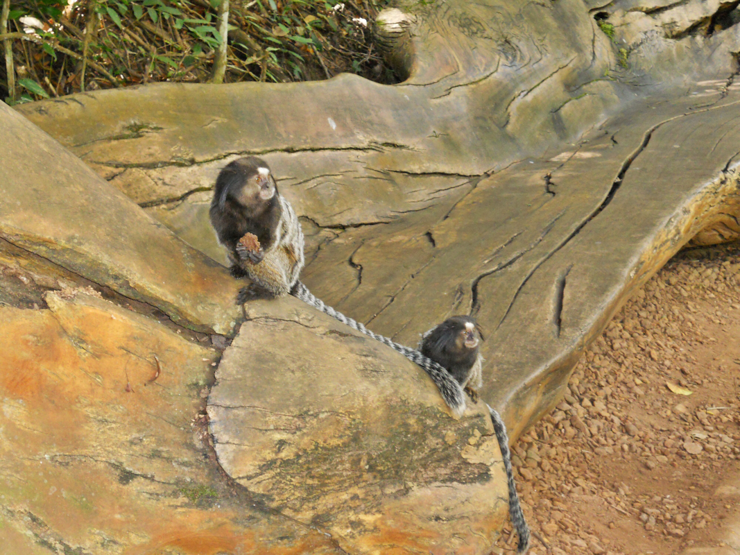
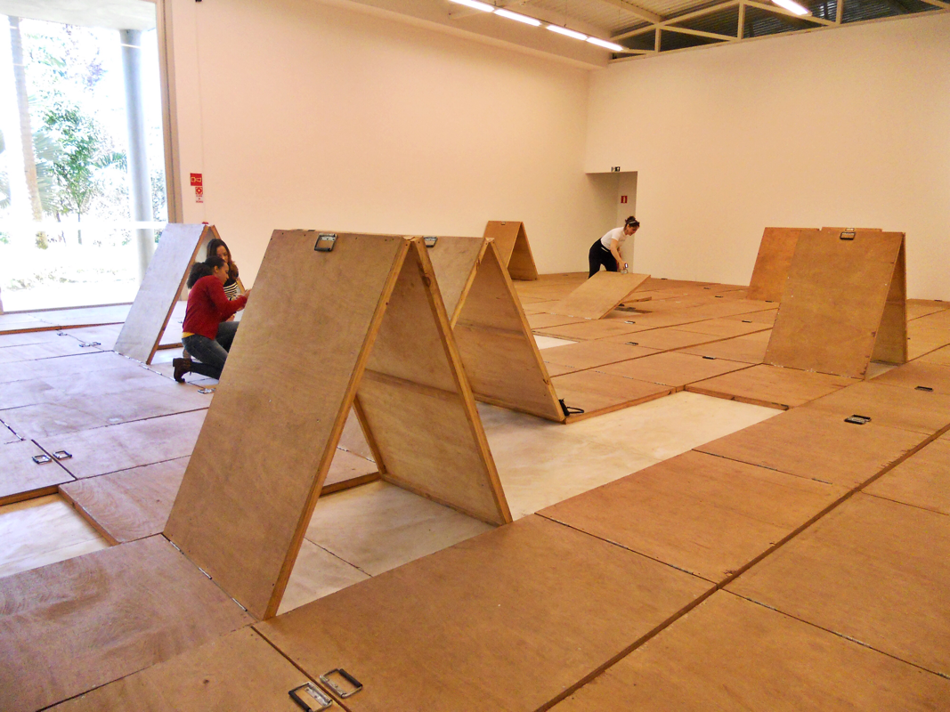
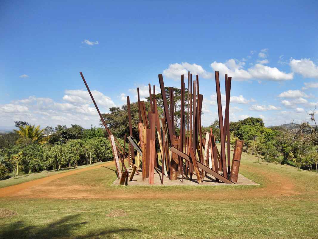
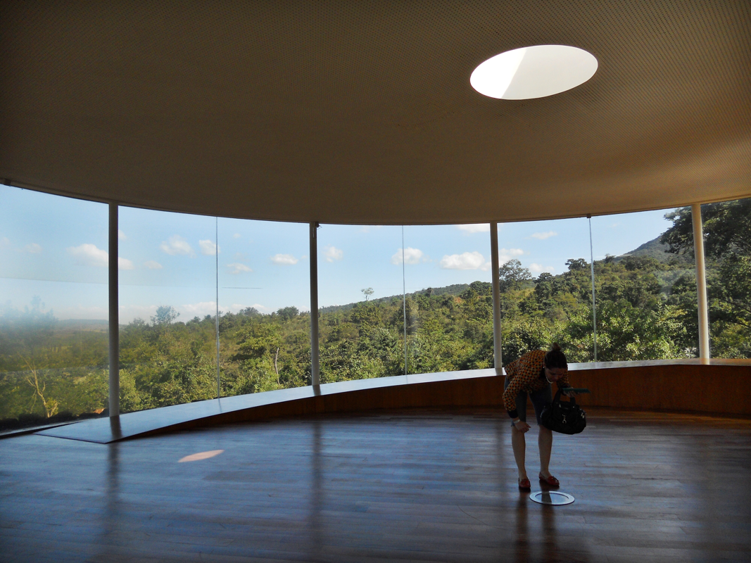
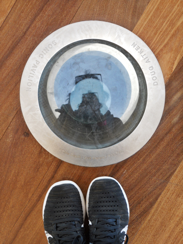
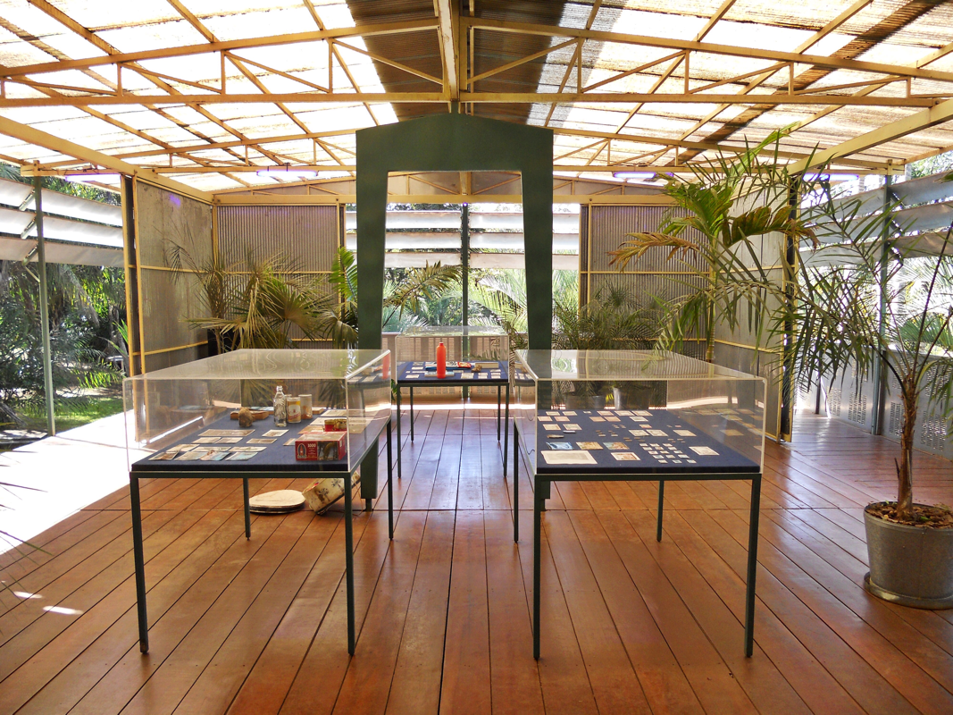
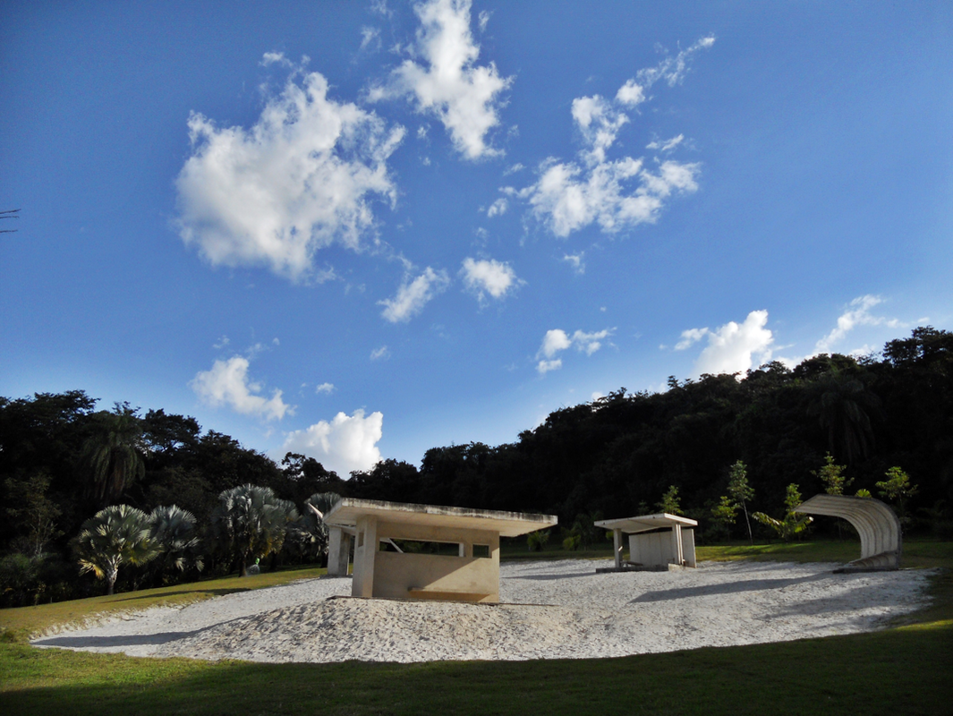
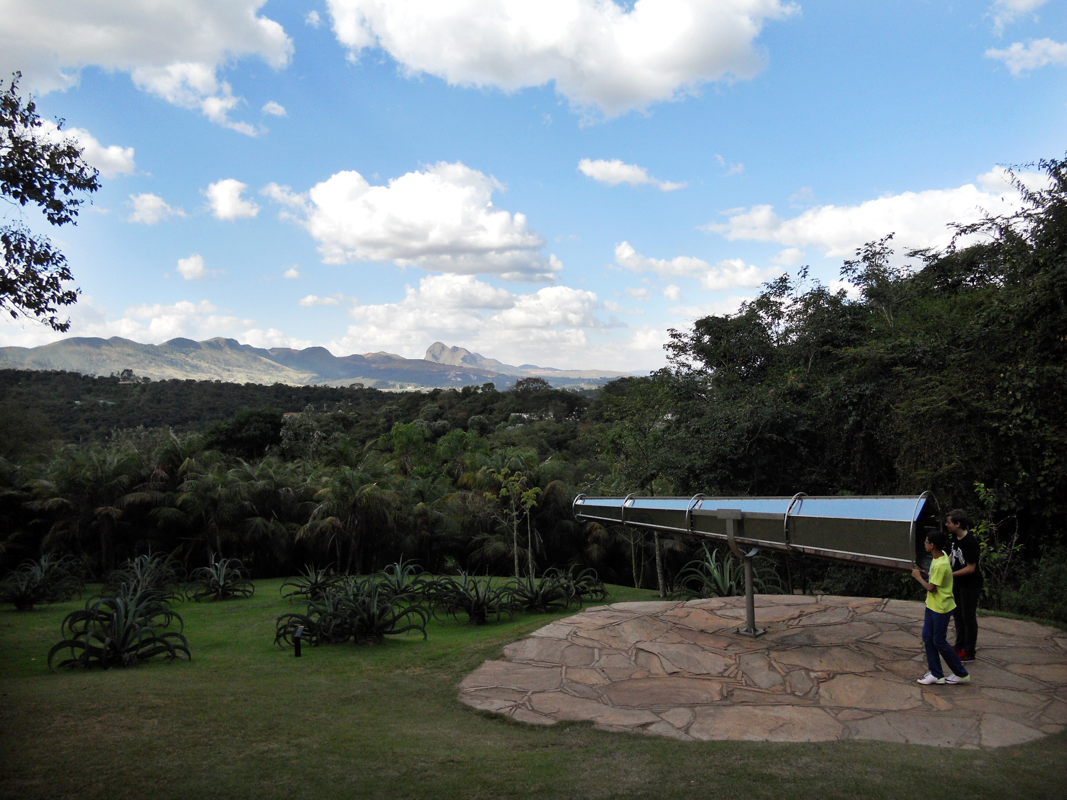
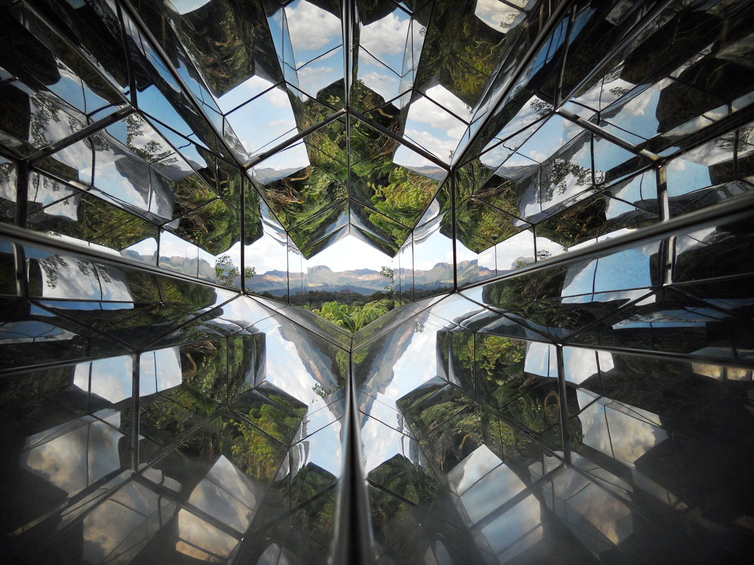
This was the "crazy" leg of my trip. I flew from São Paulo to Porto Alegre, which is located in the southernmost state of Brazil, Rio Grande do Sul. From there, it was a 7-hour bus to the small southwestern town of Santo Angelo. Cue another 1.5-hour bus the next morning to reach São Miguel das Missões, the ruinous site of a 17th-century Jesuit mission and accompanying Lucio Costa-designed museum, built in 1937. São Miguel is one of the most remote places I have ever been, and I was so in awe of where I was on the globe that I took a screenshot of my google maps location: The site of São Miguel das Missões is at the crux of my project. It combines a Costa-selected historic site chosen at the onset of Brazil's official national historic preservation program to be representative of Brazil's architectural heritage, with a building designed by him in a modernist architectural language that responds to an existing colonial-era structure. São Miguel das Missões was named a UNESCO World Heritage Site in 1983. The ruins of the church, São Miguel Arcanjo are completely magnificent -- visually, and for the story they embody. São Miguel is one of dozens of missions that the Jesuits built in the 17th century (the remains of 30 exist today), in a region that comprises present-day southwestern Brazil, southern Paraguay, and northern Argentina. These missions were created at the behest of the governor of the then-Spanish province of Paraguay, who ordered the Jesuits to convert the Guarani people who lived here. 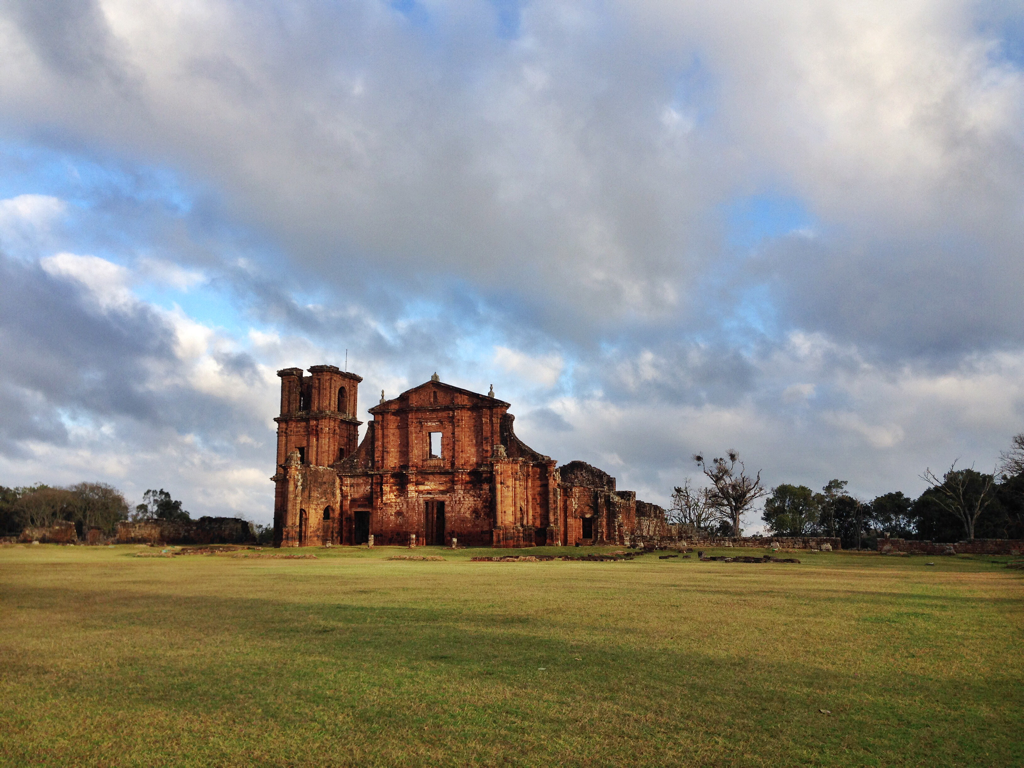 The oft-cited characteristic of the Jesuit communities is that they sought to convert the Guarani without destroying their cultural and linguistic practices. The art and music of this time and place is said to have combined Guarani and European traditions. The Jesuits also created a written form of the Tupi-Guarani language, publishing several works in it on one of South America's earliest printing presses. Looking at the architecture and the reconstructed plan, however, hierarchies of power are clear (not to mention the privilege given to a written form of language). The model in my photo below shows what is thought to have been São Miguel's layout for its 6,900 inhabitants. Starting at the bottom of the photo and circling around the site counter clockwise, this settlement contained houses for the Guarani; a house for visitors/travelers; a storehouse and workshop space; a cloister, colégio (college/education space), and priests' residence; the church; an orchard and garden; a cemetery, and an orphanage. The plan surprised me in its lack of a city-like layout. Instead of streets radiating from the main praça as one might find in a typical colonial town, the plan looks like an enlarged open-air church format, with the houses in place of "pews", and larger spaces of power centrally concentrated at one end, like an altar zone. 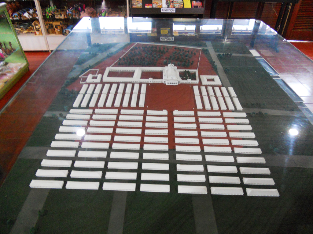 An Italian architect named Gian Battista Primoli designed the church in 1735, and it is largely what remains of São Miguel das Missões today. In 1750 the Treaty of Madrid dictated that São Miguel and like sites be handed over to Portuguese rule, which did not protect the Guarani from being enslaved. The Guarani War ensued, resulting in 1,500 Guarani deaths, many more sold into slavery, and the decimation of their population. The site fell into ruin. Costa's modest museum houses 18th-century religious art from the missions that was dispersed throughout the region. In his design, Costa utilized the existing entrance pavilion to the park, adding to it an understated glass enclosure. The open plan and large panes of glass employ some building blocks of modernism -- but I think you have to hunt for the modern aspects in this work. The pavilion's design seems to defer to the church, the crown jewel of the archaeological site. Vestiges of the ruins are worked into the walls of the museum, and the material coloration certainly is a sensitive quotation of the ruins. When I visited São Miguel das Missões, Costa's museum was under renovation because high winds had blown out the large glass windows. (Art objects have been moved to a nearby location for display.) It was also one of the only days it rained on my trip. It somehow seemed very fitting that I be incredibly aware of the weather and its impact as I walked through these ruinous shells of both baroque and modern architecture. I stuck around for the somewhat kitschy light and sound show, which recounts the history of the site in 45 minutes (and outside in 40-degree Fahrenheit weather!). It was interesting to see a different type of educational tool -- a way to convey didactic material without covering the site in informational plaques. This is a gaucho sitting in front of me! Experiencing São Miguel das Missões was certainly a highlight, but seeing the countryside of Rio Grande do Sul was also fascinating. The rolling hills were full of horses, cows, chickens, orange trees, and the occasional lone palm tree. Gauchos, a term used to refer to local ranchers of the region, wandered the town in their traditional attire of blooming pants, cowboy-like boots, hats, and ponchos. I tasted a chimarrão, erva-mate tea drunk from a gourd with a metal straw, and it was even cold enough to cozy up to the fireplace in my pousada. Welcome to the seemingly endless city of São Paulo, the third largest city in the world: 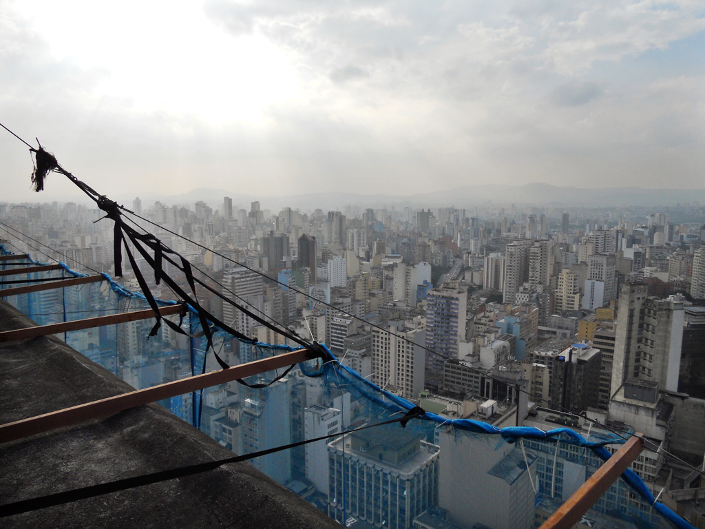 This is a view from Edificio Copan, a Niemeyer-designed apartment building in central São Paulo that dates to the early 1950s. I visited the building with my friend Jonas, a PhD student in architectural history here in São Paulo. Jonas had cleverly arranged an apartment-hunting visit so that we could pop around the building and see about 6 different living spaces! Edificio Copan has an astounding 1,160 apartments (smack in the middle of the city!) and an internal "street" with 72 businesses, making it one of the biggest buildings in Brazil. About 2,000 residents live here -- so many that the building even has its own postal code, 01046-925. When I visited, it was covered in blue mesh because of loose tiles on the facade. I think they're doing restoration work, too. Let's hope. In Sampa -- the locals' nickname for the metropolis -- I got to know a different strand of Brazilian modernism than I have seen thus far: the Paulista, or São Paulo-based, school. Paulista architecture is stereotypically rougher, bolder, and more Brutalist-leaning than that of the Carioca architects like Costa and Niemeyer. I feel so fortunate to have been able to explore some of the fabulous work of Lina Bo Bardi (1914-92), an Italian-born Brazilian who moved to Rio de Janeiro in the 1940s with her husband, art critic Pietro Maria Bardi. The couple took up residence in São Paulo in 1947 when Mr. Bardi was invited to create a modern art museum there. And here is where they lived... Lina Bo Bardi's "casa de vidro," or glass house, in the Morumbi neighborhood of São Paulo, designed in 1949. This house is visually and structurally lighter than most of her other works, with the main volume of the house hoisted on pilotis and hovering at tree-canopy level that takes advantage of the sloping site. The house pivots around a central void which protects a tree that was existing to the site. I thought the gently arching roof was rather charming, and a little more playful than the strictly flat roofs of earlier 20th-century modernism or Philip Johnson's glass house in New Canaan, CT, an unavoidable comparison. Lina Bo Bardi also designed the modern art museum that her husband founded, the Museu de Arte de São Paulo (1957-69) known as "MASP." Bardi's building uses a striking structural system in which she "hung" the main gallery volume from the roof, using giant red poured-concrete columns for support. The result of this architectural gesture was the creation of an open public space below the building at street level adjacent to Avenida Paulista, one of the biggest boulevards in São Paulo. Because of this incorporation of public space, the municipal government financed the building. MASP has two "basement" levels that again take advantage of the sloping site -- though they are full of sunlight and feel integrated with the rest of the building, thanks to a bold red stair that quotes the exterior structure. MASP has recently restaged Bardi's original gallery design. Instead of mounting the museum's paintings on walls as in a traditional scheme, Bardi created glass easels with concrete bases that are divorced from the wall, revealing both the front and the back of the paintings. The viewer approaches each artwork without any wall text in view, and must circle around the painting to see the didactic panel with artist information. Currently, there are 119 works from MASP's collection on view in this gallery, dating from 4th century B.C. to 2008. They are arranged chronologically (though Bardi's original scheme arranged works by region or artistic school) to break down some traditional art historical narratives. The layout really invites wandering... I found it almost impossible to view these works in "order" like you would in a typical museum; something ahead of you catches your eye, and you wander toward it. I visited a third major work of Bardi's in the São Paulo area, SESC Pompéia, a cultural center designed in 1977. The complex is a dazzling combination of theaters, sports facilities, a pool, restaurant and bar, gallery, artist workshops, reading area, and communal spaces for general use. Bardi adapted an existing factory building (the lower brick structure in my photos), and paired it with two large concrete towers that house the sports facilities. Red details tie everything together -- the old and the new. When I was in these spaces, I felt as though Bardi must have been able to really imagine the experience of being in every little nook of the building -- how it would feel to sit there, what one would see, etc. Okay, I cannot continue with a post about São Paulo without telling you how great the food in this city is!!! Fabulous food. I had delicious pizza with a new friend Hugo at Veridiana Pizzaria (thanks so much Francesca for introducing us!), fantastic ramen in the Japanese neighborhood of Liberdade at a place called "Lamen Kazu" (yes, it took me a while to realize that this is just ramen with a different spelling), and super creamy pastel de nata, a traditional Portuguese pastry made of egg yolks at Casa Mathilde. Other highlights included finding a Brazilian "diner" for breakfast right around the corner from where I stayed, tasting the supposed best pão de queijo in São Paulo at Lá da Venda, and seeing the myriad of bananas types at a Saturday market in Pinheiros. (I wish some of my food photos were better but we were working with some low lighting here!) I stayed in a cozy Airbnb in Pinheiros (thank you Nathalia!), a wonderful neighborhood to wander, especially on Saturdays when there is a fun antiques fair. Two things really struck me about the streetscape -- the juxtaposition between the smaller, older buildings and the tall high rises that have been built more recently, and the outrageously cool street art (even if I inadvertently posed in front of a woman's crotch). São Paulo is so rich with museums and cultural offerings. I toured the Theatro Municipal from 1911, which is modeled on the Palais Garnier opera in Paris. It makes use of some local materials, though, like a regional marble, itupararanga, which has now been completely extracted from the earth, and local woods called pau marfim and peroba rosa, both of which are now also extinct. My guide told me that when from the theater was inaugurated up until the 1970s (!), there were three segregated "orders" of seating -- the closest and best seats were occupied by the coffee barons and politicians, the second balcony level was used by lawyers, doctors, architects, and engineers, and the top level was for teachers, students, and Italian immigrants who had to use side doors to enter the theater. On my last day in Sampa, I visited Ibirapuera Park, another amazing public amenity in São Paulo. Niemeyer was commissioned to design five buildings here in 1954 for the city's 400th anniversary. A sinuous canopy connects the buildings and serves as a prime skateboard and rollerblade zone! These structures now house the São Paulo art biennial, the Museu de Arte Moderna, and the Museu Afro-Brasil, which had moving exhibitions on the history of slavery in Brazil as well as the art and material culture of Afro-Brazilian traditions practiced today. I am including an image of costumes from the maracatu festival that originated in northeastern Brazil and is now practiced throughout the country. This was a good primer for my trip to Bahia -- more to come soon in a subsequent post! Wow, there is truly no place like Brasilia. Relentless. modern. utopia. In the 1950s, Brazilian president Juscelino Kubitschek called for the relocation of Brazil's capital city from Rio de Janeiro to Brasília. At the time, the land that would become Brasília was unsettled, as this photo from 1957 of Brasília's beginnings by Mario Fontenelle shows: 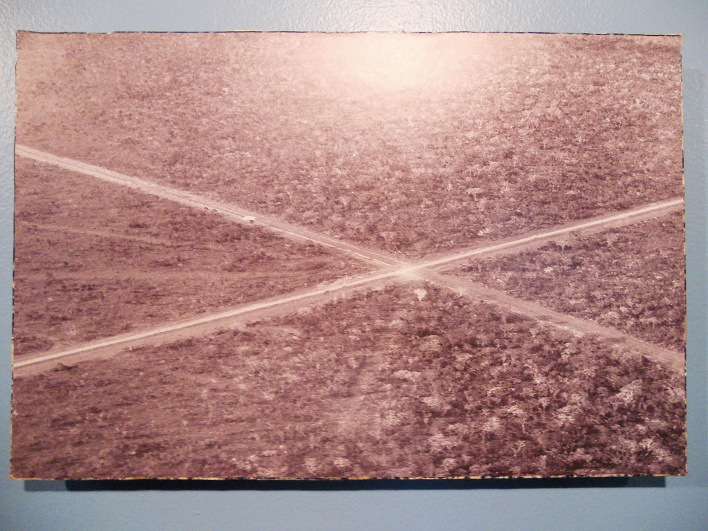 The project of Brasília was said to be an attempt to make the capital more geographically central for the entire country and to bring development further into the interior. One Brazilian friend told me that he still finds this problematic today; that the government is too removed from the action and the realities of the majority of the population. At the same time, my Airbnb host said she really likes living in Brasília, that the quality of life is very good, and that it is much calmer than other major Brazilian metropolises. Kubitschek asked Niemeyer to design the city plan and the architecture. Niemeyer took on the buildings but delegated the plan, a competition for which was launched in 1957. Le Corbusier submitted, citing their previous collaboration on the Ministry of Health and Education building -- famously, he did not even receive a reply. Kubitschek and Niemeyer did not want an international star to design their version of modern Brazil. The story goes that Lucio Costa nonchalantly submitted his proposal; he was not intending to enter the competition, but a solution came to him in finished form and he had to submit it. He won the competition with his "pilot plan." From the air, the plan resembles an airplane, with the "body" of the plane being the "Eixo Monumental," or the Monumental Axis, which contains the government buildings; the commercial, hotel, and banking sectors; and the bus station. The "wings" of the plane form the residential blocks and their corresponding commercial strips. Being in Brasília was like being in a diagram on an architect's drafting table. As I mentioned, the entire city is divided into sectors, so all of the functions of the city are parceled out into different zones. The addresses indicate the zone of the city. For instance: SCLS 405, Bloco B, Loja 6 is the address of a restaurant in Setor Comércio Local Sul, not to be confused with SQS 405, Bloco B, which would be apartment building B in Super Quadra Sul 405. It continues: SEN = Setor de Embaixadas Norte (the northern embassies), SHS = Setor Hoteleiro Sul (the southern hotel sector), and SCS = Setor Comerical Sul (the commercial office-block next to the main shopping center)... just to name a few. You really know where you are if you know the system! I got to spend 3 days in Brasília, staying in one of the residential "super squares" and walking -- yes walking -- and taking the buses everywhere. Brasília is decidedly *not* built for the pedestrian. Having grown up in Cincinnati, a city I love dearly but one in which you need a car to get around, I understood the shocked response when I asked, "how far it is to walk from the Congresso Nacional to the Cathedral?" "Oh you can't walk there!" Brasília does funny things with scale. It was about a 30-minute walk between these two buildings on the Eixo Monumental, though it looks like it would be so much closer. You can SEE the building you want to walk towards for miles because the space is so open, yet you have very few visual reference points for how far away it actually is. You walk past identical government ministry buildings that are designed for a car's approach, not a pedestrian's, and there are few stands/shops at a human scale to engage your eye as you walk by. But it's Brasil, so the buses are full and run frequently. There is a metro in Asa Sul (the southern residential wing) and points south of the Pilot Plan -- though because of a strike, it was only running during rush hour when I was there. Here are some photos from my first morning in Brasilia, starting out at the Praça dos Trés Poderes -- home to the Congresso Nacional (the National Congress -- the "bowl" is the chamber of the deputies and the "dome" is the senate), the Palácio do Planalto (the Palace of the Plateau, the president's offices), and the Supremo Tribunal Federal (the Supreme Court). I passed by the Palácio do Itamaraty (the foreign ministry building) and Palácio da Justiça (Ministry of Justice), and strolled down the Esplanade of the Ministries with their 11 matching buildings. Niemeyer designed all of these buildings between 1956 and 1960. Most of them work with variations of a "modern columnar order," i.e. thin columns and arches stretched and arranged in different ways, typically around a glass box. Vehicle-width ramps of varying heights lead from the street -- not the sidewalk -- up into the buildings. Most of the buildings (except the Ministries) seem to hover above the ground, just touching down in the lightest structurally-possible way. It was a Saturday and it was was very quiet in the Distrito Federal. For lunch, I had to cab to the "commercial zone" of the city, with the malls and the food courts. There was absolutely nowhere to eat down by the government buildings. The last photo in this gallery is from Monday, and you can see the difference when the Eixo Monumental was packed with cars. I couldn't miss the Catedral Metropolitana or the Museu Nacional either: On Sunday, I trekked to the top of Costa's TV Tower for the best view in town. Even the addresses of the little fair and food court at the base of the tower follow the city-wide system! I wandered around the lovely Super Square 308 -- the first residential block to be built and the "model" square for the residential sector. It contains apartment buildings, the commercial strips (the designated zones for shops), a Niemeyer-designed church, a school, a social club (think tennis and swim club), a health center, a kindergarten, a library, and a movie theater. Here are some photos of other super squares nearby. They fit the "model" more or less, but do vary from block to block: One of my favorite things about Brasília -- and I am sure this would seem normal to anyone who is from there (forgive me, Daniella) -- was how a little cafe would be nestled in the midst of one of the commercial strips between the super squares. Ernesto Cafés Especias was one of these spots -- a wonderful breakfast stop. Like many of shops in these commercial strips, Ernesto had this great grassy backyard with outdoor seating. (Apologies for the photo quality, these were shot from my little Brazilian cell phone since I left my camera at home that morning!) I also visited the presidential palace, the Palácio da Alvorada, or "Palace of the Dawn" (1956-58). I could barely see it because this is as close as one can get! You can make out the gracefully curving arches, a similar style to the government buildings in town. This is the building supposedly inspired by the arches of Diamantina's market. I'm not sure I quite see it, unless you consider Niemeyer was working with inverted shapes, or playing with the market's shadows... My Airbnb host Maria Sofia was so kind to give me an evening tour of Brasilia, when the Eixo Monumental takes on an entirely different and beautiful quality: This post chronicles some of my favorite sights and historical tidbits from a week traveling around the colonial towns in the state of Minas Gerais: Sabará, Ouro Preto, Mariana, Congonhas, and Diamantina. Minas Gerais, or "General Mines" gets its name from the gold, diamond, and deposits of other precious stones that were discovered here in the 17th century -- the largest then-known in the Americas. The 870-mile Estrada Real connected these towns to the Atlantic coast, a project of the Portuguese crown that was built by thousands of enslaved Africans. As if the well-preserved colonial towns were not enough, Lucio Costa's travels in the region early in his career in the 1920s also drew me to Minas Gerais as a critical place to explore the ways in which Brazilian modernists were engaging with the architecture of Brazil's past to shape a certain vision for its future. His addition of these towns to Brazil's national historical preservation list, IPHAN, (originally SPHAN), bolstered the region's role as a hub for "patrimony" or heritage tourism. I started in Sabará, just 15 miles from Belo Horizonte. Sabará was one of the world's wealthiest cities in the 18th century, when it is said to have produced more gold in one week than the rest of Brazil produced in a year! I visited four churches (of the 20+ this town seems to have) that were all added to IPHAN in 1938 at the direction of Costa. Igreja do Carmo was filled with baroque paintings and carvings and about 30 enthusiastic Brazilian school kids. The church's main claims to fame are its facade, altar, and side altars, all crafted by Aleijadinho between 1763 and 1778. Aleijadinho is one of Brazil's most celebrated artists of the Baroque/Rococo period. More on him later on in this post. I also thought the trompe l'oeil painting on the side altars was particularly fun. Igreja Nossa Senhora do Rosário dos Pretos was started in 1768 and financed by the enslaved community in Sabará. It remains unfinished, as work was abandoned with the abolition of slavery in Brazil in 1888. It contains an older chapel from 1713 inside its walls. Further outside of town are the churches of Nossa Senhora de Conceição and the tiny, adorable Nossa Senhora do Ó. The interior surfaces of both of these churches are blanketed with wildly ornate gold-leaf carvings and, fascinatingly, both contain architectural "chinoiserie" painting. Once thought to have been painted by an artist trained in Asia, they are now believed to be painted in the European chinoiserie style of the 18th century. I found Winterthur's Made in America exhibition catalogue very insightful regarding this practice and east-west exchange in this period. The Museu do Ouro, or the Gold Museum, displays artifacts from colonial-era Minas and tells a bit about the history of the gold mines and slave labor in this area. The Museu do Ouro officially opened in April 23, 1943, and prominently displayed in the lobby (the only space in which I was allowed to take photos) was a letter from Lucio Costa about its founding. Records of modern artists' visits to the museum are also exhibited -- Roberto Burle Marx and Cândido Portinari in 1944, for instance, as well as Juseclino Kubitschek's visit in 1943 when he was the mayor of Belo Horizonte (and busy commissioning Pumpulha from my last blog post). To me, this display of 20th-century artists and politicians' interactions with the Museu do Ouro reinforced how intertwined modernism and the Portuguese colonial towns are in the story of the "patrimony" or architectural heritage of Brazil that was shaped in the 1930s, 40s, and 50s. Sabará is also home to a lovely little theater dating to 1770. Ouro Preto was the most populous city in the Americas in the mid-18th century, with an estimated 110,000 people, most of whom were enslaved. By comparison, New York had a population of about 50,000 at the time, and Rio de Janeiro numbered 20,000. Ouro Preto was the capital of Minas Gerais from 1720 until 1897 when it was shifted to the new Belo Horizonte. This move ended up preserving much of the 18th and 19th-century built environment In Ouro Preto. The historic city center was added to the UNESCO world heritage list in 1980. I splurged on a night in Oscar Niemeyer's Grande Hotel de Ouro Preto, a project that established Brazilian's modernism's dialogue with the past and garnered Niemeyer wide-spread recognition. The back story is that in 1938, the government of Minas Gerias wanted to build a new hotel in Ouro Preto to boost tourism. With the help of SPHAN, they considered several approaches: constructing an imitation of the 17th and 18th century houses in the town, or linking some of the existing houses to form a larger hotel space within. In the end, they decided to commission a building that was meant to be both modern yet also visually compatible with the historic city fabric. The job went to the young Niemeyer, who, I think, succeeded in bridging these two opposing design aims. Though my Lonely Planet guide refers to it as an eyesore, and though I am not always a fan of Niemeyer's architecture, between the siting, the building's height and scale, and the blue balconies and red tile roof, it is hard to imagine a better balance of modernist principles and a sensitive addition to the historic city center. (In the last photo in this series you can see the hotel on the right side.) I balanced out these accommodations with a stay the next two nights at the fabulous Pouso do Chico Rei, which was truly like stepping backward in time. A bit about some of the most spectacular churches in Ouro Preto: The Igreja de São Francisco de Assis's facade was carved by Aleijadinho, and the interior of the church was painted by his frequent collaborator Manuel da Costa Ataíde. One of the aspects of the baroque churches in Minas that struck me the most was the way in which so many surfaces reinforce the undulating, swirling, wavy aesthetic: from the overall plan and elevation of the church, to the balustrades to the side altars, to the paintings and even their frames. Begun in 1733, the Igreja de Santa Efigênia was a worship space for the enslaved population in Ouro Preto, financed with gold from Chico Rei's mine (which you can still visit!) Chico Rei was an African king who was captured with his tribe and sold to a mine owner in Ouro Preto. Working Sundays and holidays, Chico Rei bought his freedom, eventually freeing his son and his entire tribe. He then bought a nearby gold mine and began celebrating African holidays in traditional costume again. Sadly, when news of this reached the Portguese crown, the king banned enslaved persons from purchasing their freedom. As at São Francisco de Assis, Aleijadinho completed the facade at Santa Efigênia. The image of Santa Efigênia, princess of Nubia, graces the altar. Igreja de Nossa Senhora do Carmo built between 1766 and 1776, and Matriz Nossa Senhora do Pilar, from 1727-1770, are two other amazing churches in Ouro Preto. Nossa Senhora do Carmo was a stone's throw from the second place I stayed in Ouro Preto. Before services, the church bells would ring for a good five minutes! Aleijadinho completed this exterior facade too, and on the interior, the lower chancel walls sport Portuguese azulejos -- supposedly the only church in Minas Gerais to have them. Matriz Nossa Senhora do Pilar appeared more neo-classical than baroque -- for whatever these labels are worth. The gold-covered interior, meant to be one of Brazil's most opulent, is more linear than curvy, with a 10-sided nave and pilasters. Ouro Preto has a lovely little museum of oratórios, small mobile chapels that were installed in domestic settings -- halls, bedrooms, kitchens -- and/or taken on travels. The oratórios are beautiful examples of "miniature" architecture and made the practice of religion more intimate, spontaneous, and immediate. Oratórios were also placed at corners throughout the city to protect against bad omens, as well as serve the practical function of illuminating facades and streets at night. Here are some images from the museum and of two of the few remaining exterior oratorios in Ouro Preto. One final museum stop in Ouro Preto filled me in on the history of the Inconfidência Mineira of 1789, a failed uprising against Portuguese colonization that took place in Ouro Preto. Poets Cláudio Manuel da Costa, Tomás Antônio Gonzaga, Joaquim José da Silva Xavier (nicknamed "Tiradentes"), and artists such as Aleijadinho plotted a rebellion largely in response to the required quinto do ouro, or "royal fifth" of gold from the town's mines that was required to be set aside for the Portuguese crown. Though books were prohibited in the colony at the time, ideas from the French and American revolutions reached Ouro Preto -- a clandestine French copy of what I think must be the articles of confederation of the United States was on display in the museum, titled "Récueil des loix constitutives des colonies angloises, confederées sous la dénominacion d'Ètats-Unis de l'Amerique-Septentriole," from 1778. Incredible to think that ideas hatched in Independence Hall, just a 20 minute walk from my apartment in Philly, traveled to Ouro Preto and inspired this push in the Portuguese colonies for independence, expanded commerce with other nations, more harbors, universities, and so on. Just a half-hour bus ride took me to sweet little Mariana. Founded in 1696, Mariana was Minas's capital city before Ouro Preto. Most of the churches here were closed for restoration, but I did get to mosey through Praça Gomes Freire, one of the nicest little urban squares I have seen in Brazil. I promised more about Aleijadinho, whose work figures so prominently in the religious architecture of this region. Antônio Francisco Lisboa (1738-1814), was known as Aleijadinho, or "Little Cripple" because of a debilitating disease that caused him the loss of his fingers, toes, and use of his lower legs. With the help of enslaved and freed assistants, he used hammers and chisels strapped to his arms to pioneer the baroque style in this region, the "barroco mineiro." I traveled to what is considered his most famous work in Congonhas: The Prophets. Created between 1800 and 1850, the Prophets are 12 Old Testament soapstone figures that line the entrance of the Basilica do Bom Jesus de Matohinhos. The figures are graceful, curving, and seem to dance around you as you move up the stairs; they bob in and out of view as you move to and from them. Each oriented slightly differently, the figures seem to respond to not only the viewer, but also to one another as a unified, whole ensemble. Six chapels zigzag up the hill to the Basilica do Bom Jesus de Matohinhos, telling the story of the Passion of Christ. Yes, Aleijadinho did these figures too. The entire complex quotes the Bom Jesus do Monte in Braga, Portugal, though that version has 17 chapels! Scholars disagree on Aleijadinho's design origins for these sculptures -- Portuguese, Florentine, German, and Flemish inspirations have been argued. Current thinking is that Aleijadinho mixed several European engravings and/or models to develop his approach. My final stop in Minas Gerais was Diamantina, the northern-most end of the Estrada Real and one of the most remote places I am visiting on this trip. Like the other towns, Diamantina has a beautifully preserved city center, but it is especially famous for its balconies. I wish I had gotten to see the vesperata, evening serenades when musicians play from the balconies lining the main Praça. Next time! Diamantina's Mercado Municipal was constructed in 1835 and added to IPHAN only in 2007. Visually, it is a beautiful array of arches, arranged roughly in a gridded pattern, but varying in width to accommodate a slightly irregular site. One guide told me these arches inspired Niemeyer's design for the presidential palace in Brasilia. TBD in an upcoming post! The historic shells of two houses in Diamantina were really fun to tour too: Casa da Glória and Casa Chica da Silva. I say "shells" because they are used now as space for rotating exhibitions, i.e. they are not recreated as living spaces with period furnishings. Casa da Glória was originally the residence of Diamantina's diamond supervisors, and then later a boarding school for girls. It was then that the house's famous second-story bridge was constructed (1878-80) to keep the girls discreetly out of view. One hallway has an amazing treliça (the semi-open wall formed with crisscrossing wooden slats). The feeling of walking down this hallways is like driving down a road with sunlight flickering through the trees. Casa Chica da Silva was the home of a diamond contractor and his longtime partner, the former enslaved woman Chica da Silva. An important local personage, the bell tower in the nearby Igreja do Carmo is said to have been constructed at the back of the church at Chica da Silva's request so that she could sit in the front pews; Portuguese law at the time denied blacks from passing "beyond the bell tower." Finally, I visited the Casa de Juscelino Kubitschek, his childhood home and the perfect prelude to my next stop in Brasilia. One of the small galleries in the house held Lucio Costa's sketches from his 1922 visit to Diamantina, which document church facades, windows, locks, door knockers, and the corners of ordinary houses in town. The windows of the Igreja do Carmo seem to have been renovated, but the pulpit appears rather the same! I took a slight detour to visit magical Inhotim, a 5,000-acre contemporary art museum and botanical garden located about an hour and a half bus ride from Belo Horizonte. Bernardo de Mello Paz opened this park/disney land for the contemporary art scholar in 2006 on land that was originally his own farm (a different kind of cultivation, I suppose!). There are said to be 500+ artworks at Inhotim, and rare species of plants from every continent. Here are photos of a few of my favorites. Info in the captions!
When I was scooting around Airbnb looking for a place to stay in Belo Horizonte, the first thing I noticed about the city was its striking city plan. This led to some googling.
Brazilian urbanist Aarão Reis designed the city in the 1890s. At that time, the people in Minas Gerais (the state that BH is in) had decided to move their capital city from the old 18th-century town of Ouro Preto to a new city -- one less associated with former colonial rule -- that would become Belo Horizonte. Fascinatingly, it is composed of a grid of large avenidas with a smaller grid superimposed at a 45-degree angle. This makes for some really tricky intersections to cross where four streets converge! 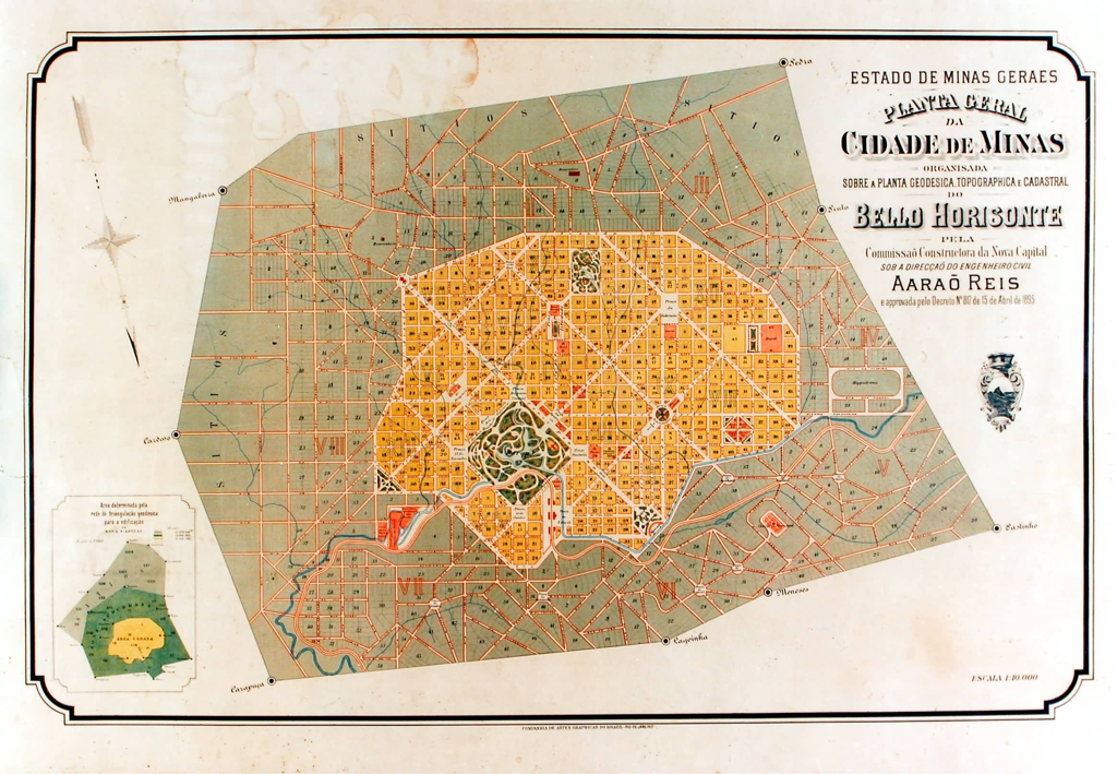
Source: Comissão Construtora de Belo Horizonte
Fast forward to the 1940s, when Juscelino Kubitschek, then-mayor of Belo Horizonte (who would later become president and commission Brasília), wanted to renovate the new-ish capital city. Kubitschek decided to create an entirely new neighborhood in the Brazilian modernist style. Impressed by Niemeyer's Grande Hotel de Ouro Preto (more on this in an upcoming blog post!), Kubitschek asked the 31 year old Niemeyer to create Pampulha on the banks of an artificial lake north of the city center.
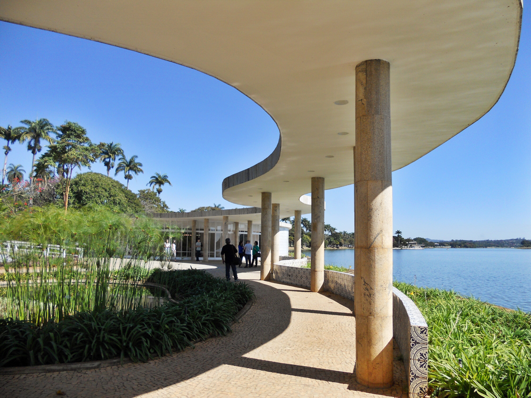
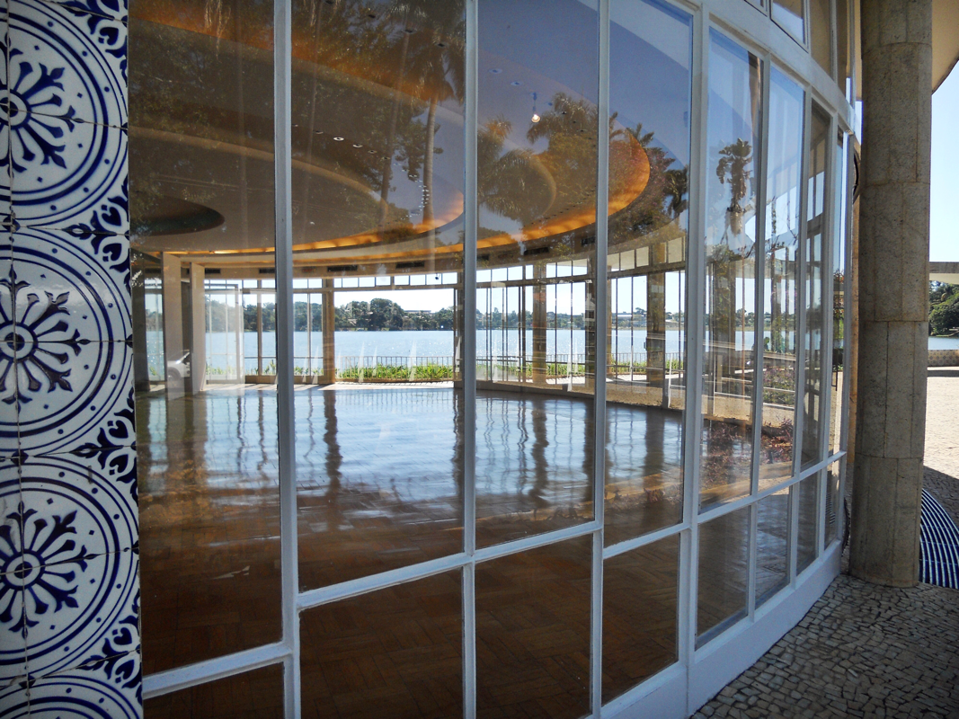
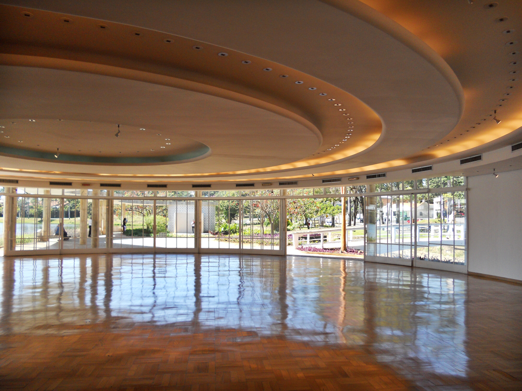
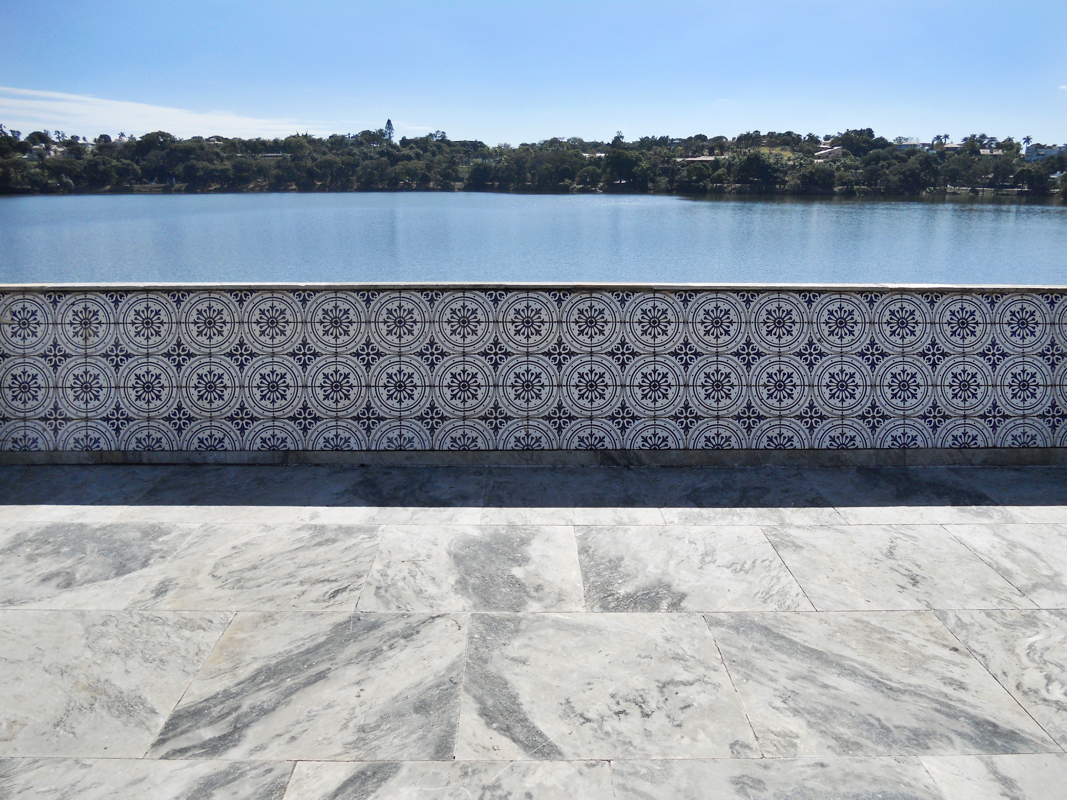
Niemeyer designed a casino, dance hall, yacht club, church, hotel (unbuilt), and a weekend house for Kubitschek in Pampulha. The Casa do Baile (1942), or dance hall, is a little jewel of a building. In essence, it is a cylindrical volume with a roof slab that peels off and extends horizontally to form a curving canopy, following the edge of the lake. Large curving glass doors open out onto a patio. The play between the artificial and the natural is at once subtle and overt: the building seems to blend so seamlessly with the setting -- until you remember that the lake, too, is designed. And not to be too heavy handed, but the reflections of the water "dancing" on the underside of the canopy are pretty fantastic. In more recent years, Niemeyer created a couple wall drawings in the Casa do Baile that posit the project of Pampulha as the precursor to Brasília.
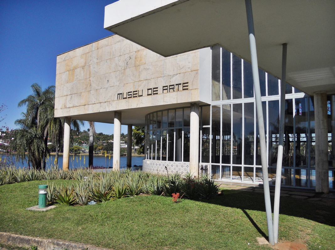
Visiting what was once the casino (1942), now a modern art museum, permanently solidified my knowledge of the word "fechado" -- it was closed for an exhibition change-over. Before my uber left (at which point I would have been about an hour and a half walk from the buildings on the other side of the lake!), I took some quick photos of the exterior. Later, across the lake I looked back at the building and its (do I even need to say it?) Burle Marx-landscaped gardens.
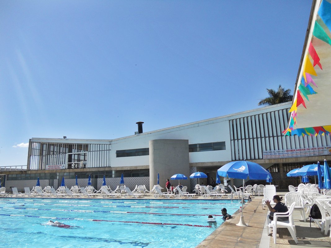
A gentleman named Wagner showed me around the yacht club (1942), which I unwittingly waltzed into thinking it was a tourist site like the other buildings. But no! It is a functioning private swim and tennis club. The yacht club building is famed for its use of a "butterfly roof," which would become a trope of mid-century modernism. The butterfly roof, truly a roof leak made to order, inverts a traditional pitched roof form into a V-shape.
Originally, boats could dock on the lower level, and the upper deck was apparently meant to make you feel as if you were out on the water on a boat.
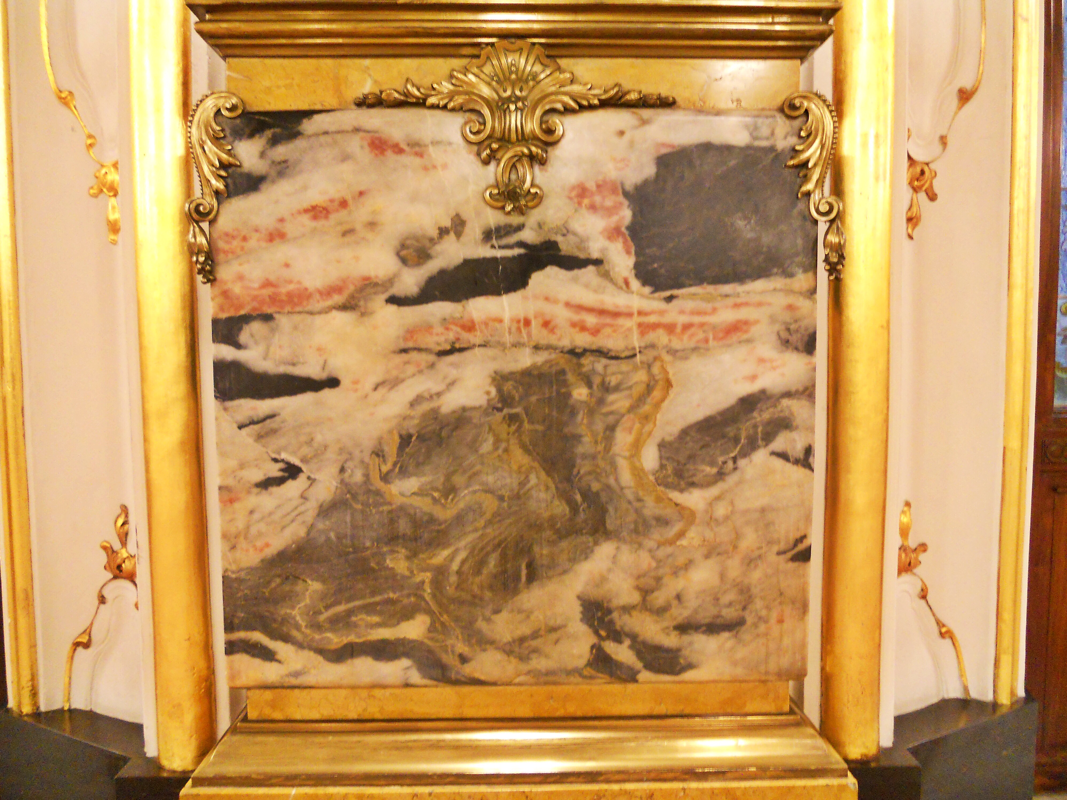
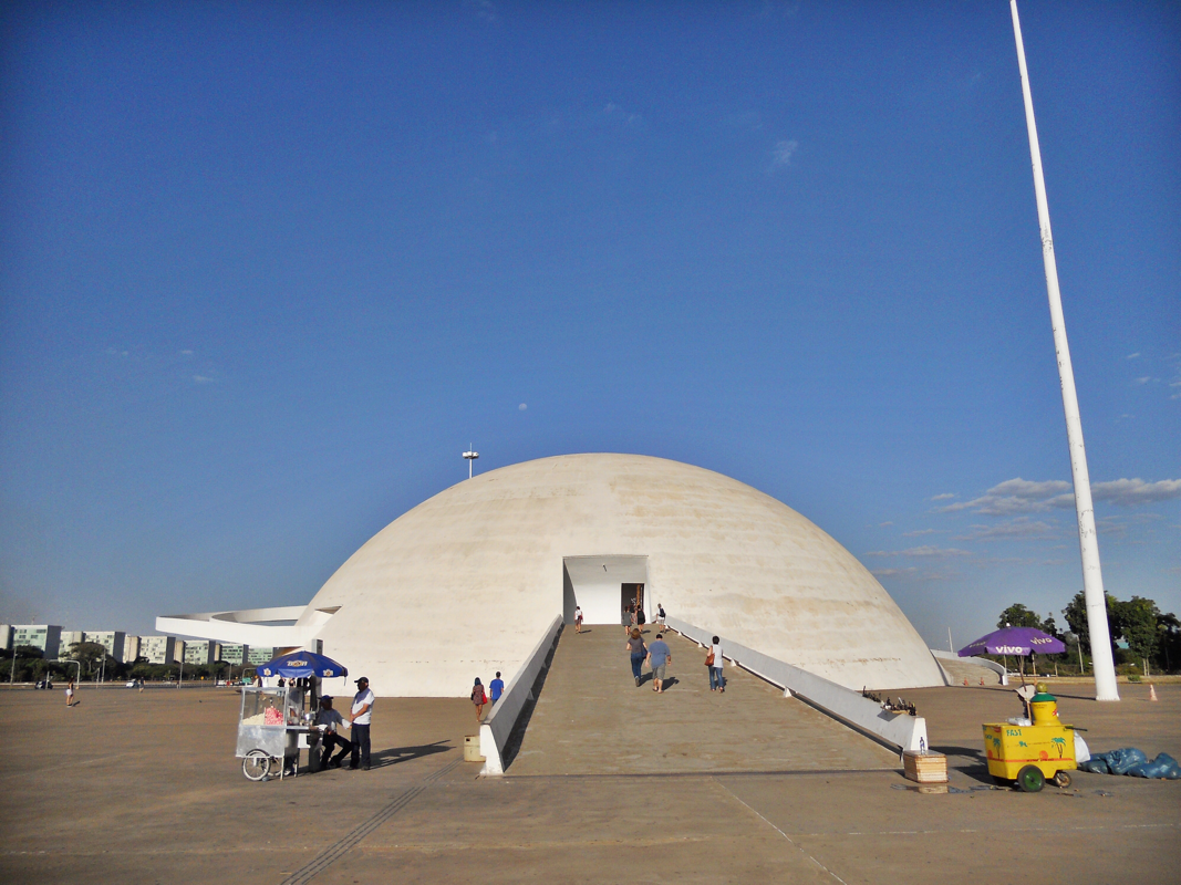
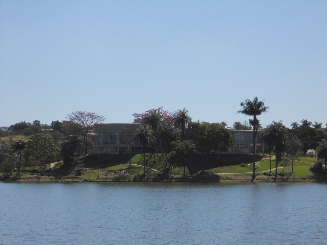
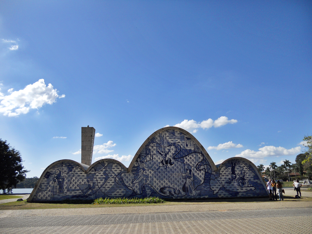
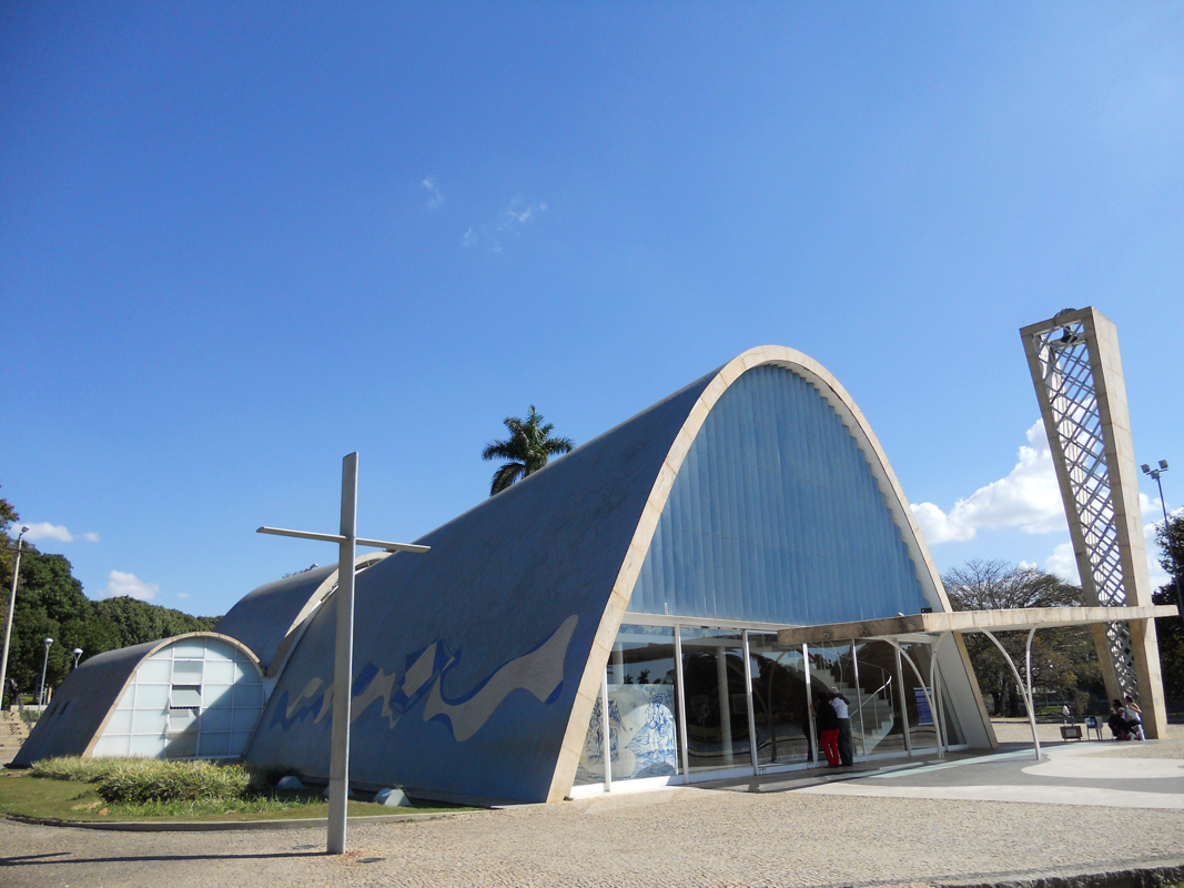
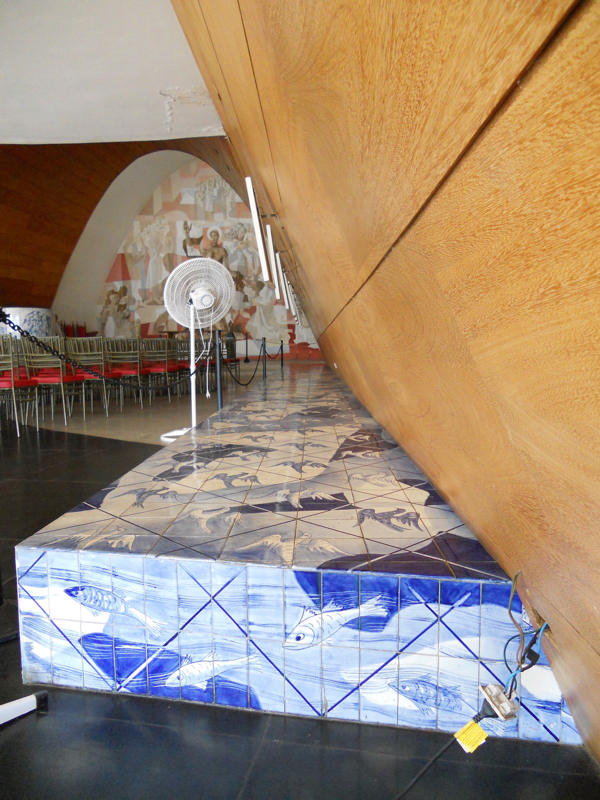
The iconic Igreja de São Francisco de Assis is made up of of self-supporting reinforced concrete domes of varying sizes, the largest of which serves as the nave of the church. The building's form and Cândido Portinari's accompanying murals were so unusual at the time that after the church was completed in 1943, the archbishop refused to consecrate it, deeming it "unfit for religious purposes." It wasn't consecrated until 1959. The blue and white Portinari tiles gesture toward the blue and white Portuguese azulejos that I mentioned in my last post on the baroque church in Rio de Janeiro, Nossa Senhora da Glória.
I think the Igreja de São Francisco de Assis is a good example of how many of Niemeyer's works seem to evade scale. Out of a "typical" city context, and with such inventive forms, it is so hard to predict the size of the works before you see them in person. This church is actually pretty small!
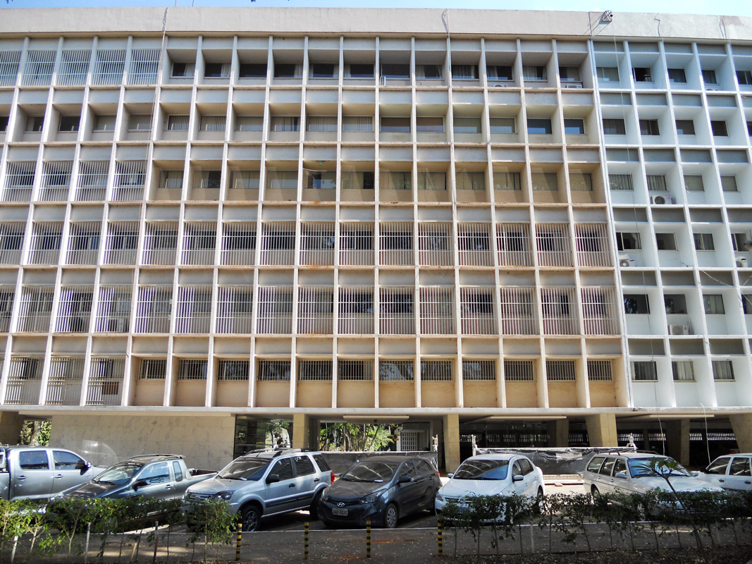
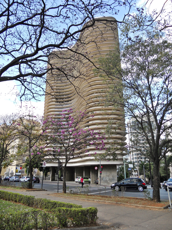
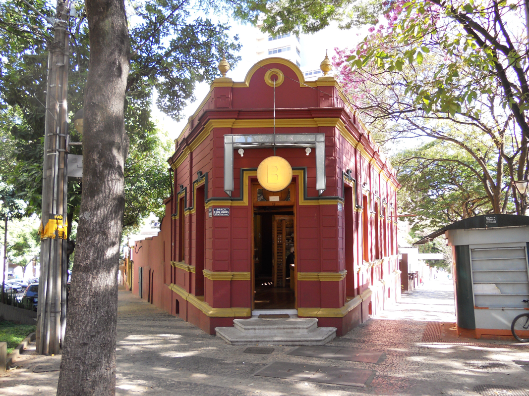
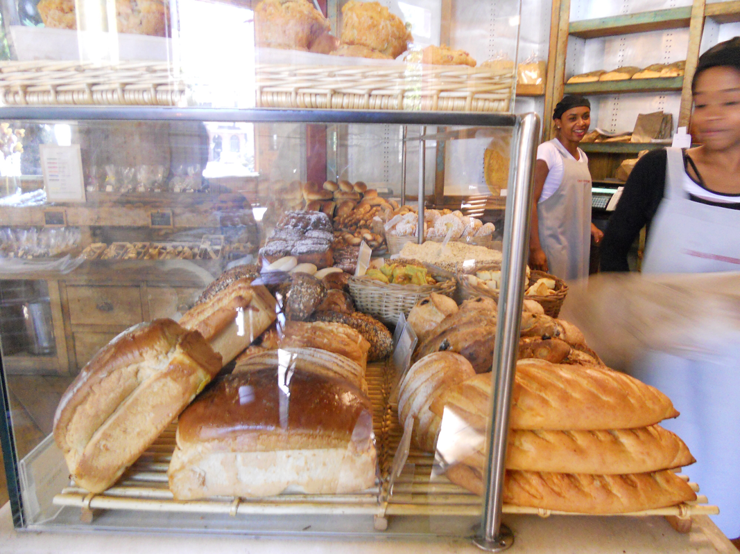
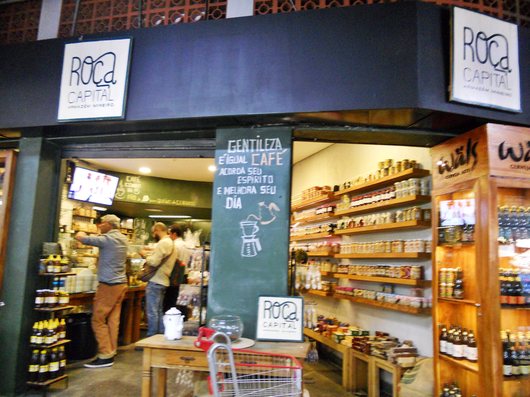
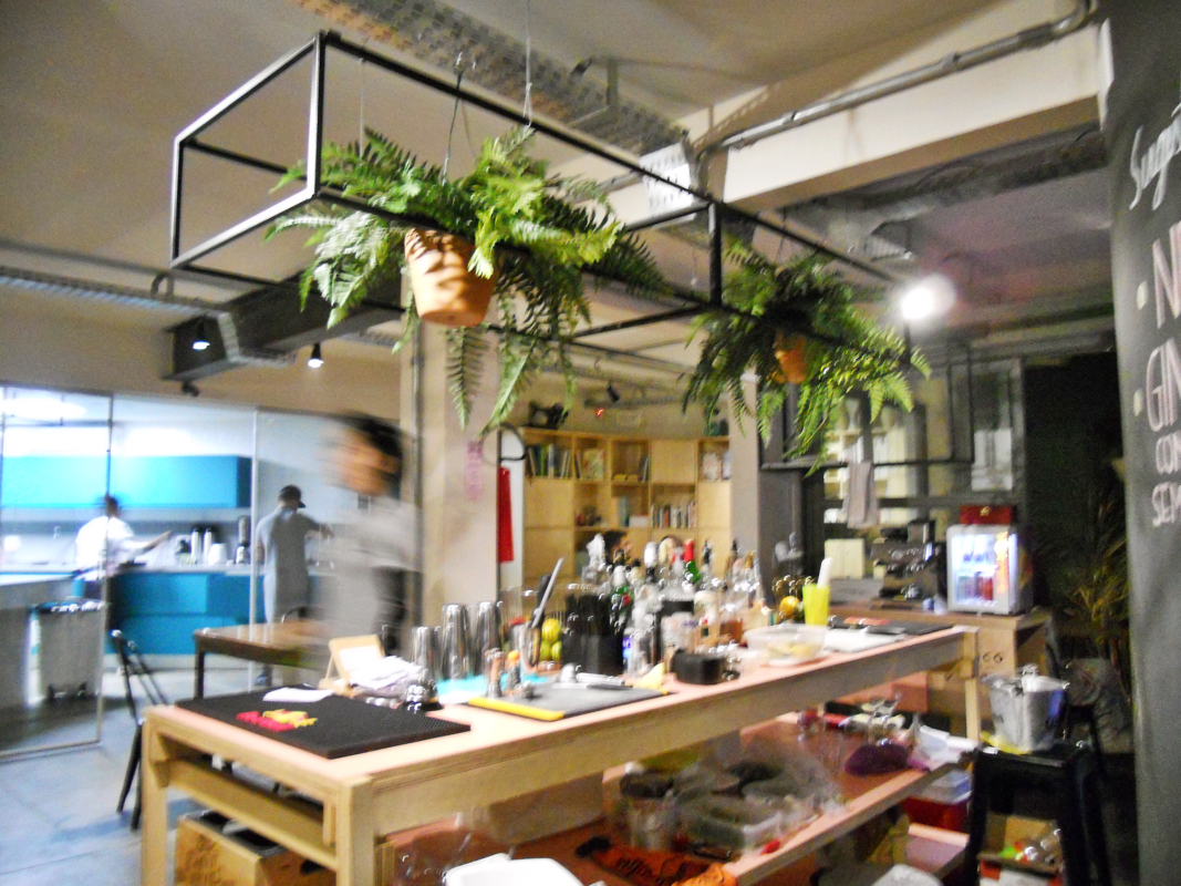
Even when Niemeyer's buildings are in an urban setting, such as the residential building he did in Belo Horizonte (in the photo gallery below), they still confuse. The building looks taller than it is; one would expect each horizontal band to represent a building floor, but there are actually three bands per floor, so it is not as tall as it appears. (Thanks Renato for pointing this out to me!) Back in the Centro, Renato and Isadora, my lovely hosts in Beagá (Portuguese for "B-H") pointed me toward some great spots. Here are some of my favorites: Casa Bonomi for breakfast, the Mercado Central for all things Minas Gerais, and Guaja, a new co-working space where Isadora works with a hip, hip bar. I will never forget stargazing with them from Praça do Papa and seeing the Southern Cross constellation -- only visible regularly in the southern hemisphere, always pointing southward. |